
Bruker:4ing/Sandkasse2: Forskjell mellom sideversjoner
flere bilder |
Marambio |
||
| Linje 1: | Linje 1: | ||
{{Infoboks forskningsstasjon |
|||
[[Norsk Folkemuseum]] er et av de største friluftsmuseene i Skandinavia. Nedenfor er ei liste over bygningene. |
|||
| navn = Marambio |
|||
| lokaltnavn = Base Marambio |
|||
| bilde = B.MARAMBIO.JPG |
|||
| bildetekst = Airfield control tower at Marambio |
|||
| sted = Antarktis |
|||
| høyde = |
|||
| tilhører = Argentina |
|||
| drift = |
|||
| påbegynt = |
|||
| ferdigstilt = |
|||
| åpnet = 29. oktober 1969 |
|||
| status = |
|||
| nedlagt = |
|||
| bygninger = |
|||
| bygningsareal = |
|||
| bygningshøyde = |
|||
| sesong = helårs |
|||
| bemanning_sommer = 200 |
|||
| bemanning_vinter = 55 |
|||
| url = http://www.marambio.aq/marambio.html |
|||
| posisjonskart = Antarktishalvøya |
|||
| breddegrad = -64.2410 |
|||
| lengdegrad = -56.6268 |
|||
| koordinatregion = AQ |
|||
| commonscat = |
|||
}} |
|||
'''Marambio Base''' ({{lang-es|Base Marambio}}) is a permanent, all year-round [[Argentina|Argentine]] [[Antarctica|Antarctic]] base named after [[Vice-Commodore]] [[Gustavo Argentino Marambio]], an Antarctic aviation pioneer. It is located in [[Marambio Island]], [[Graham Land]], [[Antarctic Peninsula]], some {{convert|100|km|-1|abbr=on}} from the coastal civilian village of [[Esperanza Base|Esperanza]]. |
|||
__TOC__ |
|||
At the time of its construction it was the first airfield in Antarctica and is still one of the most frequently used ones due to its suitability for wheeled landing, for which it is called "Antarctica's Entrance Door" ({{lang-es|Puerta de Entrada a la Antártida}}).<ref name=fa1>{{cite web|url=http://www.fuerzaaerea.mil.ar/mision/base_marambio.html|title=Misión y Organización – Organismos y Unidades – Base Marambio|publisher=Argentine Air Force|language=Spanish|archiveurl=http://web.archive.org/web/20131203024221/http://www.fuerzaaerea.mil.ar/mision/base_marambio.html|archivedate=3 December 2013}}</ref> It is also Argentina's most important base in the continent.<ref |
|||
== Oscar IIs Samling == |
|||
name=fa1/> |
|||
{|class="sortable wikitable" |
|||
!Bygning |
|||
!Type |
|||
!Fra |
|||
!Datering |
|||
!Ervervet |
|||
!Gjenreist |
|||
!Nummer |
|||
!Merknad |
|||
!Bilde |
|||
|- |
|||
|[[Gol stavkirke]] |
|||
|[[Stavkirke]] |
|||
|[[Gol]] i [[Hallingdal]] |
|||
|[[1200]] (ca.) |
|||
| |
|||
|[[1885]] |
|||
|181 |
|||
| |
|||
|[[Fil:Folkemuseet på Bygdøy.jpg|100px]] |
|||
|- |
|||
|Hovestua |
|||
|Stue |
|||
|Hove i [[Heddal]], [[Telemark]] |
|||
|[[1738]] |
|||
| |
|||
|[[1881]] |
|||
|182 |
|||
| |
|||
| |
|||
|- |
|||
|Loft fra Søndre Berdal |
|||
|[[Loft]] |
|||
|Søndre Berdal, Nesland, [[Vinje kommune|Vinje]] i Telemark. |
|||
|[[1750-årene]] |
|||
| |
|||
|[[1885]] |
|||
|183 |
|||
| |
|||
|[[Fil:Stabur Bygdo Christiania Norway crop.jpg|100px]] |
|||
|- |
|||
|Rolstadloftet |
|||
|[[Loft]] (Soveloft) |
|||
|Rolstad i [[Sør-Fron]], [[Gudbrandsdalen]] |
|||
|[[1300]] (ca.) |
|||
| |
|||
|[[1888]] |
|||
|184 |
|||
| |
|||
| |
|||
|- |
|||
|«Setabu» |
|||
|[[Loft]] («Setabu») |
|||
|Støylsemne, [[Hylestad]], [[Valle]] i [[Setesdal]] |
|||
|[[1500-tallet]] |
|||
| |
|||
|[[1913]] |
|||
|185 |
|||
| |
|||
| |
|||
|} |
|||
{{As of|2014}} Marambio is one of 13 research bases in Antarctica operated by Argentina.<ref name=dna2>{{cite web|url=http://www.dna.gov.ar/INGLES/DIVULGAC/BASES.HTM|title=Argentine Antarctic Stations|publisher=Dirección Nacional del Antártico|archiveurl=http://web.archive.org/web/20130620202830/http://www.dna.gov.ar/INGLES/DIVULGAC/BASES.HTM|archivedate=20 June 2013}}</ref> |
|||
== Landsbygda == |
|||
==History== |
|||
{|class="sortable wikitable" |
|||
The increased Antarctic activity that Argentina developed since 1940 created the need for an aviation runway operable throughout the year for wheeled units. The flight of Vice-Commodore [[Mario Luis Olezza]] to the [[South Pole]], the newly built United States [[McMurdo Station]] and the frequent operations launched from the [[Matienzo Base]] showed the need to secure better transport and communications in the sector.<ref name=fundmar1/> |
|||
!Bygning |
|||
!Del |
|||
!Type |
|||
!Fra |
|||
!Datering |
|||
!Ervervet |
|||
!Gjenreist |
|||
!Nummer |
|||
!Merknad |
|||
!Bilde |
|||
|- |
|||
|Goahti (Gamme) |
|||
|Sameplassen |
|||
|Gamme |
|||
| |
|||
|[[1992]] |
|||
| |
|||
|[[1992]] |
|||
|198 |
|||
|Bygd av en reindriftsame fra [[Elgå]] i [[Engerdal kommune|Engerdal]]. |
|||
| |
|||
|- |
|||
|Buvrie (Stabbur) |
|||
|Sameplassen |
|||
|[[Ájtte|Buvrie]] |
|||
| |
|||
|[[1998]] |
|||
| |
|||
|[[1998]] |
|||
|199 |
|||
|Bygd av en reindriftsame fra [[Elgå]] i [[Engerdal kommune|Engerdal]]. |
|||
| |
|||
|- |
|||
|Kjellebergstua |
|||
|[[Setesdalstunet på Norsk Folkemuseum|Setesdalstunet]] |
|||
|[[Årestue]], peisestue |
|||
|Kjelleberg, [[Valle kommune|Valle]], [[Setesdal]] |
|||
|[[1650]] (ca.) |
|||
|[[1912]] |
|||
|[[1913]] |
|||
|1/2 |
|||
|Kjellebergstua består av «gamlestog», som er ei årestue, og «nyestog», som er ei peisestue. |
|||
| |
|||
|- |
|||
|Oseloftet |
|||
|[[Setesdalstunet på Norsk Folkemuseum|Setesdalstunet]] |
|||
|[[Loft]] |
|||
|Ose, [[Bygland kommune|Bygland]], [[Setesdal]] |
|||
|[[1700]] (ca.) |
|||
|[[1912]] |
|||
|[[1913]] |
|||
|3 |
|||
| |
|||
|[[Fil:Oseloftet.jpg|100px]] |
|||
|- |
|||
|Åmlidstua |
|||
|[[Setesdalstunet på Norsk Folkemuseum|Setesdalstunet]] |
|||
|[[Årestue]] |
|||
|Åmlid, [[Valle kommune|Valle]], [[Setesdal]] |
|||
|[[1650]]-[[1700]] (ca.) |
|||
|[[1895]] |
|||
|[[1898]] |
|||
|4 |
|||
| |
|||
| |
|||
|- |
|||
|Loft fra Brottveit |
|||
|[[Setesdalstunet på Norsk Folkemuseum|Setesdalstunet]] |
|||
|[[Loft]] |
|||
|Brottveit, [[Valle kommune|Valle]], [[Setesdal]] |
|||
|[[1650]]-[[1700]] (ca.) |
|||
|[[1909]] |
|||
|[[1910]] |
|||
|5 |
|||
|Brottveitloftet er ett av få trihøgde loft i [[Norge]]. |
|||
| |
|||
|- |
|||
|Stolpehus fra Kjelleberg |
|||
|[[Setesdalstunet på Norsk Folkemuseum|Setesdalstunet]] |
|||
|[[Stolpehus]] |
|||
|Kjelleberg, [[Valle]], [[Setesdal]] |
|||
|[[Middelalder]] |
|||
|[[1941]] |
|||
|[[1941]] |
|||
|6 |
|||
| |
|||
| |
|||
|- |
|||
|Løe fra Rysstad |
|||
|[[Setesdalstunet på Norsk Folkemuseum|Setesdalstunet]] |
|||
|[[Løe]] |
|||
|Rysstad, [[Valle kommune|Valle]], [[Setesdal]] |
|||
|[[1800]]-[[1850]] (ca.) |
|||
|[[1938]] |
|||
|[[1938]] |
|||
|7 |
|||
| |
|||
| |
|||
|- |
|||
|Fjøs fra Rike |
|||
|[[Setesdalstunet på Norsk Folkemuseum|Setesdalstunet]] |
|||
|[[Fjøs]] |
|||
|Rike, [[Valle kommune|Valle]], [[Setesdal]] |
|||
|[[1800]]-[[1850]] (ca.) |
|||
|[[1941]] |
|||
|[[1941]] |
|||
|8 |
|||
| |
|||
| |
|||
|- |
|||
|Løe fra Skomedal |
|||
|[[Setesdalstunet på Norsk Folkemuseum|Setesdalstunet]] |
|||
|[[Løe]] |
|||
|Skomedal, [[Bygland kommune|Bygland]], [[Setesdal]] |
|||
|[[1800]]-[[1850]] (ca.) |
|||
|[[1941]] |
|||
|[[1941]] |
|||
|9 |
|||
| |
|||
| |
|||
|- |
|||
|Fjøs fra Skomedal |
|||
|[[Setesdalstunet på Norsk Folkemuseum|Setesdalstunet]] |
|||
|[[Fjøs]] |
|||
|Skomedal, [[Bygland kommune|Bygland]], [[Setesdal]] |
|||
|[[1850]]-[[1900]] (ca.) |
|||
|[[1941]] |
|||
|[[1941]] |
|||
|10 |
|||
| |
|||
| |
|||
|- |
|||
|Stall fra Kultran |
|||
|[[Setesdalstunet på Norsk Folkemuseum|Setesdalstunet]] |
|||
|[[Stall]] |
|||
|Kultran, [[Bykle kommune|Bykle]], [[Setesdal]] |
|||
|[[1800]] (ca.) |
|||
|[[1941]] |
|||
|[[1941]] |
|||
|11 |
|||
| |
|||
| |
|||
|- |
|||
|Badstue fra Åmlid |
|||
|[[Setesdalstunet på Norsk Folkemuseum|Setesdalstunet]] |
|||
|[[Badstue]] |
|||
|Åmlid, [[Valle kommune|Valle]], [[Setesdal]] |
|||
|[[1600-tallet]] |
|||
|[[1912]] |
|||
|[[1913]] |
|||
|12 |
|||
| |
|||
| |
|||
|- |
|||
|Stall fra Heimtveiten |
|||
|[[Setesdalstunet på Norsk Folkemuseum|Setesdalstunet]] |
|||
|[[Stall]] |
|||
|Heimtveiten, [[Bykle kommune|Bykle]], [[Setesdal]] |
|||
|[[1850]] |
|||
|[[1966]] |
|||
|Under oppføring |
|||
|13 |
|||
| |
|||
| |
|||
|- |
|||
|Sagastua |
|||
|[[Setesdalstunet på Norsk Folkemuseum|Setesdalstunet]] |
|||
|[[Årestue]] |
|||
| |
|||
|[[1994]] |
|||
| |
|||
|[[1994]] |
|||
|14 |
|||
|Kopi av «gamlestog» i Kjellebergstua, nr. 1/2. |
|||
| |
|||
|- |
|||
|Raulandstua |
|||
|[[Numedalstunet på Norsk Folkemuseum|Numedalstunet]] |
|||
|[[Årestue]] |
|||
|Søre Rauland, [[Nore og Uvdal kommune|Nore og Uvdal]] |
|||
|[[1238]] (ca.) |
|||
|[[1895]] |
|||
|[[1899]] |
|||
|21 |
|||
| |
|||
|[[Fil:Raulandstua 2.jpg|100px]] |
|||
|- |
|||
|[[Grøslistua]] |
|||
|[[Numedalstunet på Norsk Folkemuseum|Numedalstunet]] |
|||
|[[Peisestue]] |
|||
|Grøsli, [[Flesberg kommune|Flesberg]] |
|||
|[[1650]] (ca.) |
|||
|[[1895]] |
|||
|[[1899]] |
|||
|22 |
|||
| |
|||
| |
|||
|- |
|||
|Stue fra Væråsmogen |
|||
|[[Numedalstunet på Norsk Folkemuseum|Numedalstunet]] |
|||
|[[Peisestue]] |
|||
|Væråsmogen, [[Flesberg kommune|Flesberg]] |
|||
|[[1750]]-[[1800]] (ca.) |
|||
|[[1913]] |
|||
|[[1914]] |
|||
|23 |
|||
| |
|||
| |
|||
|- |
|||
|Eldhus fra Bakke |
|||
|[[Numedalstunet på Norsk Folkemuseum|Numedalstunet]] |
|||
|[[Eldhus]] |
|||
|Bakke, [[Rollag kommune|Rollag]] |
|||
|[[1750]]-[[1800]] (ca.) |
|||
|[[1945]] |
|||
|[[1945]] |
|||
|24 |
|||
| |
|||
| |
|||
|- |
|||
|Loft fra Søre Rauland |
|||
|[[Numedalstunet på Norsk Folkemuseum|Numedalstunet]] |
|||
|[[Loft]] |
|||
|Søre Rauland, [[Nore og Uvdal kommune|Nore og Uvdal]] |
|||
|[[1209]] (etter) |
|||
|[[1945]] |
|||
|[[1945]] |
|||
|25 |
|||
|«Buret», førsteetasjen, ble bygd etter 1209, mens «loftet», andreetasjen, ble bygd etter 1594. |
|||
| |
|||
|- |
|||
|Stall fra Grønneflåta |
|||
|[[Numedalstunet på Norsk Folkemuseum|Numedalstunet]] |
|||
|[[Stall]] |
|||
|Grønneflåta, [[Nore og Uvdal kommune|Nore og Uvdal]] |
|||
|[[1750]]-[[1800]] (ca.) |
|||
|[[1942]] |
|||
|[[1946]] |
|||
|26 |
|||
| |
|||
| |
|||
|- |
|||
|Stall fra Nedre Værås |
|||
|[[Numedalstunet på Norsk Folkemuseum|Numedalstunet]] |
|||
|[[Stall]] |
|||
|Nedre Værås, [[Flesberg kommune|Flesberg]] |
|||
|[[1800]] (ca.) |
|||
|[[1941]] |
|||
|[[1942]] |
|||
|27 |
|||
| |
|||
| |
|||
|- |
|||
|Løe fra Nørstebø |
|||
|[[Numedalstunet på Norsk Folkemuseum|Numedalstunet]] |
|||
|[[Løe]] |
|||
|Nørstebø, [[Nore og Uvdal kommune|Nore og Uvdal]] |
|||
|[[1600-tallet]] |
|||
|[[1942]] |
|||
|[[1943]] |
|||
|28 |
|||
| |
|||
| |
|||
|- |
|||
|Fjøs fra Ramberg |
|||
|[[Numedalstunet på Norsk Folkemuseum|Numedalstunet]] |
|||
|[[Fjøs]] |
|||
|Ramberg, Dagali, [[Hol kommune|Hol]] |
|||
|[[1800]]-[[1850]] (ca.) |
|||
|[[1942]] |
|||
|[[1943]] |
|||
|29 |
|||
|Dagali hørte opprinnelig til Numedal. |
|||
| |
|||
|- |
|||
|Barfrøstue fra Gammelstu Trønnes |
|||
|[[Østerdalstunet på Norsk Folkemuseum|Østerdalstunet]] |
|||
|[[Barfrøstue]] |
|||
|Gammelstu Trønnes, [[Stor-Elvdal kommune|Stor-Elvdal]] |
|||
|[[1670]] |
|||
|[[1903]] |
|||
|[[1905]] |
|||
|151 |
|||
|Barfrøet ble bygd på rundt 1800. |
|||
| |
|||
|- |
|||
|Sommerstue fra Kilde |
|||
|[[Østerdalstunet på Norsk Folkemuseum|Østerdalstunet]] |
|||
|Sommerstue |
|||
|Kilde, [[Åmot kommune|Åmot]] |
|||
|[[1700]]-[[1750]] |
|||
|[[1903]] |
|||
|[[1905]] |
|||
|152 |
|||
| |
|||
| |
|||
|- |
|||
|Stabbur fra Murud |
|||
|[[Østerdalstunet på Norsk Folkemuseum|Østerdalstunet]] |
|||
|Stabbur |
|||
|Murud, [[Elverum kommune|Elverum]] |
|||
|[[1600-tallet]] |
|||
|[[1942]] |
|||
|[[1943]] |
|||
|153 |
|||
| |
|||
| |
|||
|- |
|||
|Stabbur fra Simenstua |
|||
|[[Østerdalstunet på Norsk Folkemuseum|Østerdalstunet]] |
|||
|Stabbur |
|||
|Simenstua, [[Stor-Elvdal kommune|Stor-Elvdal]] |
|||
|[[1600-tallet]] |
|||
|[[1944]] |
|||
|[[1944]] |
|||
|154 |
|||
| |
|||
| |
|||
|- |
|||
|Loft fra Kilde |
|||
|[[Østerdalstunet på Norsk Folkemuseum|Østerdalstunet]] |
|||
|[[Loft]] |
|||
|Kilde, [[Åmot kommune|Åmot]] |
|||
|[[1700-tallet]] |
|||
|[[1903]] |
|||
|[[1905]] |
|||
|155 |
|||
|Loftet var opprinnelig to bygninger, begge fra 1700-tallet, som ble satt sammen rundt 1850. |
|||
| |
|||
|- |
|||
|Loftsbu fra Urstrømmen |
|||
|[[Østerdalstunet på Norsk Folkemuseum|Østerdalstunet]] |
|||
|[[Loftsbu]] |
|||
|Urstrømmen, [[Alvdal kommune|Alvdal]] |
|||
|[[1750]]-[[1800]] |
|||
|[[1941]] |
|||
|[[1943]] |
|||
|156 |
|||
| |
|||
| |
|||
|- |
|||
|Stall-løe fra lille Ingelsrud |
|||
|[[Østerdalstunet på Norsk Folkemuseum|Østerdalstunet]] |
|||
|Stall-løe |
|||
|Lille Ingelsrud, [[Åsnes kommune|Åsnes]] |
|||
|[[1750]]-[[1800]] |
|||
|[[1941]] |
|||
|[[1942]] |
|||
|157 |
|||
| |
|||
| |
|||
|- |
|||
|Løe fra Kvislerbråten |
|||
|[[Østerdalstunet på Norsk Folkemuseum|Østerdalstunet]] |
|||
|Løe |
|||
|Kvislerbråten, [[Sør-Odal kommune|Sør-Odal]] |
|||
|[[1800]]-[[1850]] |
|||
|[[1942]] |
|||
|[[1944]] |
|||
|158 |
|||
| |
|||
| |
|||
|- |
|||
|Fjøs fra Engan |
|||
|[[Østerdalstunet på Norsk Folkemuseum|Østerdalstunet]] |
|||
|[[Fjøs]] |
|||
|Engan, [[Os kommune (Hedmark)|Os]] |
|||
|[[1744]] |
|||
|[[1941]] |
|||
|[[1943]] |
|||
|159 |
|||
|Takene på nummer 159 og 160 er sammenbygd. |
|||
|[[Fil:Norsk Folkemuseum3.jpg|100px]] |
|||
|- |
|||
|Løe fra Engan |
|||
|[[Østerdalstunet på Norsk Folkemuseum|Østerdalstunet]] |
|||
|[[Løe]] |
|||
|Engan, [[Os kommune (Hedmark)|Os]] |
|||
|[[1800]] (ca.) |
|||
|[[1941]] |
|||
|[[1943]] |
|||
|160 |
|||
|Takene på nummer 159 og 160 er sammenbygd. |
|||
|[[Fil:Norsk Folkemuseum3.jpg|100px]] |
|||
|- |
|||
|Do fra Ålborg |
|||
|[[Østerdalstunet på Norsk Folkemuseum|Østerdalstunet]] |
|||
|[[Utedo]] |
|||
|Ålborg, [[Tynset kommune|Tynset]] |
|||
|[[1800-tallet]] |
|||
|[[1948]] |
|||
|[[1949]] |
|||
|161 |
|||
| |
|||
| |
|||
|- |
|||
|Kjone fra Melstrøm |
|||
|[[Østerdalstunet på Norsk Folkemuseum|Østerdalstunet]] |
|||
|Kjone |
|||
|Melstrøm, [[Sør-Odal kommune|Sør-Odal]] |
|||
|[[1850]] (ca.) |
|||
|[[1931]] |
|||
|[[1932]] |
|||
|162 |
|||
| |
|||
| |
|||
|- |
|||
|Ampiansbråten |
|||
|Finnetorpet |
|||
|Røykstue |
|||
|Ampiansbråten, [[Kongsvinger kommune|Kongsvinger]] |
|||
|[[1830]] (ca.) |
|||
|[[1925]] |
|||
|[[1927]] |
|||
|164 |
|||
| |
|||
| |
|||
|- |
|||
|Karterud |
|||
| |
|||
|Hovedbygning |
|||
|Karterud, [[Kongsvinger kommune|Kongsvinger]] |
|||
|[[1700]] (ca.) |
|||
|[[1942]] |
|||
|[[1944]] |
|||
|166 |
|||
|Opprinnelig en etasje, andre etasjen ble påbygd midt på 1700-tallet. |
|||
|[[Fil:Oslo - Manor House at Folkemuseum.jpg|100px]] |
|||
|- |
|||
|Stue fra Håli |
|||
|Valdres |
|||
|[[Stue]] |
|||
|[[Håli]], [[Vang kommune|Vang]] i [[Valdres]] |
|||
|[[1700-tallet]] |
|||
|[[1906]] |
|||
|[[1907]] |
|||
|31 |
|||
| |
|||
| |
|||
|- |
|||
|Tørkehus fra Istad |
|||
|Valdres |
|||
|[[Tørkehus]] |
|||
|Istad, [[Øystre Slidre kommune|Øystre Slidre]] |
|||
|[[1800]]-[[1850]] |
|||
|[[1925]] |
|||
|[[1927]] |
|||
|32 |
|||
| |
|||
| |
|||
|- |
|||
|Sel og melkebu fra Landsverkseter |
|||
|Gudbrandsdalen |
|||
|Sel |
|||
|Landsverkseter, [[Nord-Fron kommune|Nord-Fron]] |
|||
|[[1800]] (ca.) |
|||
|[[1907]] |
|||
|[[1910]] |
|||
|41 |
|||
| |
|||
| |
|||
|- |
|||
|Fjøs fra Loftsgård |
|||
|Gudbrandsdalen |
|||
|[[Fjøs]] |
|||
|Loftsgård, [[Sel kommune|Sel]] |
|||
|[[1850]] (ca.) |
|||
|[[1907]] |
|||
|[[1910]] |
|||
|42 |
|||
| |
|||
| |
|||
|- |
|||
|Geitefjøs fra Kleppdalssetra eller Tjønnsetra |
|||
|Gudbrandsdalen |
|||
|[[Fjøs]] |
|||
|Kleppdalssetra eller Tjønnsetra, [[Nord-Fron kommune|Nord-Fron]] |
|||
|[[1850]] (ca.) |
|||
|[[1907]] |
|||
|[[1910]] |
|||
|43 |
|||
| |
|||
| |
|||
|- |
|||
|Stiklestadlåna |
|||
|[[Trøndelagstunet på Norsk Folkemuseum|Trøndelagstunet]] |
|||
|[[Låne]] / våningshus |
|||
|[[Stiklestad (gård)|Stiklestad]] vestre, [[Verdal kommune|Verdal]] |
|||
|[[1800]] (ca.) |
|||
|[[1919]] |
|||
|[[1926]] |
|||
|51 |
|||
|Ominnredet 2010 for å vise bomiljø fra [[1950-årene]]. |
|||
| |
|||
|- |
|||
|Stabbur fra Koa |
|||
|[[Trøndelagstunet på Norsk Folkemuseum|Trøndelagstunet]] |
|||
|[[Stabbur]] |
|||
|[[Koa (gård)|Koa]], [[Inderøy kommune|Inderøy]] |
|||
|[[1904]] (ca.) |
|||
|[[2004]] |
|||
|[[2007]] |
|||
|50 |
|||
| |
|||
| |
|||
|- |
|||
|Hovdehuset |
|||
|[[Trøndelagstunet på Norsk Folkemuseum|Trøndelagstunet]] |
|||
|Våningshus |
|||
|[[Hovde (Ørland)|Hovde]], [[Ørland kommune|Ørland]] |
|||
|[[1700]] (ca.) |
|||
|[[1922]] |
|||
|[[1931]] |
|||
|52 |
|||
|Utvidet i [[1850]]. |
|||
| |
|||
|- |
|||
|Elnanlåven |
|||
|[[Trøndelagstunet på Norsk Folkemuseum|Trøndelagstunet]] |
|||
|Driftsbygning |
|||
|Elnan vestre, [[Steinkjer kommune|Steinkjer]] |
|||
|[[1899]] |
|||
|[[1998]] |
|||
|[[2001]] |
|||
|54 |
|||
| |
|||
| |
|||
|- |
|||
|Lekestue fra Bygdøy |
|||
|[[Trøndelagstunet på Norsk Folkemuseum|Trøndelagstunet]] |
|||
|Lekestue |
|||
|[[Bygdøyveien]] 58, [[Bygdøy]] |
|||
|[[1950]] |
|||
|[[2010]] |
|||
|[[2011]] |
|||
|60 |
|||
| |
|||
| |
|||
|- |
|||
|Stue fra Bakarplassen under garden Mjøen |
|||
|[[Husmannsplassen på Norsk Folkemuseum|Husmannsplassen]] |
|||
|[[Stue]] |
|||
|[[Mjøen (Oppdal)|Mjøen]] i [[Oppdal]] |
|||
|[[1800]] (ca.) |
|||
|[[1911]] |
|||
|[[1914]] |
|||
|56 |
|||
| |
|||
| |
|||
|- |
|||
|Stabbur fra Enlid |
|||
|[[Husmannsplassen på Norsk Folkemuseum|Husmannsplassen]] |
|||
|[[Stabbur]] |
|||
|Enlid, [[Midtre Gauldal kommune|Midtre Gauldal]] |
|||
|[[1700]] (ca.) |
|||
|[[1951]] |
|||
|[[1952]] |
|||
|57 |
|||
| |
|||
|[[Fil:Norsk Folkemuseum - Stabbur fra Enlid.jpg|100px]] |
|||
|- |
|||
|Fjøs fra Bonesøyen under garden Bones |
|||
|[[Husmannsplassen på Norsk Folkemuseum|Husmannsplassen]] |
|||
|[[Fjøs]] |
|||
|[[Bones (Midtre Gauldal)|Bones]], [[Midtre Gauldal]] |
|||
|[[1800]] (ca.) |
|||
|[[1950]] |
|||
|[[1951]] |
|||
|58 |
|||
| |
|||
| |
|||
|- |
|||
|Løe fra Bonesøyen under garden Bones |
|||
|[[Husmannsplassen på Norsk Folkemuseum|Husmannsplassen]] |
|||
|[[Løe]] |
|||
|[[Bones (Midtre Gauldal)|Bones]], [[Midtre Gauldal]] |
|||
|[[1850]] (ca.) |
|||
|[[1950]] |
|||
|[[1951]] |
|||
|59 |
|||
| |
|||
| |
|||
|- |
|||
|Oppgangssag fra Åkra |
|||
|Vannkraft |
|||
|Oppgangssag |
|||
|Åkra, [[Ullensvang kommune|Ullensvang]] |
|||
|[[1700-tallet]] |
|||
|[[1932]] |
|||
|[[1937]] |
|||
|61 |
|||
| |
|||
| |
|||
|- |
|||
|Stampe fra Jøssvoll |
|||
|Vannkraft |
|||
|Stampe |
|||
|Jøssvoll, [[Stordal kommune|Stordal]] |
|||
|[[1850]]-[[1900]] (ca.) |
|||
|[[1934]] |
|||
|[[1936]] |
|||
|62 |
|||
| |
|||
| |
|||
|- |
|||
|Smie fra husmannsplassen Sagan |
|||
|Vannkraft |
|||
|[[Smie]] |
|||
|Sagan, [[Halsa kommune|Halsa]] |
|||
|[[1800-tallet]] |
|||
|[[1930]] |
|||
|[[1930]] |
|||
|63 |
|||
| |
|||
| |
|||
|- |
|||
|Øygardsbuene |
|||
|Vannkraft |
|||
|[[Bu]] |
|||
|Åknes og Austegarden, [[Åseral kommune|Åseral]] |
|||
|[[1800]] (ca.) |
|||
|[[1925]] |
|||
|[[1930]] |
|||
|64, 65, 66 |
|||
| |
|||
| |
|||
|- |
|||
|Stue fra Årheim |
|||
|Fjordane |
|||
|[[Stue]] |
|||
|Årheim, [[Stryn kommune|Stryn]] |
|||
|[[1800]] (ca.) |
|||
|[[1911]] |
|||
|[[1914]] |
|||
|71 |
|||
| |
|||
|- |
|||
|Stue og sengebu fra ytre Sæle |
|||
|Fjordane |
|||
|[[Stue]] |
|||
|ytre Sæle, [[Gaular kommune|Gaular]] |
|||
|[[1650]]-[[1700]] (ca.) |
|||
|[[1922]] |
|||
|[[1931]]/[[1932]] |
|||
|74, 75 |
|||
| |
|||
| |
|||
|- |
|||
|Løe med stall fra Sandnes |
|||
|Fjordane |
|||
|[[Løe]] |
|||
|Sandnes, [[Jølster kommune|Jølster]] |
|||
|[[1700-tallet]] |
|||
|[[1925]] |
|||
|[[1931]]/[[1932]] |
|||
|72, 73 |
|||
| |
|||
| |
|||
|- |
|||
|Bualoft fra Midtbære |
|||
|Voss |
|||
|[[Loft]] |
|||
|Midtbære, Raundalen, [[Voss kommune|Voss]] |
|||
|[[1600-tallet]] |
|||
|[[1925]] |
|||
|[[1930]] |
|||
|76 |
|||
|Påbygd på 1700-tallet. |
|||
| |
|||
|- |
|||
|Sengebu fra Heimbære |
|||
|Voss |
|||
| |
|||
|Heimbære, Raundalen, [[Voss kommune|Voss]] |
|||
|[[1650]]-[[1700]] (ca.) |
|||
|[[1925]] |
|||
|[[1930]] |
|||
|77 |
|||
| |
|||
| |
|||
|- |
|||
|Røykovnstue fra Nes |
|||
|[[Hardangertunet på Norsk Folkemuseum|Hardangertunet]] |
|||
|[[Stue]] |
|||
|Nes i Mundheim, [[Kvam kommune|Kvam]] |
|||
|[[1600-tallet]] |
|||
|[[1922]] |
|||
|[[1927]] |
|||
|81 |
|||
| |
|||
| |
|||
|- |
|||
|Bualoft fra Nes |
|||
|[[Hardangertunet på Norsk Folkemuseum|Hardangertunet]] |
|||
|[[Loft]] |
|||
|Nes i Mundheim, [[Kvam kommune|Kvam]] |
|||
|[[1769]] |
|||
|[[1922]] |
|||
|[[1927]] |
|||
|82 |
|||
| |
|||
| |
|||
|- |
|||
|Eldhus fra Nes |
|||
|[[Hardangertunet på Norsk Folkemuseum|Hardangertunet]] |
|||
|[[Eldhus]] |
|||
|Nes i Mundheim, [[Kvam kommune|Kvam]] |
|||
|[[1600]] (ca.) |
|||
|[[1925]] |
|||
|[[1931]] |
|||
|83 |
|||
| |
|||
|- |
|||
|Stabbur fra Nes |
|||
|[[Hardangertunet på Norsk Folkemuseum|Hardangertunet]] |
|||
|[[Stabbur]] |
|||
|Nes i Mundheim, [[Kvam kommune|Kvam]] |
|||
|[[1743]] |
|||
|[[1922]] |
|||
|[[1931]] |
|||
|84 |
|||
| |
|||
| |
|||
|- |
|||
|Stall fra Øye |
|||
|[[Hardangertunet på Norsk Folkemuseum|Hardangertunet]] |
|||
|[[Stall]] |
|||
|Øye i Varaldsøy, [[Kvinnherad kommune|Kvinnherad]] |
|||
| |
|||
|[[1954]] |
|||
|[[1955]] |
|||
|85 |
|||
| |
|||
| |
|||
|- |
|||
|Skytje fra Bakka |
|||
|[[Hardangertunet på Norsk Folkemuseum|Hardangertunet]] |
|||
|[[Skytje]] |
|||
|Bakka i Hålandsdalen, [[Fusa kommune|Fusa]] |
|||
| |
|||
|[[1954]] |
|||
|[[1955]] |
|||
|86 |
|||
| |
|||
| |
|||
|- |
|||
|Jærhus fra Lende |
|||
|Jæren |
|||
|[[Jærhus]] |
|||
|Lende, [[Time kommune|Time]] |
|||
|[[1845]] |
|||
|[[1938]] |
|||
|[[1939]] |
|||
|91 |
|||
| |
|||
|[[Fil:Norsk Folkemuseum - Jærhus fra Lende.jpg|100px]] |
|||
|- |
|||
|Bur fra Tjaldal |
|||
|Vest-Agder |
|||
|[[Bur]] |
|||
|Tjaldal, [[Åseral kommune|Åseral]] |
|||
|[[1650]] (ca.) |
|||
|[[1931]] |
|||
|[[1943]] |
|||
|96 |
|||
| |
|||
| |
|||
|- |
|||
|Bur fra Håbergsland |
|||
|Vest-Agder |
|||
|[[Bur]] |
|||
|Håbergsland, [[Hægebostad kommune|Hægebostad]] |
|||
|[[1651]] |
|||
|[[1930]] |
|||
|[[1943]] |
|||
|97 |
|||
| |
|||
| |
|||
|- |
|||
|Stue fra Smedstad |
|||
|[[Østlandstunet på Norsk Folkemuseum|Østlandstunet]] |
|||
|[[Stue]] |
|||
|Smedstad, [[Gjerdrum kommune|Gjerdrum]] |
|||
|[[1751]] |
|||
|[[1917]] |
|||
|[[1928]] |
|||
|101 |
|||
| |
|||
| |
|||
|- |
|||
|Stue fra Lille-Løken |
|||
|[[Østlandstunet på Norsk Folkemuseum|Østlandstunet]] |
|||
|[[Stue]] |
|||
|Lille-Løken, [[Trøgstad kommune|Trøgstad]] |
|||
|[[1769]] |
|||
|[[1925]] |
|||
|[[1929]] |
|||
|102 |
|||
| |
|||
| |
|||
|- |
|||
|Stall med låve fra Døli |
|||
|[[Østlandstunet på Norsk Folkemuseum|Østlandstunet]] |
|||
|[[Stall]] |
|||
|Døli, [[Nannestad kommune|Nannestad]] |
|||
|[[1800]]-[[1850]] |
|||
|[[1942]] |
|||
|[[1945]] |
|||
|103 |
|||
| |
|||
| |
|||
|- |
|||
|Grisehus fra Vilberg |
|||
|[[Østlandstunet på Norsk Folkemuseum|Østlandstunet]] |
|||
|[[Grisehus]] |
|||
|Vilberg, [[Ullensaker kommune|Ullensaker]] |
|||
|[[1850]]-[[1900]] |
|||
|[[1946]] |
|||
|[[1946]] |
|||
|104 |
|||
| |
|||
| |
|||
|- |
|||
|Låve fra Garsvik |
|||
|[[Østlandstunet på Norsk Folkemuseum|Østlandstunet]] |
|||
|[[Låve]] |
|||
|Garsvik, [[Aurskog-Høland kommune|Aurskog-Høland]] |
|||
|[[1838]] |
|||
|[[1946]] |
|||
|[[1946]] |
|||
|105 |
|||
| |
|||
| |
|||
|- |
|||
|Pottemakeri fra Norum |
|||
|[[Østlandstunet på Norsk Folkemuseum|Østlandstunet]] |
|||
|[[Pottemakeri]] |
|||
|Norum, [[Nes kommune (Akershus)|Nes]] |
|||
|[[1860-årene]] |
|||
|[[1930]] |
|||
|[[1946]] |
|||
|106 |
|||
| |
|||
| |
|||
|- |
|||
|Kjone fra Karsrud |
|||
|[[Østlandstunet på Norsk Folkemuseum|Østlandstunet]] |
|||
|[[Kjone]] |
|||
|Karsrud, Våle, [[Re kommune]] |
|||
|[[1835]] (ca.) |
|||
|[[1935]] |
|||
|[[1936]] |
|||
|107 |
|||
| |
|||
| |
|||
|- |
|||
|Stue fra Nedre-Jordet |
|||
|[[Hallingdalstunet på Norsk Folkemuseum|Hallingdalstunet]] |
|||
|[[Stue]] |
|||
|Nedre-Jordet, [[Hol kommune|Hol]] |
|||
|[[1750]] (ca.) |
|||
|[[1924]] |
|||
|[[1926]] |
|||
|111 |
|||
| |
|||
| |
|||
|- |
|||
|Loft fra Holshagen |
|||
|[[Hallingdalstunet på Norsk Folkemuseum|Hallingdalstunet]] |
|||
|[[Loft]] |
|||
|Holshagen, [[Hol kommune|Hol]] |
|||
|[[1650]] (ca.) |
|||
|[[1946]] |
|||
|[[1946]] |
|||
|118 |
|||
| |
|||
| |
|||
|- |
|||
|Løe fra Holshagen |
|||
|[[Hallingdalstunet på Norsk Folkemuseum|Hallingdalstunet]] |
|||
|[[Løe]] |
|||
|Holshagen, [[Hol kommune|Hol]] |
|||
| |
|||
|[[1959]] |
|||
|[[2008]] |
|||
|119 |
|||
| |
|||
| |
|||
|- |
|||
|Loftstue fra Halvorsgard |
|||
|[[Hallingdalstunet på Norsk Folkemuseum|Hallingdalstunet]] |
|||
|[[Loftstue]] |
|||
|Halvorsgard, [[Hol kommune|Hol]] |
|||
|[[1750]] (ca.) |
|||
|[[1911]] |
|||
|[[1913]] |
|||
|112 |
|||
| |
|||
| |
|||
|- |
|||
|Stall fra Halvorsgard |
|||
|[[Hallingdalstunet på Norsk Folkemuseum|Hallingdalstunet]] |
|||
|[[Stall]] |
|||
|Halvorsgard, [[Hol kommune|Hol]] |
|||
|[[1700-tallet]] |
|||
|[[1927]] |
|||
|[[1930]] |
|||
|115 |
|||
| |
|||
| |
|||
|- |
|||
|Geitehus fra Halvorsgard |
|||
|[[Hallingdalstunet på Norsk Folkemuseum|Hallingdalstunet]] |
|||
|[[Geitehus]] |
|||
|Halvorsgard, [[Hol kommune|Hol]] |
|||
|[[1700-tallet]] |
|||
|[[1927]] |
|||
|[[1930]] |
|||
|116 |
|||
| |
|||
| |
|||
|- |
|||
|Bur fra Trøym |
|||
|[[Hallingdalstunet på Norsk Folkemuseum|Hallingdalstunet]] |
|||
|[[Bur]] |
|||
|[[Trøym]], [[Hemsedal kommune|Hemsedal]] |
|||
|[[1650]]-[[1700]] (ca.) |
|||
|[[1926]] |
|||
|[[1927]] |
|||
|117 |
|||
| |
|||
| |
|||
|- |
|||
|Stue fra Bjørnebergstølen |
|||
|[[Hallingdalstunet på Norsk Folkemuseum|Hallingdalstunet]] |
|||
|[[Stue]] |
|||
|Bjørnebergstølen, [[Hemsedal kommune|Hemsedal]] |
|||
|[[1790]] (ca.) |
|||
|[[1923]] |
|||
|[[1925]] |
|||
|113 |
|||
| |
|||
| |
|||
|- |
|||
|Fjøs fra Torsgard |
|||
|[[Hallingdalstunet på Norsk Folkemuseum|Hallingdalstunet]] |
|||
|[[Fjøs]] |
|||
|Torsgard, [[Ål kommune|Ål]] |
|||
|[[1800]]-[[1850]] (ca.) |
|||
|[[1939]] |
|||
|[[1940]] |
|||
|114 |
|||
| |
|||
| |
|||
|- |
|||
|Loft fra Grimsgard i Nes |
|||
|[[Hallingdalstunet på Norsk Folkemuseum|Hallingdalstunet]] |
|||
|[[Loft]] |
|||
|[[Grimsgard (Nes i Hallingdal)|Grimsgard]], [[Nes kommune (Buskerud)|Nes]] i [[Hallingdal]] |
|||
|[[1700]] (ca.) |
|||
|[[1908]] |
|||
|[[1910]] |
|||
|122 |
|||
| |
|||
| |
|||
|- |
|||
|Stue fra Gulsvik |
|||
|[[Hallingdalstunet på Norsk Folkemuseum|Hallingdalstunet]] |
|||
|[[Stue]] |
|||
|Gulsvik, [[Flå kommune|Flå]] |
|||
|[[1700-tallet]] |
|||
|[[1908]] |
|||
|[[1911]] |
|||
|121 |
|||
| |
|||
| |
|||
|- |
|||
|Linstabbur fra Hole |
|||
|[[Hallingdalstunet på Norsk Folkemuseum|Hallingdalstunet]] |
|||
|[[Stabbur]] |
|||
|Hole, [[Sigdal kommune|Sigdal]] |
|||
|[[1600-tallet]] |
|||
|[[1941]] |
|||
|[[1942]] |
|||
|123 |
|||
| |
|||
| |
|||
|- |
|||
|Ylistua |
|||
|[[Telemarkstunet på Norsk Folkemuseum|Telemarkstunet]] |
|||
|[[Peisestue]] |
|||
|Nordre Yli, [[Notodden kommune|Notodden]] |
|||
|[[1750]]-[[1800]] |
|||
|[[1908]] |
|||
|[[1910]] |
|||
|131 |
|||
|«Uppstugu», toetasjes stue. |
|||
| |
|||
|- |
|||
|Cappelenstua fra Akkerhaugen |
|||
|[[Telemarkstunet på Norsk Folkemuseum|Telemarkstunet]] |
|||
|[[Stue]] |
|||
|[[Akkerhaugen]], [[Sauherad]] |
|||
|[[1800]] (ca.) |
|||
|[[1909]] |
|||
|[[1910]] |
|||
|132 |
|||
| |
|||
|[[Fil:Norsk Folkemuseum 1 - Cappelenstua.jpg|100px]] |
|||
|- |
|||
|Loft fra Søndre Tveito |
|||
|[[Telemarkstunet på Norsk Folkemuseum|Telemarkstunet]] |
|||
|[[Loft]] |
|||
|Søndre Tveito, Hovin, [[Tinn kommune|Tinn]] |
|||
|[[1300]] (ca.) |
|||
|[[1942]] |
|||
|[[1943]] |
|||
|133 |
|||
| |
|||
|[[Fil:Telemarkstunet Norsk Folkemuseum 0.jpg|100px]] |
|||
|- |
|||
|Bur fra Nedre Nisi |
|||
|[[Telemarkstunet på Norsk Folkemuseum|Telemarkstunet]] |
|||
|[[Bur]] |
|||
|Nedre Nisi, [[Notodden kommune|Notodden]] |
|||
|[[1797]] |
|||
|[[1942]] |
|||
|[[1943]] |
|||
|134 |
|||
| |
|||
|[[Fil:Norsk folkemuseum - Bur fra Nedre Nisi i Gransherad.jpg|100px]] |
|||
|- |
|||
|Stalløe fra Jørgedal |
|||
|[[Telemarkstunet på Norsk Folkemuseum|Telemarkstunet]] |
|||
|[[Løe]] |
|||
|Jørgedal, [[Bø kommune (Telemark)|Bø]] |
|||
|[[1800]]-[[1850]] (ca.) |
|||
|[[1944]] |
|||
|[[1945]] |
|||
|135 |
|||
| |
|||
| |
|||
|- |
|||
|Sauestall fra Jørgedal |
|||
|[[Telemarkstunet på Norsk Folkemuseum|Telemarkstunet]] |
|||
|[[Sauestall]] |
|||
|Jørgedal, [[Bø kommune (Telemark)|Bø]] |
|||
|[[1800]]-[[1850]] (ca.) |
|||
|[[1944]] |
|||
|[[1945]] |
|||
|136 |
|||
| |
|||
| |
|||
|- |
|||
|Løe fra Natadal |
|||
|[[Telemarkstunet på Norsk Folkemuseum|Telemarkstunet]] |
|||
|[[Løe]] |
|||
|Natadal, [[Seljord kommune|Seljord]] |
|||
|[[1760]] (ca.) |
|||
|[[1944]] |
|||
|[[1945]] |
|||
|137 |
|||
| |
|||
| |
|||
|- |
|||
|Fjøs fra Jørisdal |
|||
|[[Telemarkstunet på Norsk Folkemuseum|Telemarkstunet]] |
|||
|[[Fjøs]] |
|||
|Jørisdal, [[Tinn kommune|Tinn]] |
|||
|[[1600-tallet]] |
|||
|[[1942]] |
|||
|[[1942]] |
|||
|138 |
|||
| |
|||
| |
|||
|- |
|||
|Eldhus fra Megarden |
|||
|[[Telemarkstunet på Norsk Folkemuseum|Telemarkstunet]] |
|||
|[[Eldhus]] |
|||
|Megarden, Hovin, [[Tinn kommune|Tinn]] |
|||
|[[1600-tallet]] (trolig) |
|||
|[[1944]] |
|||
|[[1945]] |
|||
|139 |
|||
| |
|||
| |
|||
|- |
|||
|Badstue fra Moen i Notodden |
|||
|[[Telemarkstunet på Norsk Folkemuseum|Telemarkstunet]] |
|||
|[[Badstue]] |
|||
|[[Moen (Notodden)|Moen]], [[Notodden kommune|Notodden]] |
|||
|[[1800]]-[[1850]] |
|||
|[[1942]] |
|||
|[[1943]] |
|||
|140 |
|||
| |
|||
| |
|||
|- |
|||
|Loft fra Rofshus |
|||
|[[Telemarkstunet på Norsk Folkemuseum|Telemarkstunet]] |
|||
|[[Loft]] |
|||
|Rofshus, Mo, [[Tokke kommune|Tokke]] |
|||
|[[1754]] |
|||
|[[1898]] |
|||
|[[1899]] |
|||
|141 |
|||
|Nummer 141 og 142 er museets første bygninger, utenom [[Oscar IIs Samling]]. |
|||
|[[Fil:Norsk Folkemuseum - Loft fra Rofshus.jpg|100px]] |
|||
|- |
|||
|Bur fra Rofshus |
|||
|[[Telemarkstunet på Norsk Folkemuseum|Telemarkstunet]] |
|||
|[[Bur]] |
|||
|Rofshus, Mo, [[Tokke kommune|Tokke]] |
|||
|[[1754]] |
|||
|[[1898]] |
|||
|[[1899]] |
|||
|142 |
|||
|Nummer 141 og 142 er museets første bygninger, utenom [[Oscar IIs Samling]]. |
|||
|[[Fil:Norsk Folkemuseum 3 - Loft og bur fra Rofshus, Tokke.jpg|100px]] |
|||
|- |
|||
|Løe fra Suistog Øygarden |
|||
|[[Telemarkstunet på Norsk Folkemuseum|Telemarkstunet]] |
|||
|[[Løe]] |
|||
|Suistog Øygarden, Rauland, [[Vinje kommune|Vinje]] |
|||
| |
|||
|[[1945]] |
|||
|[[1946]] |
|||
|143 |
|||
|Suistog Øygarden hørte midt på 1800-tallet til Torgeir Augundsson, kjent som [[Myllarguten]]. |
|||
| |
|||
|- |
|||
|Stall fra Suistog Øygarden |
|||
|[[Telemarkstunet på Norsk Folkemuseum|Telemarkstunet]] |
|||
|[[Stall]] |
|||
|Suistog Øygarden, Rauland, [[Vinje kommune|Vinje]] |
|||
| |
|||
|[[1945]] |
|||
|[[1946]] |
|||
|144 |
|||
|Suistog Øygarden hørte midt på 1800-tallet til Torgeir Augundsson, kjent som [[Myllarguten]]. |
|||
| |
|||
|- |
|||
|Sauestall fra Suistog Øygarden |
|||
|[[Telemarkstunet på Norsk Folkemuseum|Telemarkstunet]] |
|||
|[[Sauestall]] |
|||
|Suistog Øygarden, Rauland, [[Vinje kommune|Vinje]] |
|||
| |
|||
|[[1945]] |
|||
|[[1946]] |
|||
|145 |
|||
|Suistog Øygarden hørte midt på 1800-tallet til Torgeir Augundsson, kjent som [[Myllarguten]]. |
|||
| |
|||
|- |
|||
|Posthus fra Svartdal |
|||
|[[Telemarkstunet på Norsk Folkemuseum|Telemarkstunet]] |
|||
|[[Posthus]] |
|||
|Svartdal, [[Seljord kommune|Seljord]] |
|||
|[[1937]] |
|||
|[[1993]] |
|||
|[[1994]] |
|||
|146 |
|||
| |
|||
| |
|||
|- |
|||
|Bedehuset |
|||
| |
|||
|[[Bedehus]] |
|||
|[[Hinna]], [[Jæren]] |
|||
|[[1876]] |
|||
|[[1979]] |
|||
|[[1992]] |
|||
|197 |
|||
| |
|||
| |
|||
|- |
|||
|Skolestua |
|||
| |
|||
|Skolebygning |
|||
|[[Lindås]], [[Hordaland]] |
|||
|[[1866]]/[[1867]] |
|||
|[[1968]] |
|||
|[[1976]] |
|||
|196 |
|||
| |
|||
| |
|||
|- |
|||
|Prestegården |
|||
| |
|||
|[[Prestegård]] |
|||
|[[Leikanger kommune|Leikanger]] |
|||
|[[1752]] |
|||
|[[1910]] |
|||
|[[1911]]-[[1914]] |
|||
|191 |
|||
|Huser [[Thaulowmuseet]]. |
|||
|[[Fil:Leikanger prestegård.jpg|100px]] |
|||
|- |
|||
|Lysthus |
|||
| |
|||
|Lysthus |
|||
|[[Damstredet (Oslo)|Damstredet]], [[Oslo]] |
|||
|[[1800-tallet]] |
|||
|[[1902]] |
|||
|[[1902]] |
|||
|192 |
|||
| |
|||
| |
|||
|- |
|||
|Dukkestue fra «Heia» |
|||
| |
|||
|Dukkestue |
|||
|«Heia», [[Drammensveien (Oslo)|Drammensveien]] 107 |
|||
|[[1854]]-[[1855]] |
|||
|[[1932]] |
|||
|[[1934]] |
|||
|193 |
|||
| |
|||
| |
|||
|- |
|||
|Kvern fra Harstad |
|||
| |
|||
|[[Kvern]] |
|||
|Harstad, [[Valle kommune|Valle]] |
|||
|[[1500-tallet]] |
|||
|[[1914]] |
|||
|[[1914]] |
|||
|171 |
|||
| |
|||
| |
|||
|- |
|||
|Kvern fra Seim |
|||
| |
|||
|[[Kvern]] |
|||
|Seim, [[Voss kommune|Voss]] |
|||
|[[1800]] (ca.) |
|||
|[[1914]] |
|||
|[[1915]] |
|||
|172 |
|||
| |
|||
| |
|||
|- |
|||
|Tømmerkoie fra Åmot |
|||
| |
|||
|[[Koie]] |
|||
|[[Åmot kommune|Åmot]] |
|||
|[[1800-tallet]] |
|||
|[[1903]] |
|||
|[[1905]] |
|||
|176 |
|||
| |
|||
| |
|||
|- |
|||
|Tømmerkoie fra Fønhus |
|||
| |
|||
|[[Koie]] |
|||
|Fønhus, [[Sør-Aurdal kommune|Sør-Aurdal]] |
|||
|[[1800-tallet]] |
|||
|[[1914]] |
|||
|[[1915]] |
|||
|177 |
|||
| |
|||
| |
|||
|} |
|||
The Argentine Air Force set about to find a suitable spot to mount an airport. On 25 November 1968, two helicopters operating from the [[icebreaker]] [[ARA General San Martín (Q4)|ARA ''General San Martín'']] descended on the Marambio Island as part of such survey. Their report favoring the place was decisive: it lacked large obstacles that could trouble aircraft maneuvering, and its long plateau was virtually free of ice.<ref name=fundmar1/> |
|||
== Gamlebyen == |
|||
On 30 August 1969, an Air Force team led by Vice-Commodore Olezza occupied the island, carrying with them the elements needed for the construction of the projected landing track. When initially opened, the ''05/23''-oriented runway had a length of {{convert|300|m|abbr=on}}. It was the first one in the continent.<ref name=fpt1>{{cite web|url=http://www.french-polar-team.fr/LU_Marambio_Station_Seymour_Island.php|title=Marambio Station / Seymour Island|publisher=French-Polar-Team|date=|archiveurl=http://web.archive.org/web/20140107115629/http://www.french-polar-team.fr/LU_Marambio_Station_Seymour_Island.php|archivedate=7 March 2014}}</ref> The task took three months of work and culminated when a [[de Havilland Canada DHC-2 Beaver]], set with conventional wheels, took off from Matienzo Base and landed on the new airport. Before the end of October the runway had already reached {{convert|800|m|abbr=on}}.<ref name=fundmar2>{{cite web|url=http://www.marambio.aq/primerherculesmarambio.html|title=Primer aterrizaje de un Hércules C-130 (TC-61) en Marambio|publisher=Fundación Marambio|date=|language=Spanish|archiveurl=http://web.archive.org/web/20130529034716/http://www.marambio.aq/primerherculesmarambio.html|archivedate=29 May 2013}}</ref> |
|||
{|class="sortable wikitable" |
|||
!Bygning |
|||
!Type |
|||
!Fra |
|||
!Datering |
|||
!Ervervet |
|||
!Gjenreist |
|||
!Nummer |
|||
!Merknad |
|||
!Bilde |
|||
|- |
|||
|Forstadshus fra Smalgangen 5 (Skjenkestua) |
|||
|Forstadshus |
|||
|[[Smalgangen (Grønland)|Smalgangen]] 5, [[Grønland (Oslo)|Grønland]], [[Oslo]] |
|||
|[[1700]] (ca.) |
|||
|[[1921]] |
|||
|[[1923]] |
|||
|211 |
|||
| |
|||
| |
|||
|- |
|||
|«Hans Nielsen Hauges fengsel» |
|||
|Fengsel |
|||
|[[Garmanngården|Rådhusgata 7]], [[Oslo]] |
|||
|[[1800]] (ca.) |
|||
|[[1919]] |
|||
|[[1923]] |
|||
|212 |
|||
| |
|||
| |
|||
|- |
|||
|[[Generalitetsgården]]/[[Norsk Farmasihistorisk Museum|Farmasimuseet]] |
|||
| |
|||
|[[Dronningens gate (Oslo)|Dronningens gate]] 15, [[Kvadraturen (Oslo)|Kvadraturen]], [[Oslo]] |
|||
|[[1714]] |
|||
|[[1918]] |
|||
|[[1928]] |
|||
|213 |
|||
| |
|||
|[[Fil:Norsk Farmasihistorisk Museum.JPG|100px]] |
|||
|- |
|||
|Collett- og Cappelengården |
|||
|Kjøpmannshus |
|||
|[[Kvadraturen (Oslo)|Kvadraturen]], [[Oslo]] |
|||
|[[1650]] (ca.) |
|||
|[[1938]] |
|||
|[[1964]]-[[1993]] |
|||
|216 |
|||
| |
|||
|[[Fil:Collettgården OB.F01779.jpg|100px]] |
|||
|- |
|||
| Forstadshus fra [[Rødfyllgata]] 21 (Banken) |
|||
| Forstadshus |
|||
|[[Rødfyllgata]] 21, [[Vaterland]], [[Oslo]] |
|||
|[[1700]]-[[1750]] |
|||
|[[1956]]-[[1957]] |
|||
|[[1995]] |
|||
|217 |
|||
| |
|||
|[[Fil:Christiania Sparebank Oslo folkemuseet IMG 9445.JPG|100px]] |
|||
|- |
|||
|Lagerbygning fra [[Rødfyllgata]] 12 |
|||
|Lagerbygning |
|||
|[[Rødfyllgata]] 12, [[Vaterland]], [[Oslo]] |
|||
|[[1750]] (ca.) |
|||
|[[1956]]-[[1957]] |
|||
|[[1981]] |
|||
|218 |
|||
| |
|||
| |
|||
|- |
|||
|Kopi av fasade fra [[Sagveien]] 10 |
|||
| |
|||
|[[Sagveien (Oslo)|Sagveien]] 10, [[Sagene (strøk)|Sagene]], [[Oslo]] |
|||
| |
|||
| |
|||
| |
|||
|219 |
|||
| |
|||
| |
|||
|- |
|||
|Forstadshus fra [[Enebakkveien]] 16 |
|||
|Forstadshus |
|||
|[[Enebakkveien (Oslo)|Enebakkveien]] 16, [[Vålerenga]], [[Oslo]] |
|||
|[[1870]] (ca.) |
|||
|[[1981]] |
|||
|[[1985]] |
|||
|220 |
|||
| |
|||
| |
|||
|- |
|||
|Tollbugata 14 |
|||
|Bokbindergård |
|||
|[[Tollbugata (Oslo)|Tollbugata]] 14, [[Oslo]] |
|||
|[[1700]] (ca.) |
|||
|[[1915]] |
|||
|[[1918]] |
|||
|221 |
|||
| |
|||
| |
|||
|- |
|||
|Bolighus fra Christian Krohgs gate 16 |
|||
|Bolighus |
|||
|[[Christian Krohgs gate (Oslo)|Christian Krohgs gate]] 16, [[Fjerdingen (Oslo)|Fjerdingen]], [[Oslo]] |
|||
|[[1700]] (ca.) |
|||
|[[1933]] |
|||
|[[1971]] |
|||
|222 |
|||
| |
|||
| |
|||
|- |
|||
|Vognmannsgata 9 (Kolonialen) |
|||
|Forstadshus |
|||
|[[Vognmannsgata (Oslo)|Vognmannsgata]] 9, [[Vaterland]], [[Oslo]] |
|||
|[[1700-tallet|1700]]/[[1800-tallet]] |
|||
|[[1961]] |
|||
|[[1972]] |
|||
|223 |
|||
|Innredet som kolonial. |
|||
| |
|||
|- |
|||
|Bygård fra Fred. Olsens gate 13 |
|||
|Bygård |
|||
|[[Fred. Olsens gate (Oslo)|Fred. Olsens gate]] 13, [[Oslo]] |
|||
|[[1700]] (ca.) |
|||
|[[1957]] |
|||
|[[1981]]-[[1986]] |
|||
|224 |
|||
|Huser ei tannlegehistorisk utstilling. |
|||
| |
|||
|- |
|||
|Chrystiegården |
|||
|Kjøpmannshus |
|||
|[[Brevik (by)|Brevik]], [[Porsgrunn kommune]] |
|||
|[[1761]] |
|||
|[[1916]] |
|||
|[[1946]]-[[1971]] |
|||
|227 |
|||
| |
|||
|[[Fil:Chrystiegården - Norsk Folkemuseum 237.jpg|100px]] |
|||
|- |
|||
|Barthegården |
|||
|Bygård |
|||
|Kragerø |
|||
|[[1700]] (ca.) |
|||
|[[1922]] |
|||
|[[1924]] |
|||
|229 |
|||
| |
|||
|[[Fil:Barthegården fra Kragerø - Norsk Folkemuseum 229.jpg|100px]] |
|||
|- |
|||
|Bensinstasjonen |
|||
|Bensinstasjon |
|||
| |
|||
|[[1993]] |
|||
| |
|||
|[[1993]] |
|||
|230 |
|||
|Kopi etter bensinstasjon fra Holmestrand fra 1928. |
|||
|[[Fil:Esso station Norway Wessels gt 15 folkemuseet IMG 9462.JPG|100px]] |
|||
|- |
|||
|«OBOS-gården», Wessels gate 15 |
|||
|Bygård |
|||
|[[Wessels gate (Oslo)|Wessels gate]], [[Oslo]] |
|||
|[[1865]] |
|||
|[[1999]] |
|||
|[[2001]] |
|||
|234 |
|||
| |
|||
|[[Fil:WG-hj¢rnet.jpg|100px]] |
|||
|- |
|||
|Terningbekken |
|||
|Løkkehus |
|||
|[[Drammensveien (Oslo)|Drammensveien]] 82, [[Oslo]] |
|||
|[[1830-årene]] |
|||
|[[1899]] |
|||
|[[1899]] |
|||
|241 |
|||
| |
|||
|[[Fil:Terningbekken 2.jpg|100px]] |
|||
|- |
|||
|Ventehall fra Pipervika |
|||
|Ventehall |
|||
|[[Pipervika]], [[Oslo]] |
|||
|[[1883]] |
|||
|[[1931]] |
|||
|[[1932]] |
|||
|242 |
|||
| |
|||
|[[Fil:Ventehall for fjordbåtpassasjerer på PiperviksbryggenA-20031 Ua 0013 002.jpg|100px]] |
|||
|- |
|||
|Dueslag fra Valle gård |
|||
|Dueslag |
|||
|[[Valle (gård i Oslo)|Valle]] ved [[St. Hanshaugen (strøk)|St. Hanshaugen]], [[Oslo]] |
|||
|[[1830-årene]] |
|||
|[[1960]] (ca.) |
|||
|[[2007]] |
|||
|244 |
|||
| |
|||
| |
|||
|- |
|||
|Narvesens tårnkiosk fra Elisenbergveien |
|||
|Kiosk |
|||
|[[Elisenbergveien]], [[Frogner (Oslo)|Frogner]], [[Oslo]] |
|||
|[[1910]] |
|||
| |
|||
|[[1992]] |
|||
|251 |
|||
| |
|||
| |
|||
|- |
|||
|Narvesenkiosken «Tyrihans» |
|||
|Kiosk |
|||
|[[Carl Berners plass]], [[Oslo]] |
|||
|[[1923]] |
|||
| |
|||
|[[1986]] |
|||
|252 |
|||
| |
|||
| |
|||
|- |
|||
|Telefonkiosken «Riks» |
|||
|Telefonkiosk |
|||
|Oslo |
|||
|[[1933]] |
|||
| |
|||
|[[1994]] |
|||
|253 |
|||
| |
|||
| |
|||
|- |
|||
|Nedstigningstårn |
|||
| |
|||
|[[Oslo]] |
|||
|[[1920]] |
|||
| |
|||
|[[1994]] |
|||
|255 |
|||
| |
|||
| |
|||
|- |
|||
|Kanten 3B (Kairo Tobakk og Frukt) |
|||
|Forstadshus |
|||
|[[Kanten (Oslo)|Kanten]], [[Oslo]] |
|||
|[[1800]] (ca.) |
|||
|[[1922]] |
|||
|[[1924]] |
|||
|201 |
|||
| |
|||
| |
|||
|- |
|||
|[[Kanten 1B]] |
|||
|Forstadshus |
|||
|[[Kanten (Oslo)|Kanten]], [[Oslo]] |
|||
|[[1800]] (ca.) |
|||
|[[1925]] |
|||
|[[1956]] |
|||
|202 |
|||
| |
|||
| |
|||
|- |
|||
|[[Johannesgata 4 (Oslo)|Johannesgata 4]] |
|||
|Forstadshus |
|||
|[[Enerhaugen]], [[Oslo]] |
|||
|[[1840]] (ca.) |
|||
|[[1959]]-[[1960]] |
|||
|[[1960]]-[[1969]] |
|||
|206 |
|||
| |
|||
| |
|||
|- |
|||
|[[Stupinngata 10]] |
|||
|Forstadshus |
|||
|[[Enerhaugen]], [[Oslo]] |
|||
|[[1840]] (ca.) |
|||
|[[1959]]-[[1960]] |
|||
|[[1960]]-[[1969]] |
|||
|207 |
|||
| |
|||
| |
|||
|- |
|||
|[[Flisberget 2]] |
|||
|Forstadshus |
|||
|[[Enerhaugen]], [[Oslo]] |
|||
|[[1840]] (ca.) |
|||
|[[1959]]-[[1960]] |
|||
|[[1960]]-[[1969]] |
|||
|205 |
|||
| |
|||
| |
|||
|- |
|||
|[[Johannesgata 12 (Oslo)|Johannesgata 12]] |
|||
|Forstadshus |
|||
|[[Enerhaugen]], [[Oslo]] |
|||
|[[1840]] (ca.) |
|||
|[[1959]]-[[1960]] |
|||
|[[1960]]-[[1969]] |
|||
|203 |
|||
| |
|||
| |
|||
|- |
|||
|[[Johannesgata 14 (Oslo)|Johannesgata 14]] |
|||
|Forstadshus |
|||
|[[Enerhaugen]], [[Oslo]] |
|||
|[[1840]] (ca.) |
|||
|[[1959]]-[[1960]] |
|||
|[[1960]]-[[1969]] |
|||
|204 |
|||
| |
|||
| |
|||
|- |
|||
|Vannpost fra Flisberget |
|||
| |
|||
|[[Enerhaugen]], [[Oslo]] |
|||
|[[1920]] (ca.) |
|||
|[[1959]]-[[1960]] |
|||
|[[1960]]-[[1969]] |
|||
|208 |
|||
| |
|||
| |
|||
|- |
|||
|} |
|||
The base was founded on 29 October 1969. That day a [[Fokker F-27 Friendship]] of the Argentine Air Force manned by Vice-Commodore [[Erwin Roberto Kern]], left [[Rio Gallegos]] and landed directly in Marambio Base, carrying on board civil and military authorities.<ref name=fa1/> It was the first aircraft taking off in another continent and landing in Antarctica using conventional landing gear:<ref name=fundmar1/> Antarctica was no longer an isolated place; from that day onwards all domestic and foreign Antarctic bases got interconnected with the rest of the world throughout the year. It was the most important Antarctic event in the decade.<ref name=fundmar1/> |
|||
== Kilder == |
|||
*Artikkelen [http://lokalhistoriewiki.no/index.php/Bygningene_i_friluftsmuseet_p%C3%A5_Norsk_Folkemuseum Bygningene i friluftsmuseet på Norsk Folkemuseum] på [[Lokalhistoriewiki]] |
|||
By April 1970 the runway had reached {{convert|1200|m|abbr=on}} long and {{convert|40|m|abbr=on}} wide.<ref name=fpt1/> On 11 April 1970 the Argentine Air Force began landing their [[C-130 Hercules]] on Antarctica when the TC-61 commanded by [[Commodore (rank)|Commodore]] [[Arturo Athos Gandolfi]] landed in Marambio, starting a long-standing and uninterrupted tradition of air-supplying the Antarctic Argentine bases from the mainland.<ref name=fundmar2/> and the [[Fokker F-28 Fellowship]] presidential aircraft [[Tango 01|T-01 ''Patagonia'']] was the first jet to land in Antarctica when it touched down at Marambio on 28 July 1973, 13:28 h.<ref name=fpt1/> |
|||
* Mork, Paal (red.), «Norsk Folkemuseum - Friluftsmuseet», ''By og Bygd'' 43, Norsk Folkemuseum, 2010 |
|||
{{koord|59.906323|N|10.68373|Ø|vis=tittel}} |
|||
==Description== |
|||
{{As of|2014}} Marambio has 27 buildings with a total covered area exceeding {{convert|20000|m2|sqft ha|abbr=on}}.<ref name=fundmar1/><ref name=fa1/> It can host a permanent crew of 45 men and a large complement of scientific personnel, totaling about 200 people,<ref name=fundmar1/> although on average it is populated with 55 members in winter and 150 in summer.<ref name=dna1/> |
|||
Some of the facilities are: main, dining and recreation halls; emergency house with 28-bed capacity; personnel accommodation buildings; aircraft parking platform; flight deck; airline passenger terminal; flight ground support equipment; library; mail office; gym; chapel; laundry; kitchen; two freezing chambers; snow melter; satellite dish for television and internet; radio communications station; towing and personnel carrier vehicles (including [[tractor]]s, [[truck]]s and [[forklift]]s); road maintenance tools and vehicles (several [[bulldozer|snow dozers]], [[tracked loader]]s and [[grader]]s); mechanical, carpentry, blacksmithing, turning, plumbing and electricity workshops; laboratory with substations for APT (Automatic Picture Transmission) satellite imagery receiver, [[ozone]] and [[uv light]] measurement, [[sounding balloon]] setup and launching, a MBI International Meteorological Center, and others; several warehouses and deposits; fuel storage array; [[potable water]] and sewerage network; incinerator and waste disposal module, and firefighting system.<ref name=fundmar1/><ref name=dna1/> The base also has [[CATV]] and public and internal mobile phone service.<ref name=fundmar1/> |
|||
The {{convert|45|m2|abbr=on}} medical suite is attended by one doctor and three paramedics, and has three beds and [[x-ray]], [[dentistry]], [[coronary care unit|coronary care]] and [[telemedicine]] facilities. Over {{convert|492000|l|abbr=on}} of Antarctic [[gasoil]] are used every year for transportation, and to feed the 1,000 [[Kilowatt|kW]] main power plant with its three [[Caterpillar Inc.|Caterpillar]] generators. The base also has a sewage treatment plant.<ref name=fundmar1/> Most buildings are connected together by risen metal footpaths to isolate them from snow and ice.<ref name=fundmar1/> |
|||
On 2010 the Argentine company [[CITEDEF]] designed and installed a [[Wind generators|wind generator]] on the base. |
|||
===Airport=== |
|||
{{Infobox airport| |
|||
|name = Marambio |
|||
|image = File:Marambioair.PNG |
|||
|caption = Aerial view of Marambio's runway |
|||
|IATA = MBO |
|||
|ICAO = SAWB |
|||
|type = landing track |
|||
|owner = |
|||
|operator = |
|||
|city-served = Marambio Base |
|||
|location = [[Antarctica]] |
|||
|elevation-f = |
|||
|elevation-m = |
|||
|coordinates = |
|||
|website = |
|||
|r1-number = 05/23 |
|||
|r1-length-f = 4134 |
|||
|r1-length-m = 1260 |
|||
|r1-surface = Graded<ref>{{cite web|url=http://worldaerodata.com/wad.cgi?id=AY06443|title=Base Marambio|publisher=World Aero Data|archiveurl=http://web.archive.org/web/20130406033525/http://worldaerodata.com/wad.cgi?id=AY06443|archivedate=6 April 2013}}</ref> |
|||
|footnotes = |
|||
}} |
|||
The flight control tower is {{convert|12|m|abbr=on}} high, and {{As of|2014|alt=as of 2014}} it is equipped with low-visibility weather navigation and landing assistance systems like [[VHF omnidirectional range|VOR]], [[Distance Measuring Equipment|DME]], [[Non-directional beacon|NDB]]<ref name=fpt1/> and [[radio beacon]]. Its runway is lined with strobe lights. Supplies are taken to Marambio Base during the whole year, to be later distributed to other Argentine bases nearby (except for [[Belgrano II]]). There are over 100 intercontinental flights every year.<ref name=fpt1/> The parking platform lets in heavy cargo planes like the Hercules C-130 with access to fuel and concurrent services. |
|||
There is also an [[hangar]] for the Argentine Air Force [[de Havilland Canada DHC-6 Twin Otter]] that routinely operates from the base along the two [[Bell 212]]s that are deployed during the summer campaigns to support scientific activities and link to other Argentine bases.<ref name=fa1/> |
|||
These facilities make Marambio the main air-support node for most bases in Argentine Antarctica, all the year-round, providing medical evacuation; search and rescue; personnel, cargo and mail transfer and release, both for local and foreign stations.<ref name=fundmar1/> |
|||
===Communications=== |
|||
The base is connected to the Argentine mainland and the world through a satellite downlink station with telephone, fax, TV and internet. They also have a [[DirecTV]] dish which provides their service to the whole base. Argentine mobile telephone company [[Claro Americas|Claro]] and Spanish [[Movistar]] have an antenna for local coverage. Within the base and between bases, radio is the most used mean of communication, mainly through [[High frequency|HF]], [[Human voice|Vox]]/Data, aeronautic [[VHF]]-[[Amplitude modulation|AM]] and [[UHF]]-[[FM broadcasting|FM]]. |
|||
Internet access is provided by [[Speedy Argentina]], allowing the personnel in the base to be permanently connected to net services. [[Wireless LAN]] and [[Wi-Fi]] cover the entire complex, becoming one of the southernmost spots in the world with a wireless network. Telephone service is provided by [[Telefónica de Argentina]] at low national rates. |
|||
In September 2006, a [[GSM]] mobile phone network was also added to the base, provided by the Argentine mobile operator [[CTI Móvil]] (now Claro).<ref>{{cite web|url=http://www.cellular-news.com/story/19205.php|title=CTI, Nokia Deploy GSM Technology in Antarctic Base|publisher=Cellular News|date=7 September 2008|archiveurl=http://web.archive.org/web/20130619140607/http://www.cellular-news.com/story/19205.php|archivedate=19 June 2014}}</ref> |
|||
===Scientific activities=== |
|||
Scientific research at Marambio is planned and executed by specialized departments, usually during the summer campaigns: |
|||
* Earth Sciences carries out [[paleontology]], [[stratigraphy]], [[sedimentology]], [[petrography]], [[cryology]],<ref name=fundmar1/> [[glaciology]]<ref>{{cite web|url=http://nsidc.org/icetrek/log_recon.html|title=Exploring the Lifecycle of a Drifting Antarctic Iceberg|publisher=National Snow and Ice Data Center|date=}}</ref><ref>{{cite web|url=http://nsidc.org/research/projects/Scambos_Iceberg_Evolution.html|title=Investigating Iceberg Evolution During Drift and Break-Up: A Proxy for Climate-Related Changes in Antarctic Ice Shelves|last=Scambos|first=Ted|publisher=National Snow and Ice Data Center|date=}}</ref> and [[geodesy]].<ref>{{cite web|url=http://www.geoscience.scar.org/geodesy/monument/guidelines.htm|title=Guidelines for Antarctic GPS monumentation - Edition 2|publisher=Scientific Committee on Antarctic Research}}</ref><ref>{{cite journal|authors=Zakrajsek A. F., Peretti, A.|year=1997|title=Geodetic Monumentation in Antarctic Permafrost, Marambio (Seymour) Island}}</ref> |
|||
* Atmospheric Sciences research include [[cosmic ray]] and [[ionospheric]] observations,<ref>{{cite web|url=http://www.astronautix.com/sites/marambio.htm|title=Encyclopedia Astronautica – Marambio|publisher=Astronautix|archiveurl=http://web.archive.org/web/20131231033012/http://www.astronautix.com/sites/marambio.htm|archivedate=31 December 2013|quote=Sounding rocket launch location known to have been used for 7 launches from 1975 to 1982, reaching up to 400 kilometers altitude}}</ref> and [[stratosphere|stratospheric]] ozone monitoring.<ref>{{cite web|url=http://gcmd.nasa.gov/records/GCMD_JCADM_CDA_DNA_OZONE.html|title=Studies on Atmospheric Ozone from Belgrano and Marambio Stations in Antarctica, and Ushuaia, Argentina|publisher=[[NASA]]|work=[[Global Change Master Directory]]}}</ref> The LAMBI Ozone Laboratory, managed by the Atmospheric Sciences station, started in 1994 to obtain ozone records by absorption. It is a joint program with the INTA ([[Spanish National Institute for Aerospace Technology]])<ref name=fundmar1/> |
|||
* Geophysics analyzes the composition, structure and mobility of the Antarctic [[lithosphere]] by seismic, magnetic, magnetotelluric and [[gravimetry|gravimetric]] surveys. It researches on tectonic dynamics in order to define its configuration from the [[Cretaceous]] to the present. It also conducts [[paleoclimatology|paleoclimatic]] and [[paleoecology|paleoenvironmental]] studies to determine relevant trends during the late [[Cenozoic]].<ref name=fundmar1/> |
|||
* Dynamics and Chemistry of Ice investigates changes during the last decade in selected [[glacier]]s on the [[Ross Island|Ross]] and [[Vega Island|Vega]] islands. It also examines significant changes in the [[Larsen Ice Shelf]] and provides essential information on the distribution of Antarctic [[iceberg]]s along the tracks of vessels operating in the Antarctic.<ref name=fundmar1/> |
|||
* Human Impact researches environmental processes in relation to possible disturbances caused by human activities over the terrestrial ecosystem dynamics in the area of Marambio. The program develops guidelines for environmental management and monitoring.<ref name=fundmar1/> |
|||
In addition Marambio is home to various ongoing scientific projects: |
|||
* The Museoantar historical [[archeology]] program undergoes recovery, preservation and restoration of the refuges built by the 1901–04 [[Swedish Antarctic Expedition]] on [[Snow Hill Island]].<ref name=fundmar1/> |
|||
* In 2011, during the "Mars in Marambio" mission, [[NASA]] scientists arrived at the base to test a new [[space suit]] designed for future [[exploration of Mars]].<ref>{{cite web|url=http://www.reuters.com/article/2011/03/21/us-argentina-nasa-spacesuit-idUSTRE72K56M20110321|title=NASA tests Mars space suit in Argentine Antarctica|last=Henao|first=Luis Andrés|publisher=Reuters|date=21 March 2011}}</ref> |
|||
* In 2013 the [[Finnish Meteorological Institute]] in co-operation with its [[Servicio Meteorológico Nacional|Argentine counterpart]] and with the [[Argentine Air Force]] started a new continuous atmospheric measurement program in Marambio. Observations cover [[greenhouse gases]] (mostly [[Methane|CH<sub>4</sub>]] and [[Carbon Dioxide|CO<sub>2</sub>]]) while investigating the physical, chemical and optical properties of [[aerosol]] particles and incoming and outgoing [[UV radiation]]. This scientific project made Marambio the most comprehensive atmospheric measurement station in the Antarctic continent.<ref>{{cite web|url=http://en.ilmatieteenlaitos.fi/press-release/627622|title=The Finnish Meteorological Institute measures aerosols and greenhouse gases all year round in Antarctica|publisher=Finnish Meteorological Institute|date=11 March 2013|archiveurl=http://web.archive.org/web/20131019002111/http://en.ilmatieteenlaitos.fi/press-release/627622|archivedate=19 October 2013}}</ref> |
|||
* The base has been chosen for the location of balloon launches of the French project ''Estrateole'' to study the ozone layer.<ref name=fundmar1/> |
|||
<gallery mode=packed heights=120> |
|||
MAR8019.JPG|<center>Marambio under daily routine duties, date unknown</center> |
|||
Campamento cientifico.jpg|<center>Scientific camp, 2009 austral autumn</center> |
|||
Panoramica base marambio.jpg|<center>Panoramic photo of Marambio Base at dawn, 2009 austral autumn</center> |
|||
</gallery> |
|||
==Climate== |
|||
The average temperatures at the base are {{convert|−1.5|C|abbr=on}} during the summer, and {{convert|−15|C|abbr=on}} during the winter, though the strong winds can lower the [[Wind chill|apparent temperature]] down to {{convert|−60|C|abbr=on}} |
|||
Its highest recorded temperature is {{convert|17.4|C|abbr=on}} on 23 March 2015<ref>http://www.ogimet.com/cgi-bin/gsynres?ind=89055&decoded=yes&ndays=2&ano=2015&mes=03&day=24&hora=00</ref> the second highest temperature ever recorded in Antarctica after those registered in [[Signy Island]], which is much further north. |
|||
{{Weather box |
|||
|location = Marambio |
|||
|metric first = Yes |
|||
|single line = Yes |
|||
|Jan high C = 0.1 |
|||
|Feb high C = -0.6 |
|||
|Mar high C = -3.5 |
|||
|Apr high C = -7.9 |
|||
|May high C = -10.0 |
|||
|Jun high C = -10.9 |
|||
|Jul high C = -10.9 |
|||
|Aug high C = -10.8 |
|||
|Sep high C = -6.9 |
|||
|Oct high C = -3.0 |
|||
|Nov high C = -1.4 |
|||
|Dec high C = 0.5 |
|||
|year high C = -5.4 |
|||
|Jan mean C = -1.9 |
|||
|Feb mean C = -3.0 |
|||
|Mar mean C = -6.9 |
|||
|Apr mean C = -12.1 |
|||
|May mean C = -13.8 |
|||
|Jun mean C = -15.1 |
|||
|Jul mean C = -14.9 |
|||
|Aug mean C = -14.5 |
|||
|Sep mean C = -11.1 |
|||
|Oct mean C = -7.1 |
|||
|Nov mean C = -4.3 |
|||
|Dec mean C = -1.7 |
|||
|year mean C = -8.9 |
|||
|Jan low C = -3.6 |
|||
|Feb low C = -5.2 |
|||
|Mar low C = -9.9 |
|||
|Apr low C = -15.4 |
|||
|May low C = -17.2 |
|||
|Jun low C = -18.7 |
|||
|Jul low C = -18.4 |
|||
|Aug low C = -18.8 |
|||
|Sep low C = -15.0 |
|||
|Oct low C = -10.6 |
|||
|Nov low C = -7.0 |
|||
|Dec low C = -3.7 |
|||
|year low C = -12.0 |
|||
|Jan precipitation mm = 56 |
|||
|Feb precipitation mm = 48 |
|||
|Mar precipitation mm = 75 |
|||
|Apr precipitation mm = 59 |
|||
|May precipitation mm = 54 |
|||
|Jun precipitation mm = 47 |
|||
|Jul precipitation mm = 54 |
|||
|Aug precipitation mm = 72 |
|||
|Sep precipitation mm = 62 |
|||
|Oct precipitation mm = 56 |
|||
|Nov precipitation mm = 65 |
|||
|Dec precipitation mm = 59 |
|||
|year precipitation mm = |
|||
|Jan snow days = 16 |
|||
|Feb snow days = 13 |
|||
|Mar snow days = 13 |
|||
|Apr snow days = 12 |
|||
|May snow days = 9 |
|||
|Jun snow days = 8 |
|||
|Jul snow days = 8 |
|||
|Aug snow days = 7 |
|||
|Sep snow days = 8 |
|||
|Oct snow days = 10 |
|||
|Nov snow days = 13 |
|||
|Dec snow days = 15 |
|||
|year snow days= |
|||
|source 1 = Servicio Meteorologico Nacional,<ref name=SMN>{{cite web |
|||
|url=http://www.smn.gov.ar/serviciosclimaticos/?mod=turismo&id=7&provincia=Ant%E1rtida&ciudad=Base%20Marambio |
|||
|language=Spanish |
|||
|title=Servicios Climáticos – Información de Turismo – Base Marambio – Datos estadísticos (1971–1990) |
|||
|publisher=National Meteorological Service of Argentina |
|||
|accessdate=4 February 2013}}</ref> |
|||
|source 2 = Weatherbase<ref name=weatherbase>{{cite web |
|||
|url=http://www.weatherbase.com/weather/weather.php3?s=890550 |
|||
|title=Weatherbase: Historical Weather for Vicecomodoro Marambio Base, Antarctica |
|||
|publisher=Weatherbase |
|||
|accessdate=4 February 2013}}</ref> |
|||
|date=August 2010 |
|||
}} |
|||
==See also== |
|||
* [[Argentine Antarctica]] |
|||
==References== |
|||
<!-- |
|||
;Notes |
|||
{{notelist-ua}} |
|||
--> |
|||
;Citations |
|||
{{reflist}} |
|||
<!-- |
|||
;Articles |
|||
;Books |
|||
--> |
|||
== External links == |
|||
{{Commons category|Marambio Station|Marambio Base}} |
|||
* {{external link|http://www.fuerzaaerea.mil.ar/mision/base_marambio.html|name=Fuerza Aerea Argentina – Base Marambio|language=es}} |
|||
* {{external link|http://www.marambio.aq/basemarambio.html|name=Fundaciòn Marambio – Base Marambio|language=es}} |
|||
* {{external link|http://www.dna.gov.ar/INGLES/INDEX.HTM|name=Dirección Nacional del Antártico|official=yes}} |
|||
{{Forskningsstasjoner i Antarktis}} |
|||
<!-- |
|||
[[Category:Argentine Antarctica]] |
|||
[[Category:Populated places established in 1969]] |
|||
[[Category:Outposts of Graham Land]] |
|||
[[Category:Airports in Graham Land]] |
|||
[[Category:James Ross Island group]] |
|||
[[Category:British Antarctic Territory]] |
|||
[[Category:Chilean Antarctic Territory]] |
|||
--> |
|||
Sideversjonen fra 28. sep. 2015 kl. 13:24
| Marambio | |||
|---|---|---|---|
| Base Marambio | |||
 | |||
| Lokalisering | |||
| Sted | Antarktis | ||
| Basisdata | |||
| Tilhører | Argentina | ||
| Åpnet | 29. oktober 1969 | ||
| Sesong | helårs | ||
| Bemanning sommer | 200 | ||
| Bemanning vinter | 55 | ||
| Nettsted | http://www.marambio.aq/marambio.html | ||
| Kart | |||
 4ing/Sandkasse2 (Antarktishalvøya) | |||
Marambio Base (spansk: Base Marambio) is a permanent, all year-round Argentine Antarctic base named after Vice-Commodore Gustavo Argentino Marambio, an Antarctic aviation pioneer. It is located in Marambio Island, Graham Land, Antarctic Peninsula, some 100 km (100 000 m) from the coastal civilian village of Esperanza.
At the time of its construction it was the first airfield in Antarctica and is still one of the most frequently used ones due to its suitability for wheeled landing, for which it is called "Antarctica's Entrance Door" (spansk: Puerta de Entrada a la Antártida).[1] It is also Argentina's most important base in the continent.[1]
Per 2014[oppdater] Marambio is one of 13 research bases in Antarctica operated by Argentina.[2]
History
The increased Antarctic activity that Argentina developed since 1940 created the need for an aviation runway operable throughout the year for wheeled units. The flight of Vice-Commodore Mario Luis Olezza to the South Pole, the newly built United States McMurdo Station and the frequent operations launched from the Matienzo Base showed the need to secure better transport and communications in the sector.[3]
The Argentine Air Force set about to find a suitable spot to mount an airport. On 25 November 1968, two helicopters operating from the icebreaker ARA General San Martín descended on the Marambio Island as part of such survey. Their report favoring the place was decisive: it lacked large obstacles that could trouble aircraft maneuvering, and its long plateau was virtually free of ice.[3]
On 30 August 1969, an Air Force team led by Vice-Commodore Olezza occupied the island, carrying with them the elements needed for the construction of the projected landing track. When initially opened, the 05/23-oriented runway had a length of 300 m (980 ft). It was the first one in the continent.[4] The task took three months of work and culminated when a de Havilland Canada DHC-2 Beaver, set with conventional wheels, took off from Matienzo Base and landed on the new airport. Before the end of October the runway had already reached 800 m (2 600 ft).[5]
The base was founded on 29 October 1969. That day a Fokker F-27 Friendship of the Argentine Air Force manned by Vice-Commodore Erwin Roberto Kern, left Rio Gallegos and landed directly in Marambio Base, carrying on board civil and military authorities.[1] It was the first aircraft taking off in another continent and landing in Antarctica using conventional landing gear:[3] Antarctica was no longer an isolated place; from that day onwards all domestic and foreign Antarctic bases got interconnected with the rest of the world throughout the year. It was the most important Antarctic event in the decade.[3]
By April 1970 the runway had reached 1 200 m (3 900 ft) long and 40 m (130 ft) wide.[4] On 11 April 1970 the Argentine Air Force began landing their C-130 Hercules on Antarctica when the TC-61 commanded by Commodore Arturo Athos Gandolfi landed in Marambio, starting a long-standing and uninterrupted tradition of air-supplying the Antarctic Argentine bases from the mainland.[5] and the Fokker F-28 Fellowship presidential aircraft T-01 Patagonia was the first jet to land in Antarctica when it touched down at Marambio on 28 July 1973, 13:28 h.[4]
Description
Per 2014[oppdater] Marambio has 27 buildings with a total covered area exceeding 20 000 m² (220 000 ft²; 2,0 ha).[3][1] It can host a permanent crew of 45 men and a large complement of scientific personnel, totaling about 200 people,[3] although on average it is populated with 55 members in winter and 150 in summer.[6] Some of the facilities are: main, dining and recreation halls; emergency house with 28-bed capacity; personnel accommodation buildings; aircraft parking platform; flight deck; airline passenger terminal; flight ground support equipment; library; mail office; gym; chapel; laundry; kitchen; two freezing chambers; snow melter; satellite dish for television and internet; radio communications station; towing and personnel carrier vehicles (including tractors, trucks and forklifts); road maintenance tools and vehicles (several snow dozers, tracked loaders and graders); mechanical, carpentry, blacksmithing, turning, plumbing and electricity workshops; laboratory with substations for APT (Automatic Picture Transmission) satellite imagery receiver, ozone and uv light measurement, sounding balloon setup and launching, a MBI International Meteorological Center, and others; several warehouses and deposits; fuel storage array; potable water and sewerage network; incinerator and waste disposal module, and firefighting system.[3][6] The base also has CATV and public and internal mobile phone service.[3] The 45 m² (480 ft²) medical suite is attended by one doctor and three paramedics, and has three beds and x-ray, dentistry, coronary care and telemedicine facilities. Over 492 000 L (108 000 imp gal; 130 000 US gal) of Antarctic gasoil are used every year for transportation, and to feed the 1,000 kW main power plant with its three Caterpillar generators. The base also has a sewage treatment plant.[3] Most buildings are connected together by risen metal footpaths to isolate them from snow and ice.[3]
On 2010 the Argentine company CITEDEF designed and installed a wind generator on the base.
Airport
| Marambio | |||
|---|---|---|---|
Aerial view of Marambio's runway | |||
| IATA: MBO – ICAO: SAWB | |||
| Basisdata | |||
| Flyplasstype | landing track | ||
| Betjener | Marambio Base | ||
| Beliggenhet | Antarctica | ||
| Rullebane(r) | |||
| Retning | Lengde | Banedekke | |
| m | ft | ||
| 05/23 | 1 260 | 4 134 | Graded[7] |
Sjekk lokale AIP for siste oppdateringer | |||
The flight control tower is 12 m (39 ft) high, and as of 2014[oppdater] it is equipped with low-visibility weather navigation and landing assistance systems like VOR, DME, NDB[4] and radio beacon. Its runway is lined with strobe lights. Supplies are taken to Marambio Base during the whole year, to be later distributed to other Argentine bases nearby (except for Belgrano II). There are over 100 intercontinental flights every year.[4] The parking platform lets in heavy cargo planes like the Hercules C-130 with access to fuel and concurrent services. There is also an hangar for the Argentine Air Force de Havilland Canada DHC-6 Twin Otter that routinely operates from the base along the two Bell 212s that are deployed during the summer campaigns to support scientific activities and link to other Argentine bases.[1]
These facilities make Marambio the main air-support node for most bases in Argentine Antarctica, all the year-round, providing medical evacuation; search and rescue; personnel, cargo and mail transfer and release, both for local and foreign stations.[3]
Communications
The base is connected to the Argentine mainland and the world through a satellite downlink station with telephone, fax, TV and internet. They also have a DirecTV dish which provides their service to the whole base. Argentine mobile telephone company Claro and Spanish Movistar have an antenna for local coverage. Within the base and between bases, radio is the most used mean of communication, mainly through HF, Vox/Data, aeronautic VHF-AM and UHF-FM.
Internet access is provided by Speedy Argentina, allowing the personnel in the base to be permanently connected to net services. Wireless LAN and Wi-Fi cover the entire complex, becoming one of the southernmost spots in the world with a wireless network. Telephone service is provided by Telefónica de Argentina at low national rates.
In September 2006, a GSM mobile phone network was also added to the base, provided by the Argentine mobile operator CTI Móvil (now Claro).[8]
Scientific activities
Scientific research at Marambio is planned and executed by specialized departments, usually during the summer campaigns:
- Earth Sciences carries out paleontology, stratigraphy, sedimentology, petrography, cryology,[3] glaciology[9][10] and geodesy.[11][12]
- Atmospheric Sciences research include cosmic ray and ionospheric observations,[13] and stratospheric ozone monitoring.[14] The LAMBI Ozone Laboratory, managed by the Atmospheric Sciences station, started in 1994 to obtain ozone records by absorption. It is a joint program with the INTA (Spanish National Institute for Aerospace Technology)[3]
- Geophysics analyzes the composition, structure and mobility of the Antarctic lithosphere by seismic, magnetic, magnetotelluric and gravimetric surveys. It researches on tectonic dynamics in order to define its configuration from the Cretaceous to the present. It also conducts paleoclimatic and paleoenvironmental studies to determine relevant trends during the late Cenozoic.[3]
- Dynamics and Chemistry of Ice investigates changes during the last decade in selected glaciers on the Ross and Vega islands. It also examines significant changes in the Larsen Ice Shelf and provides essential information on the distribution of Antarctic icebergs along the tracks of vessels operating in the Antarctic.[3]
- Human Impact researches environmental processes in relation to possible disturbances caused by human activities over the terrestrial ecosystem dynamics in the area of Marambio. The program develops guidelines for environmental management and monitoring.[3]
In addition Marambio is home to various ongoing scientific projects:
- The Museoantar historical archeology program undergoes recovery, preservation and restoration of the refuges built by the 1901–04 Swedish Antarctic Expedition on Snow Hill Island.[3]
- In 2011, during the "Mars in Marambio" mission, NASA scientists arrived at the base to test a new space suit designed for future exploration of Mars.[15]
- In 2013 the Finnish Meteorological Institute in co-operation with its Argentine counterpart and with the Argentine Air Force started a new continuous atmospheric measurement program in Marambio. Observations cover greenhouse gases (mostly CH4 and CO2) while investigating the physical, chemical and optical properties of aerosol particles and incoming and outgoing UV radiation. This scientific project made Marambio the most comprehensive atmospheric measurement station in the Antarctic continent.[16]
- The base has been chosen for the location of balloon launches of the French project Estrateole to study the ozone layer.[3]
-

Marambio under daily routine duties, date unknown -
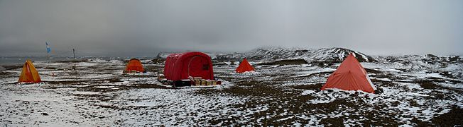
Scientific camp, 2009 austral autumn -

Panoramic photo of Marambio Base at dawn, 2009 austral autumn


Climate
The average temperatures at the base are −1,5 °C (29,3 °F) during the summer, and −15 °C (5 °F) during the winter, though the strong winds can lower the apparent temperature down to −60 °C (−76 °F) Its highest recorded temperature is 17,4 °C (63,3 °F) on 23 March 2015[17] the second highest temperature ever recorded in Antarctica after those registered in Signy Island, which is much further north.
| ||||||||||||||||||||||||||||||||||||||||||||||||||||||||||||||||||||||||||||||||||||||||||||||||||||||||||||||||||||||||||||
See also
References
- Citations
- ^ a b c d e «Misión y Organización – Organismos y Unidades – Base Marambio» (på Spanish). Argentine Air Force. Arkivert fra originalen 3 December 2013. Sjekk datoverdier i
|arkivdato=(hjelp) - ^ «Argentine Antarctic Stations». Dirección Nacional del Antártico. Arkivert fra originalen 20 June 2013. Sjekk datoverdier i
|arkivdato=(hjelp) - ^ a b c d e f g h i j k l m n o p q r Siteringsfeil: Ugyldig
<ref>-tagg; ingen tekst ble oppgitt for referansen ved navnfundmar1 - ^ a b c d e «Marambio Station / Seymour Island». French-Polar-Team. Arkivert fra originalen 7 March 2014. Sjekk datoverdier i
|arkivdato=(hjelp) - ^ a b «Primer aterrizaje de un Hércules C-130 (TC-61) en Marambio» (på Spanish). Fundación Marambio. Arkivert fra originalen 29 May 2013. Sjekk datoverdier i
|arkivdato=(hjelp) - ^ a b Siteringsfeil: Ugyldig
<ref>-tagg; ingen tekst ble oppgitt for referansen ved navndna1 - ^ «Base Marambio». World Aero Data. Arkivert fra originalen 6 April 2013. Sjekk datoverdier i
|arkivdato=(hjelp) - ^ «CTI, Nokia Deploy GSM Technology in Antarctic Base». Cellular News. 7 September 2008. Arkivert fra originalen 19 June 2014. Sjekk datoverdier i
|arkivdato=, |dato=(hjelp) - ^ «Exploring the Lifecycle of a Drifting Antarctic Iceberg». National Snow and Ice Data Center.
- ^ Scambos, Ted. «Investigating Iceberg Evolution During Drift and Break-Up: A Proxy for Climate-Related Changes in Antarctic Ice Shelves». National Snow and Ice Data Center.
- ^ «Guidelines for Antarctic GPS monumentation - Edition 2». Scientific Committee on Antarctic Research.
- ^ Zakrajsek A. F., Peretti, A. (1997). «Geodetic Monumentation in Antarctic Permafrost, Marambio (Seymour) Island».
- ^ «Encyclopedia Astronautica – Marambio». Astronautix. Arkivert fra originalen 31 December 2013. «Sounding rocket launch location known to have been used for 7 launches from 1975 to 1982, reaching up to 400 kilometers altitude» Sjekk datoverdier i
|arkivdato=(hjelp) - ^ «Studies on Atmospheric Ozone from Belgrano and Marambio Stations in Antarctica, and Ushuaia, Argentina». Global Change Master Directory. NASA.
- ^ Henao, Luis Andrés (21 March 2011). «NASA tests Mars space suit in Argentine Antarctica». Reuters. Sjekk datoverdier i
|dato=(hjelp) - ^ «The Finnish Meteorological Institute measures aerosols and greenhouse gases all year round in Antarctica». Finnish Meteorological Institute. 11 March 2013. Arkivert fra originalen 19 October 2013. Sjekk datoverdier i
|arkivdato=, |dato=(hjelp) - ^ http://www.ogimet.com/cgi-bin/gsynres?ind=89055&decoded=yes&ndays=2&ano=2015&mes=03&day=24&hora=00
- ^ «Servicios Climáticos – Información de Turismo – Base Marambio – Datos estadísticos (1971–1990)» (på Spanish). National Meteorological Service of Argentina. Besøkt 4 February 2013. Sjekk datoverdier i
|besøksdato=(hjelp)
External links
(en) Marambio Station – kategori av bilder, video eller lyd på Commons
| Skandinavia: | .svg) | |
|---|---|---|
| Europa: |
| |
| Afrika: |
| |
| Amerika: |
| |
| Asia: | ||
| Oseania: | ||
| Nedlagte stasjoner (utvalg): | ||