
Fil:FrontLines Environment Photo Contest Winner -5 (5808476109).jpg
Størrelse på denne forhåndsvisningen: 800 × 534 piksler. Andre oppløsninger: 320 × 214 piksler | 640 × 427 piksler | 1 024 × 683 piksler | 1 280 × 854 piksler.
Opprinnelig fil (1 280 × 854 piksler, filstørrelse: 432 KB, MIME-type: image/jpeg)
| Denne filen er fra Wikimedia Commons og kan brukes av andre prosjekter. Informasjonen fra filbeskrivelsessiden vises nedenfor. |
.jpg)
Beskrivelse
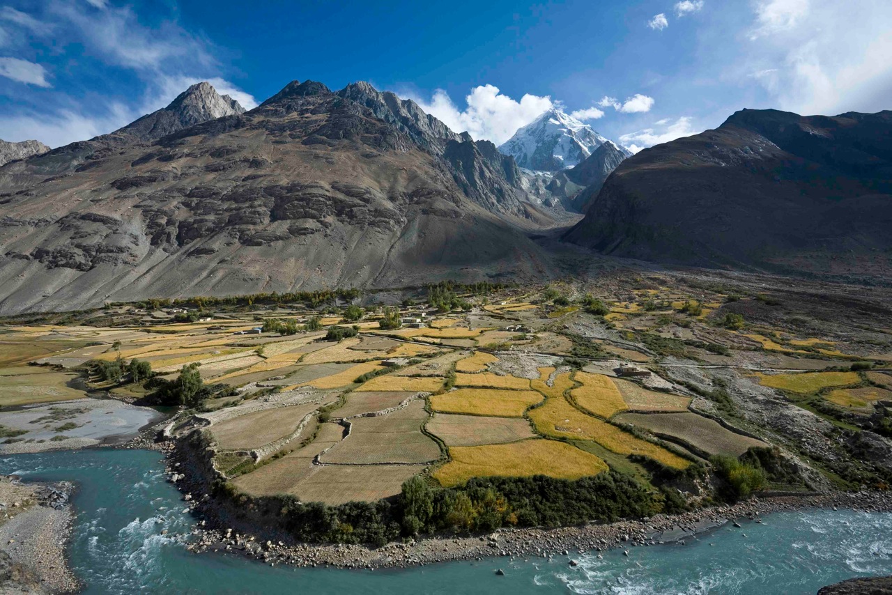
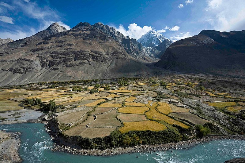
| Beskrivelse | Here, a dramatic view of flood plain cultivation in Wakhan, Afghanistan. Known as "the roof of the world," the Wildlife Conservation Society says the Wakhan Corridor has few rivals in terms of scenic beauty. The little-known area is nestled in the high Pamir Mountains and the region is flanked by the Hindu Kush, Himalayn, Karakoram, and Kunlun ranges. Credit: John Winnie Jr., WCS-Afghanistan |
| Dato | |
| Kilde | FrontLines Environment Photo Contest Winner #5 |
| Opphavsperson | USAID U.S. Agency for International Development |
| Kameraposisjon | | Dette og andre bilder på denne posisjonen på: OpenStreetMap |
|---|
.jpg¶ms=036.952778_N_0072.962500_E_globe:Earth_type:camera__&language=nb)
| Objektposisjon | | Dette og andre bilder på denne posisjonen på: OpenStreetMap |
|---|
.jpg¶ms=036.951111_N_0072.962778_E_globe:Earth_class:object_type:object__&language=nb)
The geographical information in this file was retrospectively estimated.
The location may therefore be somewhat imprecise. Verifying and refining these coordinates is strongly encouraged. |
- Notes on location estimate
- Identify village by shape of the farm field
Lisensiering
This image is a work of a United States Agency for International Development employee, taken or made as part of that person's official duties. As a work of the U.S. federal government, the image is in the public domain in the United States.
See also: The USAID privacy policy and the USAID Office of Inspector General "Disclaimers & Notices" page
|
 |
| Dette bildet ble opprinnelig lastet opp til Flickr av USAID_IMAGES på https://flickr.com/photos/46658241@N06/5808476109. Det ble undersøkt av boten FlickreviewR den 4. januar 2017 og bekreftet å være lisensiert under vilkårene til United States Government Work. |
Filhistorikk
Klikk på et tidspunkt for å vise filen slik den var på det tidspunktet.
| Dato/klokkeslett | Miniatyrbilde | Dimensjoner | Bruker | Kommentar | |
|---|---|---|---|---|---|
| nåværende | 4. jan. 2017 kl. 04:06 | | 1 280 × 854 (432 KB) | Reguyla | Transferred from Flickr via Flickr2Commons |
Filbruk
Det er ingen sider som bruker denne filen.
Global filbruk
Følgende andre wikier bruker denne filen:
- Bruk i arz.wikipedia.org
- Bruk i be.wikipedia.org
- Bruk i bg.wikipedia.org
- Bruk i ca.wikipedia.org
- Bruk i ceb.wikipedia.org
- Bruk i cs.wikipedia.org
- Bruk i de.wikipedia.org
- Bruk i de.wikivoyage.org
- Bruk i el.wikipedia.org
- Bruk i en.wikipedia.org
- Bruk i en.wikivoyage.org
- Bruk i eo.wikipedia.org
- Bruk i es.wikipedia.org
- Bruk i eu.wikipedia.org
- Bruk i fa.wikipedia.org
- Bruk i he.wikivoyage.org
- Bruk i ja.wikipedia.org
- Bruk i pl.wikipedia.org
- Bruk i pl.wiktionary.org
- Bruk i ru.wikipedia.org
- Bruk i ru.wikinews.org
- Bruk i sv.wikipedia.org
- Bruk i ta.wikipedia.org
- Bruk i uk.wikipedia.org
- Bruk i ur.wikipedia.org
- Bruk i www.wikidata.org
- Bruk i zh.wikipedia.org
.jpg)