
Fil:USGS 1950s mapping field camp.jpg

Størrelse på denne forhåndsvisningen: 800 × 497 piksler. Andre oppløsninger: 320 × 199 piksler | 640 × 398 piksler | 1 024 × 637 piksler | 1 280 × 796 piksler | 2 672 × 1 661 piksler.
Opprinnelig fil (2 672 × 1 661 piksler, filstørrelse: 3,5 MB, MIME-type: image/jpeg)
| Denne filen er fra Wikimedia Commons og kan brukes av andre prosjekter. Informasjonen fra filbeskrivelsessiden vises nedenfor. |
Beskrivelse
| Beskrivelse |
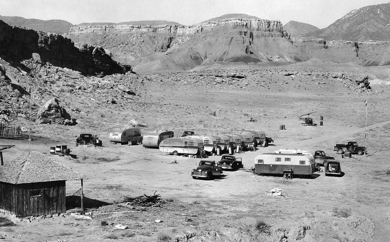
English: A typical USGS mapping field camp. Note the helicopter parked near the trailers. Helicopters were first used by the USGS for topographic mapping in Death Valley in 1948. (Description from USGS.) |
| Dato | ca. mellom 1950 og 1955 |
| Kilde | USGS Historical Photographs: Mapping Field Camp: http://online.wr.usgs.gov/outreach/historicPhotos/enlarged/mapping_camp_1950.html |
| Opphavsperson | US Geological Survey |
Lisensiering
This image is in the public domain in the United States because it only contains materials that originally came from the United States Geological Survey, an agency of the United States Department of the Interior. For more information, see the official USGS copyright policy.
|
Filhistorikk
Klikk på et tidspunkt for å vise filen slik den var på det tidspunktet.
| Dato/klokkeslett | Miniatyrbilde | Dimensjoner | Bruker | Kommentar | |
|---|---|---|---|---|---|
| nåværende | 30. jan. 2009 kl. 22:50 | | 2 672 × 1 661 (3,5 MB) | Awickert | {{Information |Description={{en|1=A typical USGS mapping field camp. Note the helicopter parked near the trailers. Helicopters were first used by the USGS for topographic mapping in Death Valley in 1948. (Description from USGS.)}} |Source=USGS Historical |
Filbruk
Det er ingen sider som bruker denne filen.
Global filbruk
Følgende andre wikier bruker denne filen:
- Bruk i en.wikipedia.org
- Bruk i la.wikipedia.org
- Bruk i sv.wikipedia.org
- Bruk i vi.wikipedia.org