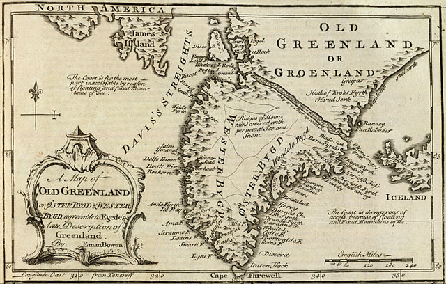
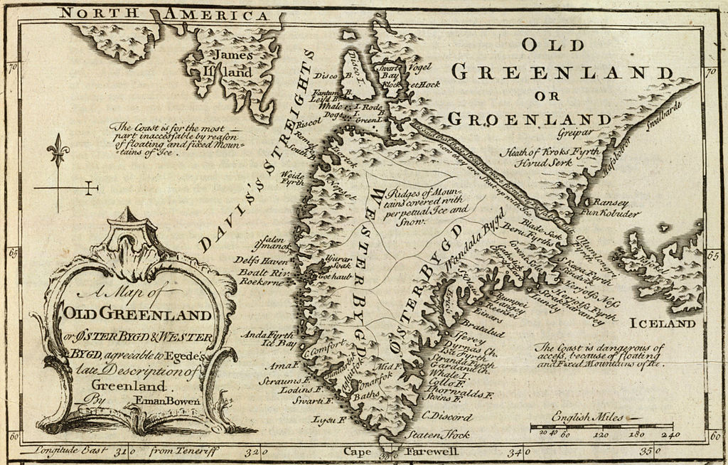
Fil:Old Greenland 1747.jpg

Sideinnholdet støttes ikke på andre språk.
Fra Wikipedia, den frie encyklopedi

Opprinnelig fil(2 048 × 1 307 piksler, filstørrelse: 2,23 MB, MIME-type: image/jpeg)


Wikimedia Commons' logo

Beskrivelse

Beskrivelse
English: Cropped and rotated from the original.


Original description from the David Rumsey Historical Map Collection:

Author:
Bowen, Emanuel
Date:
1747
Short Title:
Old Greenland.
Publisher:
William Innys [et al.]
London
Type:
Atlas Map
Obj Height cm:
33
Obj Width cm:
23
Scale 1:
9,850,000
Note:
Engraved map. Includes geographic notes and ornamental cartouche. Relief shown pictorially. Ancillary maps [here omitted]: A map of the islands of Ferro or Farro according to Jacobson Debes -- A draught of the Whirlpool, on the south east of Sumbo Rocks wth. the soundings -- An improved map of Iceland. Prime meridian: Teneriffe.
Reference:
P-Maps, p. 303 (1752 ed.); NMM p.356; M&B p 166.
Country:
Greenland; Iceland [here omitted]
Full Title:
A map of old Greenland or Oster Bygd & Wester Bygd, agreeable to Egede's late description of Greenland. By Eman. Bowen. (London: Printed for William Innys, Richard Ware, Aaron Ward, J. and P. Knapton, John Clarke, T. Longman and T. Shewell, Thomas Osborne, Henry Whitridge ... M.DCC.XLVII)
List No:
3733.070
Page No:
No. 71
Series No:
73
Publication Author:
Bowen, Emanuel
Pub Date:
1747
Pub Title:
A complete system of geography. Being a description of all the countries, islands, cities, chief towns, harbours, lakes, and rivers, mountains, mines, &c. of the known world ... In two volumes. The whole illustrated with seventy maps, by Emanuel Bowen, Geographer to His Majesty, being all new-drawn and ingraved according to the latest discoveries and surveys; making, of themselves, a complete atlas, for the sse of gentlemen, merchants, mariners, and others, who delight in history and geography ... Vol. 1. London: Printed for William Innys, Richard Ware, Aaron Ward, J. and P. Knapton, John Clarke, T. Longman and T. Shewell, Thomas Osborne, Henry Whitridge ... M.DCC.XLVII.
Pub Reference:
cf P614 (1752 edition of A Complete Atlas...); NMM p.356; M&B p 166.
Pub Note:
"Preserving all that is useful in the Fourth and Last edition of the Complete Geographer, publish'd under the name of Herman Moll, &c."
Pub List No:
3733.000
Pub Type:
Geography Book
Pub Maps:
70
Pub Height cm:
43
Pub Width cm:
28
Image No:
3733070
Institution:

Rumsey Collection
Dato
Kilde David Rumsey Collection
Opphavsperson Emanuel Bowen (c. 1694–1767)

Lisensiering

This is a faithful photographic reproduction of a two-dimensional, public domain work of art. The work of art itself is in the public domain for the following reason:
Public domain

Dette verket er offentlig eiendom i Norge, EU og land der den opphavsrettslige vernetiden etter opphavsmannens død er 100 år eller kortere. Merk at noen land har lengre vernetid.


For å kunne lagres på Commons må verket både være offentlig eiendom i USA og i opphavslandet. Vernetiden kan i noen tilfeller være lengre enn 80 år i USA, så i tillegg til dette merket trengs det et eget merke som forklarer hvorfor verket er offentlig eiendom (public domain) i USA.
The official position taken by the Wikimedia Foundation is that "faithful reproductions of two-dimensional public domain works of art are public domain".
This photographic reproduction is therefore also considered to be in the public domain in the United States. In other jurisdictions, re-use of this content may be restricted; see Reuse of PD-Art photographs for details.

Filhistorikk

Klikk på et tidspunkt for å vise filen slik den var på det tidspunktet.

Dato/klokkeslettMiniatyrbildeDimensjonerBrukerKommentar
nåværende10. mai 2012 kl. 17:21Miniatyrbilde av versjonen fra 10. mai 2012 kl. 17:212 048 × 1 307 (2,23 MB)LlywelynII

Det er ingen sider som bruker denne filen.

Global filbruk

Følgende andre wikier bruker denne filen: