
Fil:MapAfricaSize.gif
Ingen høyere oppløsning tilgjengelig.
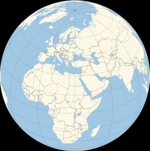
MapAfricaSize.gif (480 × 481 piksler, filstørrelse: 12,05 MB, MIME-type: image/gif, gjentas, 213 rammer, 21 s)
| Denne filen er fra Wikimedia Commons og kan brukes av andre prosjekter. Informasjonen fra filbeskrivelsessiden vises nedenfor. |
Comparing without considering lines of longitude. Africa is on the equator.
Beskrivelse
| Beskrivelse |
English: Comparison of Africa size with other continents |
| Dato | |
| Kilde | https://twitter.com/j_bertolotti/status/1258391481922080773 |
| Opphavsperson | Jacopo Bertolotti |
| Tillatelse (Gjenbruk av denne filen) |
https://twitter.com/j_bertolotti/status/1030470604418428929 |
Mathematica 12.0 code
(*Beware! The code is not optimized at all!*)
sinstep[t_] := Sin[\[Pi]/2 t]^2;
stopstep[t_] := t (2 - t);
bouncestep[t_] := 1 - Sin[\[Pi]/(2 (1 - t))] (1 - t)^2; (**beware of

p0 = Table[
   Graphics @@ GeoGraphics[GeoRange -> "World", GeoProjection -> {"Orthographic", "Centering" -> (stopstep[t] ({0, 360 + 20} - c1) + c1) }, GeoGridLines -> Automatic, GeoZoomLevel -> 2, Background -> Black]
   , {t, 0, 1, 0.02}];
p1 = Table[Show[
    Graphics @@ GeoGraphics[GeoRange -> "World", GeoProjection -> {"Orthographic", "Centering" -> c2}, GeoGridLines -> Automatic, GeoZoomLevel -> 2, Background -> Black]
    ,
    Graphics @@ GeoGraphics[{GeoStyling[Automatic, {Opacity[0.5*sinstep[t]], Purple}], Polygon[\!\(\*
NamespaceBox["LinguisticAssistant",
DynamicModuleBox[{Typeset`query$$ = "Africa", Typeset`boxes$$ =
            TemplateBox[{"\"Africa\"",
RowBox[{"Entity", "[",
RowBox[{"\"GeographicRegion\"", ",", "\"Africa\""}], "]"}],
              "\"Entity[\\\"GeographicRegion\\\", \\\"Africa\\\"]\"",
              "\"geographic region\""}, "Entity"],
            Typeset`allassumptions$$ = {{
             "type" -> "Clash", "word" -> "Africa",
              "template" -> "Assuming \"${word}\" is ${desc1}. Use as \
${desc2} instead", "count" -> "3",
              "Values" -> {{
                "name" -> "GeographicRegion", "desc" -> "a continent",
                  "input" -> "*C.Africa-_*GeographicRegion-"}, {
                "name" -> "CountryClass",
                 "desc" -> "a class of countries",
                 "input" -> "*C.Africa-_*CountryClass-"}, {
                "name" -> "GivenName", "desc" -> "a given name",
                 "input" -> "*C.Africa-_*GivenName-"}}}},
            Typeset`assumptions$$ = {}, Typeset`open$$ = {1, 2},
            Typeset`querystate$$ = {
            "Online" -> True, "Allowed" -> True,
             "mparse.jsp" -> 0.777247`6.342104047934638,
             "Messages" -> {}}},
DynamicBox[ToBoxes[
AlphaIntegration`LinguisticAssistantBoxes["", 4, Automatic,
Dynamic[Typeset`query$$],
Dynamic[Typeset`boxes$$],
Dynamic[Typeset`allassumptions$$],
Dynamic[Typeset`assumptions$$],
Dynamic[Typeset`open$$],
Dynamic[Typeset`querystate$$]], StandardForm],
ImageSizeCache->{202.2265625, {8.11328125, 18.11328125}},
TrackedSymbols:>{
              Typeset`query$$, Typeset`boxes$$,
               Typeset`allassumptions$$, Typeset`assumptions$$,
               Typeset`open$$, Typeset`querystate$$}],
DynamicModuleValues:>{},
UndoTrackedVariables:>{Typeset`open$$}],
BaseStyle->{"Deploy"},
DeleteWithContents->True,
Editable->False,
SelectWithContents->True]\)]}, GeoRange -> "World",
      GeoProjection -> {"Orthographic", "Centering" -> c2,
        GeoZoomLevel -> 1}, Background -> None, GeoBackground -> None]
    ]
   , {t, 0, 1, 0.1}];
p2 = Table[Show[
    Graphics @@
     GeoGraphics[GeoRange -> "World",
      GeoProjection -> {"Orthographic",
        "Centering" -> bouncestep[t]*(c5 - c2) + c2 }
      , GeoGridLines -> Automatic, GeoZoomLevel -> 2,
      Background -> Black]
    ,
    Graphics @@
     GeoGraphics[{GeoStyling[Automatic, {Opacity[0.5], Purple}],
       Polygon[\!\(\*
NamespaceBox["LinguisticAssistant",
DynamicModuleBox[{Typeset`query$$ = "Africa", Typeset`boxes$$ =
            TemplateBox[{"\"Africa\"",
RowBox[{"Entity", "[",
RowBox[{"\"GeographicRegion\"", ",", "\"Africa\""}], "]"}],
              "\"Entity[\\\"GeographicRegion\\\", \\\"Africa\\\"]\"",
              "\"geographic region\""}, "Entity"],
            Typeset`allassumptions$$ = {{
             "type" -> "Clash", "word" -> "Africa",
              "template" -> "Assuming \"${word}\" is ${desc1}. Use as \
${desc2} instead", "count" -> "3",
              "Values" -> {{
                "name" -> "GeographicRegion", "desc" -> "a continent",
                  "input" -> "*C.Africa-_*GeographicRegion-"}, {
                "name" -> "CountryClass",
                 "desc" -> "a class of countries",
                 "input" -> "*C.Africa-_*CountryClass-"}, {
                "name" -> "GivenName", "desc" -> "a given name",
                 "input" -> "*C.Africa-_*GivenName-"}}}},
            Typeset`assumptions$$ = {}, Typeset`open$$ = {1, 2},
            Typeset`querystate$$ = {
            "Online" -> True, "Allowed" -> True,
             "mparse.jsp" -> 0.777247`6.342104047934638,
             "Messages" -> {}}},
DynamicBox[ToBoxes[
AlphaIntegration`LinguisticAssistantBoxes["", 4, Automatic,
Dynamic[Typeset`query$$],
Dynamic[Typeset`boxes$$],
Dynamic[Typeset`allassumptions$$],
Dynamic[Typeset`assumptions$$],
Dynamic[Typeset`open$$],
Dynamic[Typeset`querystate$$]], StandardForm],
ImageSizeCache->{202.2265625, {8.11328125, 18.11328125}},
TrackedSymbols:>{
              Typeset`query$$, Typeset`boxes$$,
               Typeset`allassumptions$$, Typeset`assumptions$$,
               Typeset`open$$, Typeset`querystate$$}],
DynamicModuleValues:>{},
UndoTrackedVariables:>{Typeset`open$$}],
BaseStyle->{"Deploy"},
DeleteWithContents->True,
Editable->False,
SelectWithContents->True]\)]}, GeoRange -> "World",
      GeoProjection -> {"Orthographic", "Centering" -> {0, 20},
        GeoZoomLevel -> 1}, Background -> None,
      GeoBackground -> None]
    ]
   , {t, 0, 1, 0.051}];
p3 = Table[Show[
    Graphics @@
     GeoGraphics[GeoRange -> "World",
      GeoProjection -> {"Orthographic",
        "Centering" -> bouncestep[t]*(c3 - c5) + c5 }
      , GeoGridLines -> Automatic, GeoZoomLevel -> 2,
      Background -> Black]
    ,
    Graphics @@
     GeoGraphics[{GeoStyling[Automatic, {Opacity[0.5], Purple}],
       Polygon[\!\(\*
NamespaceBox["LinguisticAssistant",
DynamicModuleBox[{Typeset`query$$ = "Africa", Typeset`boxes$$ =
            TemplateBox[{"\"Africa\"",
RowBox[{"Entity", "[",
RowBox[{"\"GeographicRegion\"", ",", "\"Africa\""}], "]"}],
              "\"Entity[\\\"GeographicRegion\\\", \\\"Africa\\\"]\"",
              "\"geographic region\""}, "Entity"],
            Typeset`allassumptions$$ = {{
             "type" -> "Clash", "word" -> "Africa",
              "template" -> "Assuming \"${word}\" is ${desc1}. Use as \
${desc2} instead", "count" -> "3",
              "Values" -> {{
                "name" -> "GeographicRegion", "desc" -> "a continent",
                  "input" -> "*C.Africa-_*GeographicRegion-"}, {
                "name" -> "CountryClass",
                 "desc" -> "a class of countries",
                 "input" -> "*C.Africa-_*CountryClass-"}, {
                "name" -> "GivenName", "desc" -> "a given name",
                 "input" -> "*C.Africa-_*GivenName-"}}}},
            Typeset`assumptions$$ = {}, Typeset`open$$ = {1, 2},
            Typeset`querystate$$ = {
            "Online" -> True, "Allowed" -> True,
             "mparse.jsp" -> 0.777247`6.342104047934638,
             "Messages" -> {}}},
DynamicBox[ToBoxes[
AlphaIntegration`LinguisticAssistantBoxes["", 4, Automatic,
Dynamic[Typeset`query$$],
Dynamic[Typeset`boxes$$],
Dynamic[Typeset`allassumptions$$],
Dynamic[Typeset`assumptions$$],
Dynamic[Typeset`open$$],
Dynamic[Typeset`querystate$$]], StandardForm],
ImageSizeCache->{202.2265625, {8.11328125, 18.11328125}},
TrackedSymbols:>{
              Typeset`query$$, Typeset`boxes$$,
               Typeset`allassumptions$$, Typeset`assumptions$$,
               Typeset`open$$, Typeset`querystate$$}],
DynamicModuleValues:>{},
UndoTrackedVariables:>{Typeset`open$$}],
BaseStyle->{"Deploy"},
DeleteWithContents->True,
Editable->False,
SelectWithContents->True]\)]}, GeoRange -> "World",
      GeoProjection -> {"Orthographic", "Centering" -> {0, 20},
        GeoZoomLevel -> 1}, Background -> None,
      GeoBackground -> None]
    ]
   , {t, 0, 1, 0.051}];
p4 = Table[Show[
    Graphics @@
     GeoGraphics[GeoRange -> "World",
      GeoProjection -> {"Orthographic",
        "Centering" -> bouncestep[t]*(c4 - c3) + c3 }
      , GeoGridLines -> Automatic, GeoZoomLevel -> 2,
      Background -> Black]
    ,
    Graphics @@
     GeoGraphics[{GeoStyling[Automatic, {Opacity[0.5], Purple}],
       Polygon[\!\(\*
NamespaceBox["LinguisticAssistant",
DynamicModuleBox[{Typeset`query$$ = "Africa", Typeset`boxes$$ =
            TemplateBox[{"\"Africa\"",
RowBox[{"Entity", "[",
RowBox[{"\"GeographicRegion\"", ",", "\"Africa\""}], "]"}],
              "\"Entity[\\\"GeographicRegion\\\", \\\"Africa\\\"]\"",
              "\"geographic region\""}, "Entity"],
            Typeset`allassumptions$$ = {{
             "type" -> "Clash", "word" -> "Africa",
              "template" -> "Assuming \"${word}\" is ${desc1}. Use as \
${desc2} instead", "count" -> "3",
              "Values" -> {{
                "name" -> "GeographicRegion", "desc" -> "a continent",
                  "input" -> "*C.Africa-_*GeographicRegion-"}, {
                "name" -> "CountryClass",
                 "desc" -> "a class of countries",
                 "input" -> "*C.Africa-_*CountryClass-"}, {
                "name" -> "GivenName", "desc" -> "a given name",
                 "input" -> "*C.Africa-_*GivenName-"}}}},
            Typeset`assumptions$$ = {}, Typeset`open$$ = {1, 2},
            Typeset`querystate$$ = {
            "Online" -> True, "Allowed" -> True,
             "mparse.jsp" -> 0.777247`6.342104047934638,
             "Messages" -> {}}},
DynamicBox[ToBoxes[
AlphaIntegration`LinguisticAssistantBoxes["", 4, Automatic,
Dynamic[Typeset`query$$],
Dynamic[Typeset`boxes$$],
Dynamic[Typeset`allassumptions$$],
Dynamic[Typeset`assumptions$$],
Dynamic[Typeset`open$$],
Dynamic[Typeset`querystate$$]], StandardForm],
ImageSizeCache->{202.2265625, {8.11328125, 18.11328125}},
TrackedSymbols:>{
              Typeset`query$$, Typeset`boxes$$,
               Typeset`allassumptions$$, Typeset`assumptions$$,
               Typeset`open$$, Typeset`querystate$$}],
DynamicModuleValues:>{},
UndoTrackedVariables:>{Typeset`open$$}],
BaseStyle->{"Deploy"},
DeleteWithContents->True,
Editable->False,
SelectWithContents->True]\)]}, GeoRange -> "World",
      GeoProjection -> {"Orthographic", "Centering" -> {0, 20},
        GeoZoomLevel -> 1}, Background -> None,
      GeoBackground -> None]
    ]
   , {t, 0, 1, 0.051}];
p5 = Table[Show[
    Graphics @@
     GeoGraphics[GeoRange -> "World",
      GeoProjection -> {"Orthographic",
        "Centering" -> bouncestep[t]*(c6 - c4) + c4 }
      , GeoGridLines -> Automatic, GeoZoomLevel -> 2,
      Background -> Black]
    ,
    Graphics @@
     GeoGraphics[{GeoStyling[Automatic, {Opacity[0.5], Purple}],
       Polygon[\!\(\*
NamespaceBox["LinguisticAssistant",
DynamicModuleBox[{Typeset`query$$ = "Africa", Typeset`boxes$$ =
            TemplateBox[{"\"Africa\"",
RowBox[{"Entity", "[",
RowBox[{"\"GeographicRegion\"", ",", "\"Africa\""}], "]"}],
              "\"Entity[\\\"GeographicRegion\\\", \\\"Africa\\\"]\"",
              "\"geographic region\""}, "Entity"],
            Typeset`allassumptions$$ = {{
             "type" -> "Clash", "word" -> "Africa",
              "template" -> "Assuming \"${word}\" is ${desc1}. Use as \
${desc2} instead", "count" -> "3",
              "Values" -> {{
                "name" -> "GeographicRegion", "desc" -> "a continent",
                  "input" -> "*C.Africa-_*GeographicRegion-"}, {
                "name" -> "CountryClass",
                 "desc" -> "a class of countries",
                 "input" -> "*C.Africa-_*CountryClass-"}, {
                "name" -> "GivenName", "desc" -> "a given name",
                 "input" -> "*C.Africa-_*GivenName-"}}}},
            Typeset`assumptions$$ = {}, Typeset`open$$ = {1, 2},
            Typeset`querystate$$ = {
            "Online" -> True, "Allowed" -> True,
             "mparse.jsp" -> 0.777247`6.342104047934638,
             "Messages" -> {}}},
DynamicBox[ToBoxes[
AlphaIntegration`LinguisticAssistantBoxes["", 4, Automatic,
Dynamic[Typeset`query$$],
Dynamic[Typeset`boxes$$],
Dynamic[Typeset`allassumptions$$],
Dynamic[Typeset`assumptions$$],
Dynamic[Typeset`open$$],
Dynamic[Typeset`querystate$$]], StandardForm],
ImageSizeCache->{202.2265625, {8.11328125, 18.11328125}},
TrackedSymbols:>{
              Typeset`query$$, Typeset`boxes$$,
               Typeset`allassumptions$$, Typeset`assumptions$$,
               Typeset`open$$, Typeset`querystate$$}],
DynamicModuleValues:>{},
UndoTrackedVariables:>{Typeset`open$$}],
BaseStyle->{"Deploy"},
DeleteWithContents->True,
Editable->False,
SelectWithContents->True]\)]}, GeoRange -> "World",
      GeoProjection -> {"Orthographic", "Centering" -> {0, 20},
        GeoZoomLevel -> 1}, Background -> None,
      GeoBackground -> None]
    ]
   , {t, 0, 1, 0.051}];
p6 = Table[Show[
    Graphics @@
     GeoGraphics[GeoRange -> "World",
      GeoProjection -> {"Orthographic",
        "Centering" -> bouncestep[t]*(c7 - c6) + c6 }
      , GeoGridLines -> Automatic, GeoZoomLevel -> 2,
      Background -> Black]
    ,
    Graphics @@
     GeoGraphics[{GeoStyling[Automatic, {Opacity[0.5], Purple}],
       Polygon[\!\(\*
NamespaceBox["LinguisticAssistant",
DynamicModuleBox[{Typeset`query$$ = "Africa", Typeset`boxes$$ =
            TemplateBox[{"\"Africa\"",
RowBox[{"Entity", "[",
RowBox[{"\"GeographicRegion\"", ",", "\"Africa\""}], "]"}],
              "\"Entity[\\\"GeographicRegion\\\", \\\"Africa\\\"]\"",
              "\"geographic region\""}, "Entity"],
            Typeset`allassumptions$$ = {{
             "type" -> "Clash", "word" -> "Africa",
              "template" -> "Assuming \"${word}\" is ${desc1}. Use as \
${desc2} instead", "count" -> "3",
              "Values" -> {{
                "name" -> "GeographicRegion", "desc" -> "a continent",
                  "input" -> "*C.Africa-_*GeographicRegion-"}, {
                "name" -> "CountryClass",
                 "desc" -> "a class of countries",
                 "input" -> "*C.Africa-_*CountryClass-"}, {
                "name" -> "GivenName", "desc" -> "a given name",
                 "input" -> "*C.Africa-_*GivenName-"}}}},
            Typeset`assumptions$$ = {}, Typeset`open$$ = {1, 2},
            Typeset`querystate$$ = {
            "Online" -> True, "Allowed" -> True,
             "mparse.jsp" -> 0.777247`6.342104047934638,
             "Messages" -> {}}},
DynamicBox[ToBoxes[
AlphaIntegration`LinguisticAssistantBoxes["", 4, Automatic,
Dynamic[Typeset`query$$],
Dynamic[Typeset`boxes$$],
Dynamic[Typeset`allassumptions$$],
Dynamic[Typeset`assumptions$$],
Dynamic[Typeset`open$$],
Dynamic[Typeset`querystate$$]], StandardForm],
ImageSizeCache->{202.2265625, {8.11328125, 18.11328125}},
TrackedSymbols:>{
              Typeset`query$$, Typeset`boxes$$,
               Typeset`allassumptions$$, Typeset`assumptions$$,
               Typeset`open$$, Typeset`querystate$$}],
DynamicModuleValues:>{},
UndoTrackedVariables:>{Typeset`open$$}],
BaseStyle->{"Deploy"},
DeleteWithContents->True,
Editable->False,
SelectWithContents->True]\)]}, GeoRange -> "World",
      GeoProjection -> {"Orthographic", "Centering" -> {0, 20},
        GeoZoomLevel -> 1}, Background -> None,
      GeoBackground -> None]
    ]
   , {t, 0, 1, 0.051}];
p7 = Table[Show[
    Graphics @@
     GeoGraphics[GeoRange -> "World",
      GeoProjection -> {"Orthographic",
        "Centering" -> bouncestep[t]*(c8 - c7) + c7 }
      , GeoGridLines -> Automatic, GeoZoomLevel -> 2,
      Background -> Black]
    ,
    Graphics @@
     GeoGraphics[{GeoStyling[Automatic, {Opacity[0.5], Purple}],
       Polygon[\!\(\*
NamespaceBox["LinguisticAssistant",
DynamicModuleBox[{Typeset`query$$ = "Africa", Typeset`boxes$$ =
            TemplateBox[{"\"Africa\"",
RowBox[{"Entity", "[",
RowBox[{"\"GeographicRegion\"", ",", "\"Africa\""}], "]"}],
              "\"Entity[\\\"GeographicRegion\\\", \\\"Africa\\\"]\"",
              "\"geographic region\""}, "Entity"],
            Typeset`allassumptions$$ = {{
             "type" -> "Clash", "word" -> "Africa",
              "template" -> "Assuming \"${word}\" is ${desc1}. Use as \
${desc2} instead", "count" -> "3",
              "Values" -> {{
                "name" -> "GeographicRegion", "desc" -> "a continent",
                  "input" -> "*C.Africa-_*GeographicRegion-"}, {
                "name" -> "CountryClass",
                 "desc" -> "a class of countries",
                 "input" -> "*C.Africa-_*CountryClass-"}, {
                "name" -> "GivenName", "desc" -> "a given name",
                 "input" -> "*C.Africa-_*GivenName-"}}}},
            Typeset`assumptions$$ = {}, Typeset`open$$ = {1, 2},
            Typeset`querystate$$ = {
            "Online" -> True, "Allowed" -> True,
             "mparse.jsp" -> 0.777247`6.342104047934638,
             "Messages" -> {}}},
DynamicBox[ToBoxes[
AlphaIntegration`LinguisticAssistantBoxes["", 4, Automatic,
Dynamic[Typeset`query$$],
Dynamic[Typeset`boxes$$],
Dynamic[Typeset`allassumptions$$],
Dynamic[Typeset`assumptions$$],
Dynamic[Typeset`open$$],
Dynamic[Typeset`querystate$$]], StandardForm],
ImageSizeCache->{202.2265625, {8.11328125, 18.11328125}},
TrackedSymbols:>{
              Typeset`query$$, Typeset`boxes$$,
               Typeset`allassumptions$$, Typeset`assumptions$$,
               Typeset`open$$, Typeset`querystate$$}],
DynamicModuleValues:>{},
UndoTrackedVariables:>{Typeset`open$$}],
BaseStyle->{"Deploy"},
DeleteWithContents->True,
Editable->False,
SelectWithContents->True]\)]}, GeoRange -> "World",
      GeoProjection -> {"Orthographic", "Centering" -> {0, 20},
        GeoZoomLevel -> 1}, Background -> None,
      GeoBackground -> None]
    ]
   , {t, 0, 1, 0.051}];
p8 = Table[Show[
    Graphics @@
     GeoGraphics[GeoRange -> "World",
      GeoProjection -> {"Orthographic",
        "Centering" -> bouncestep[t]*(c2 - c8) + c8 }
      , GeoGridLines -> Automatic, GeoZoomLevel -> 2,
      Background -> Black]
    ,
    Graphics @@
     GeoGraphics[{GeoStyling[Automatic, {Opacity[0.5], Purple}],
       Polygon[\!\(\*
NamespaceBox["LinguisticAssistant",
DynamicModuleBox[{Typeset`query$$ = "Africa", Typeset`boxes$$ =
            TemplateBox[{"\"Africa\"",
RowBox[{"Entity", "[",
RowBox[{"\"GeographicRegion\"", ",", "\"Africa\""}], "]"}],
              "\"Entity[\\\"GeographicRegion\\\", \\\"Africa\\\"]\"",
              "\"geographic region\""}, "Entity"],
            Typeset`allassumptions$$ = {{
             "type" -> "Clash", "word" -> "Africa",
              "template" -> "Assuming \"${word}\" is ${desc1}. Use as \
${desc2} instead", "count" -> "3",
              "Values" -> {{
                "name" -> "GeographicRegion", "desc" -> "a continent",
                  "input" -> "*C.Africa-_*GeographicRegion-"}, {
                "name" -> "CountryClass",
                 "desc" -> "a class of countries",
                 "input" -> "*C.Africa-_*CountryClass-"}, {
                "name" -> "GivenName", "desc" -> "a given name",
                 "input" -> "*C.Africa-_*GivenName-"}}}},
            Typeset`assumptions$$ = {}, Typeset`open$$ = {1, 2},
            Typeset`querystate$$ = {
            "Online" -> True, "Allowed" -> True,
             "mparse.jsp" -> 0.777247`6.342104047934638,
             "Messages" -> {}}},
DynamicBox[ToBoxes[
AlphaIntegration`LinguisticAssistantBoxes["", 4, Automatic,
Dynamic[Typeset`query$$],
Dynamic[Typeset`boxes$$],
Dynamic[Typeset`allassumptions$$],
Dynamic[Typeset`assumptions$$],
Dynamic[Typeset`open$$],
Dynamic[Typeset`querystate$$]], StandardForm],
ImageSizeCache->{202.2265625, {8.11328125, 18.11328125}},
TrackedSymbols:>{
              Typeset`query$$, Typeset`boxes$$,
               Typeset`allassumptions$$, Typeset`assumptions$$,
               Typeset`open$$, Typeset`querystate$$}],
DynamicModuleValues:>{},
UndoTrackedVariables:>{Typeset`open$$}],
BaseStyle->{"Deploy"},
DeleteWithContents->True,
Editable->False,
SelectWithContents->True]\)]}, GeoRange -> "World",
      GeoProjection -> {"Orthographic", "Centering" -> {0, 50pc},
        GeoZoomLevel -> 1}, Background -> None,
      GeoBackground -> None]
    ]
   , {t, 0, 1, 0.051}];

ListAnimate[Join[p0, p1, p2, p3, p4, p5, p6, p7, p8, Reverse[p1]] ]
Lisensiering
Jeg, rettighetsinnehaver av dette arbeidet, publiserer det herved under følgende lisens:
| Denne filen er gjort tilgjengelig under lisensen Creative Commons CC0 1.0 Universal Fristatus-erklæring. | |
| Personen som koblet et verk med dette dokumentet har tilegnet arbeidet til allmennheten ved, i den utstrekning loven tillater det, å avstå fra alle de rettigheter vedkommende skulle hatt ifølge opphavsrettsloven og andre relaterte eller nærliggende juridiske rettigheter. Verk under CC0 krever ikke attributtering. Ved bruk av verket trenger du ikke å få godkjennelse fra opphavspersonen.
|
Filhistorikk
Klikk på et tidspunkt for å vise filen slik den var på det tidspunktet.
| Dato/klokkeslett | Miniatyrbilde | Dimensjoner | Bruker | Kommentar | |
|---|---|---|---|---|---|
| nåværende | 8. mai 2020 kl. 12:56 | | 480 × 481 (12,05 MB) | Berto | Uploaded own work with UploadWizard |
Filbruk
Det er ingen sider som bruker denne filen.
Global filbruk
Følgende andre wikier bruker denne filen: