
Fil:Studebaker Dealership Atlantic Co NJ HABS.jpg
Størrelse på denne forhåndsvisningen: 760 × 600 piksler. Andre oppløsninger: 304 × 240 piksler | 608 × 480 piksler | 973 × 768 piksler | 1 280 × 1 010 piksler | 2 560 × 2 021 piksler | 4 692 × 3 704 piksler.
Opprinnelig fil (4 692 × 3 704 piksler, filstørrelse: 3,77 MB, MIME-type: image/jpeg)
| Denne filen er fra Wikimedia Commons og kan brukes av andre prosjekter. Informasjonen fra filbeskrivelsessiden vises nedenfor. |
This building is NOT in the city limits of Pleasantville. It's actually in the city limits of Egg Harbor Twp, this is a common misconception. The city of Pleasantville actually starts two blocks west of this location.
Beskrivelse
| Beskrivelse |
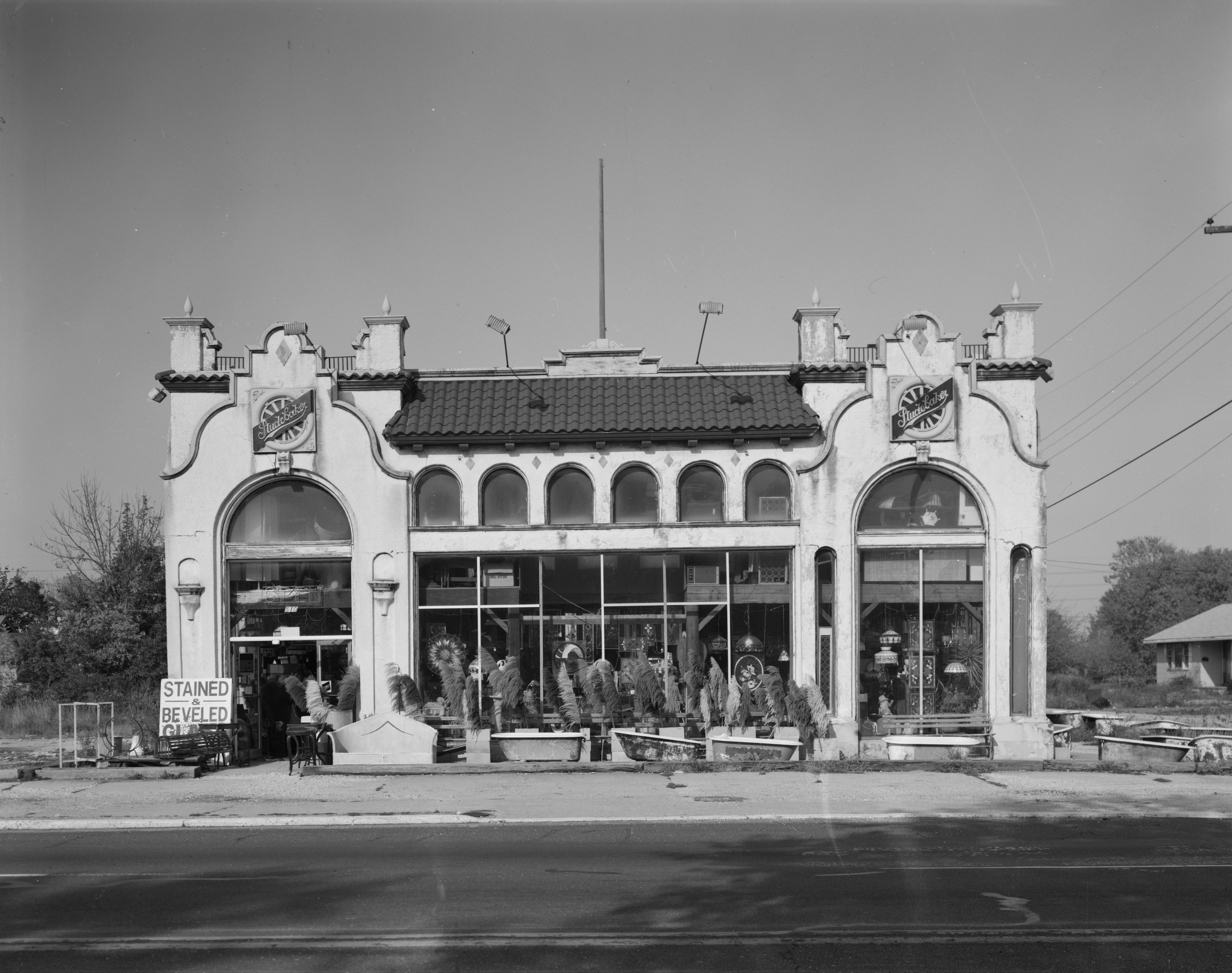
English: Cropped verion of our 2. PERSPECTIVE VIEW OF SOUTH AND WEST SIDES LOOKING NORTHEAST - Studebaker Dealership, U.S. Highway 40, Pleasantville, Atlantic County, NJ, 7006 E. Black Horse Pike, converted to jpeg |
| Dato | |
| Kilde | https://www.loc.gov/pictures/item/nj1428.photos.038302p/ |
| Opphavsperson | HABS |
| Objektposisjon | | Dette og andre bilder på denne posisjonen på: OpenStreetMap |
|---|
Lisensiering
This work is in the public domain in the United States because it is a work prepared by an officer or employee of the United States Government as part of that person’s official duties under the terms of Title 17, Chapter 1, Section 105 of the US Code.
Note: This only applies to original works of the Federal Government and not to the work of any individual U.S. state, territory, commonwealth, county, municipality, or any other subdivision. This template also does not apply to postage stamp designs published by the United States Postal Service since 1978. (See § 313.6(C)(1) of Compendium of U.S. Copyright Office Practices). It also does not apply to certain US coins; see The US Mint Terms of Use.
|
 | |
| Denne filen har blitt identifisert til å være fri for kjente restriksjoner under lov om opphavsrett, inkludert alle relaterte og nærstående rettigheter. | ||
Filhistorikk
Klikk på et tidspunkt for å vise filen slik den var på det tidspunktet.
| Dato/klokkeslett | Miniatyrbilde | Dimensjoner | Bruker | Kommentar | |
|---|---|---|---|---|---|
| nåværende | 30. nov. 2015 kl. 20:47 | | 4 692 × 3 704 (3,77 MB) | Smallbones | User created page with UploadWizard |
Filbruk
Den følgende siden bruker denne filen:
Global filbruk
Følgende andre wikier bruker denne filen:
- Bruk i ar.wikipedia.org
- Bruk i ca.wikipedia.org
- Bruk i ceb.wikipedia.org
- Bruk i ce.wikipedia.org
- Bruk i cy.wikipedia.org
- Bruk i en.wikipedia.org
- Bruk i es.wikipedia.org
- Bruk i eu.wikipedia.org
- Bruk i fr.wikipedia.org
- Bruk i ht.wikipedia.org
- Bruk i it.wikipedia.org
- Bruk i ky.wikipedia.org
- Bruk i lld.wikipedia.org
- Bruk i pl.wikipedia.org
- Bruk i pt.wikipedia.org
- Bruk i sr.wikipedia.org
- Bruk i tr.wikipedia.org
- Bruk i tt.wikipedia.org
- Bruk i uk.wikipedia.org
- Bruk i uz.wikipedia.org
- Bruk i vo.wikipedia.org
- Bruk i www.wikidata.org
- Bruk i zh-min-nan.wikipedia.org