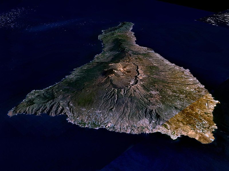
Fil:Nasa world wind - teneriffa.jpg

Størrelse på denne forhåndsvisningen: 800 × 599 piksler. Andre oppløsninger: 320 × 240 piksler | 640 × 479 piksler | 1 024 × 766 piksler | 1 280 × 958 piksler.
Opprinnelig fil (1 280 × 958 piksler, filstørrelse: 120 KB, MIME-type: image/jpeg)
Filhistorikk
Klikk på et tidspunkt for å vise filen slik den var på det tidspunktet.
| Dato/klokkeslett | Miniatyrbilde | Dimensjoner | Bruker | Kommentar | |
|---|---|---|---|---|---|
| nåværende | 31. mar. 2005 kl. 03:15 |  | 1 280 × 958 (120 KB) | Simplicius | {{NASA-PD}} Teneriffa from the west side. One sees Teide (3,700 meters) and the Caldera (2,000 m). To the right hand the new airport. On the left side one sees that there is more humidity and therefore vegetation at the north side of the island. |
Filbruk
Den følgende siden bruker denne filen:
Global filbruk
Følgende andre wikier bruker denne filen:
- Bruk i ar.wikipedia.org
- Bruk i be-tarask.wikipedia.org
- Bruk i cs.wikipedia.org
- Bruk i de.wikipedia.org
- Bruk i de.wikinews.org
- Bruk i de.wikivoyage.org
- Bruk i en.wiktionary.org
- Bruk i eo.wikipedia.org
- Bruk i es.wikipedia.org
- Bruk i fa.wikipedia.org
- Bruk i fi.wikipedia.org
- Bruk i frr.wikipedia.org
- Bruk i fy.wikipedia.org
- Bruk i gl.wikipedia.org
- Bruk i he.wikipedia.org
- Bruk i hu.wikipedia.org
- Bruk i incubator.wikimedia.org
- Bruk i it.wikipedia.org
- Bruk i mn.wikipedia.org
- Bruk i nn.wikipedia.org
- Bruk i pl.wiktionary.org
- Bruk i ru.wikipedia.org
- Bruk i sh.wikipedia.org
- Bruk i sk.wikipedia.org
- Bruk i sw.wikipedia.org
- Bruk i tr.wikipedia.org
- Bruk i uk.wikipedia.org
- Bruk i vi.wikivoyage.org
- Bruk i zgh.wikipedia.org

