
Fil:Moscow-downtownmap.jpg

Størrelse på denne forhåndsvisningen: 482 × 599 piksler. Andre oppløsninger: 193 × 240 piksler | 386 × 480 piksler | 1 004 × 1 248 piksler.
Opprinnelig fil (1 004 × 1 248 piksler, filstørrelse: 247 KB, MIME-type: image/jpeg)
| Denne filen er fra Wikimedia Commons og kan brukes av andre prosjekter. Informasjonen fra filbeskrivelsessiden vises nedenfor. |

|
Dette bildet bør gjenskapes med hjelp av vektorgrafikk som en SVG-fil. Dette har flere fordeler, se Commons:Media for cleanup for mer informasjon. Hvis en SVG-fil med dette bildet er tilgjengelig, vennligst last den opp. Etter opplasting erstatt denne malen med {{vector version available|nytt bilde.svg}}.
|


Beskrivelse
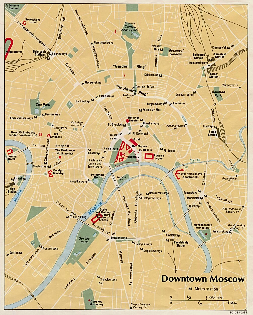
This is a map of downtown Moscow showing the concentric circles and radii formed by the city's streets. This image was taken from the University of Texas's Perry-Castañeda Library: Map Collection. It was created in 1988 by the Central Intelligence Agency, making it ineligible for copyright.
| This image is a work of a Central Intelligence Agency employee, taken or made as part of that person's official duties. As a Work of the United States Government, this image or media is in the public domain in the United States.
|

|
Filhistorikk
Klikk på et tidspunkt for å vise filen slik den var på det tidspunktet.
| Dato/klokkeslett | Miniatyrbilde | Dimensjoner | Bruker | Kommentar | |
|---|---|---|---|---|---|
| nåværende | 20. sep. 2006 kl. 17:29 | | 1 004 × 1 248 (247 KB) | Santac | {{SVG}} {{badjpeg}} This is a map of downtown Moscow showing the concentric circles and radii formed by the city's streets. This image was taken from the University of Texas's [http://www.lib.utexas.edu/maps/world_cities/moscow.jpg Perry-Castañ |
Filbruk
Det er ingen sider som bruker denne filen.
Global filbruk
Følgende andre wikier bruker denne filen:
- Bruk i da.wikipedia.org