
Fil:Map of Alabama NA.png

Størrelse på denne forhåndsvisningen: 776 × 600 piksler. Andre oppløsninger: 311 × 240 piksler | 621 × 480 piksler | 994 × 768 piksler | 1 280 × 989 piksler | 2 122 × 1 640 piksler.
Opprinnelig fil (2 122 × 1 640 piksler, filstørrelse: 1,61 MB, MIME-type: image/png)
| Denne filen er fra Wikimedia Commons og kan brukes av andre prosjekter. Informasjonen fra filbeskrivelsessiden vises nedenfor. |
Beskrivelse
| Beskrivelse |
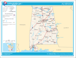
English: Map of the U.S. state of Alabama, with full legend area, copied from the National Atlas of the United States in high resolution form (1.61 megabytes). |
| Dato | (uploaded on 14. august 2006) |
| Kilde | |
| Opphavsperson | National Atlas of the United States (uploaded by User:Huebi) |
| Andre versjoner |
The map has some related variations:
|
Lisensiering
This map was obtained from an edition of the National Atlas of the United States. Like almost all works of the U.S. federal government, works from the National Atlas are in the public domain in the United States.
Online access: NationalAtlas.gov | 1970 print edition: Library of Congress, Perry-Castañeda Library
|
Filhistorikk
Klikk på et tidspunkt for å vise filen slik den var på det tidspunktet.
| Dato/klokkeslett | Miniatyrbilde | Dimensjoner | Bruker | Kommentar | |
|---|---|---|---|---|---|
| nåværende | 14. aug. 2006 kl. 22:08 | | 2 122 × 1 640 (1,61 MB) | Huebi~commonswiki | {{Information| |Description=Map of Alabama |Source=[http://www.nationalatlas.gov National Atlas] }} Category:Maps of the United States Category:Maps of Alabama {{PD-USGov-Atlas}} |
Filbruk
Den følgende siden bruker denne filen:
Global filbruk
Følgende andre wikier bruker denne filen:
- Bruk i als.wikipedia.org
- Bruk i bs.wikipedia.org
- Bruk i ca.wikipedia.org
- Bruk i de.wikipedia.org
- Bruk i en.wikipedia.org
- Bruk i hi.wikipedia.org
- Bruk i hr.wiktionary.org
- Bruk i hsb.wikipedia.org
- Bruk i hu.wikipedia.org
- Bruk i ilo.wikipedia.org
- Bruk i it.wikipedia.org
- Bruk i ja.wikipedia.org
- Bruk i ko.wikipedia.org
- Bruk i or.wikipedia.org
- Bruk i simple.wikipedia.org
- Bruk i si.wikipedia.org
- Bruk i uz.wikipedia.org
- Bruk i zea.wikipedia.org