
Fil:Map Boulaide.PNG
Ingen høyere oppløsning tilgjengelig.
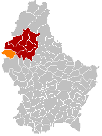
Map_Boulaide.PNG (203 × 270 piksler, filstørrelse: 6 KB, MIME-type: image/png)
| Denne filen er fra Wikimedia Commons og kan brukes av andre prosjekter. Informasjonen fra filbeskrivelsessiden vises nedenfor. |
Beskrivelse
| Beskrivelse |
English: Own edit of Kanton WiltzLocatie.png |
| Dato | 18. oktober 2005 (original upload date) |
| Kilde | No machine-readable source provided. Own work assumed (based on copyright claims). |
| Opphavsperson | Ingen maskinlesbar opphavsperson oppgitt. Markussep er antatt opphavsperson, basert på opplysninger om opphavsrett. |
Lisensiering
| Jeg, opphavsrettensholderen til dette verket, frigir dette verket til allmennheten. Dette gjelder på verdensbasis. I enkelte land kan dette være juridisk umulig. I så fall: Jeg gir hvem som helst retten til å bruke dette verket for ethvert formål, uten noen vilkår, med mindre slike vilkår kreves ved lov. |
Filhistorikk
Klikk på et tidspunkt for å vise filen slik den var på det tidspunktet.
| Dato/klokkeslett | Miniatyrbilde | Dimensjoner | Bruker | Kommentar | |
|---|---|---|---|---|---|
| nåværende | 8. jan. 2018 kl. 20:11 | | 203 × 270 (6 KB) | NordNordWest | corr |
| 8. jan. 2018 kl. 19:26 |  | 203 × 270 (6 KB) | NordNordWest | upd | |
| 10. nov. 2015 kl. 22:56 |  | 203 × 270 (6 KB) | NordNordWest | no more districts in Luxembourg | |
| 24. des. 2014 kl. 18:47 |  | 203 × 270 (3 KB) | Les Meloures | communes merged | |
| 28. okt. 2011 kl. 15:03 |  | 203 × 270 (3 KB) | Les Meloures | Something didn't work | |
| 28. okt. 2011 kl. 13:25 |  | 203 × 270 (4 KB) | Les Meloures | Replace map after creation of new municipalities in Luxembourg | |
| 28. okt. 2011 kl. 00:43 |  | 203 × 270 (3 KB) | Les Meloures | Change map after creation of new municipalities in Luxembourg | |
| 3. mai 2006 kl. 21:43 |  | 203 × 270 (4 KB) | Markussep | ||
| 18. okt. 2005 kl. 21:31 |  | 203 × 270 (4 KB) | Markussep | own edit of Image:Kanton WiltzLocatie.png Category:Maps of municipalities of Luxembourg |
Filbruk
De følgende 2 sidene bruker denne filen:
Global filbruk
Følgende andre wikier bruker denne filen:
- Bruk i als.wikipedia.org
- Bruk i da.wikipedia.org
- Bruk i de.wikipedia.org
- Bruk i fa.wikipedia.org
- Bruk i it.wikipedia.org
- Bruk i nl.wikipedia.org
- Bruk i pl.wikipedia.org
- Bruk i pt.wikipedia.org
- Bruk i ru.wikipedia.org
- Bruk i sk.wikipedia.org
- Bruk i sv.wikipedia.org
- Bruk i tr.wikipedia.org
- Bruk i uk.wikipedia.org
- Bruk i zh-min-nan.wikipedia.org
- Bruk i zh.wikipedia.org