
Fil:Luftaufnahme DLR Köln.jpg

Størrelse på denne forhåndsvisningen: 424 × 600 piksler. Andre oppløsninger: 170 × 240 piksler | 339 × 480 piksler | 543 × 768 piksler | 724 × 1 024 piksler | 2 480 × 3 508 piksler.
Opprinnelig fil (2 480 × 3 508 piksler, filstørrelse: 5,11 MB, MIME-type: image/jpeg)
| Denne filen er fra Wikimedia Commons og kan brukes av andre prosjekter. Informasjonen fra filbeskrivelsessiden vises nedenfor. |
Beskrivelse
| Beskrivelse |
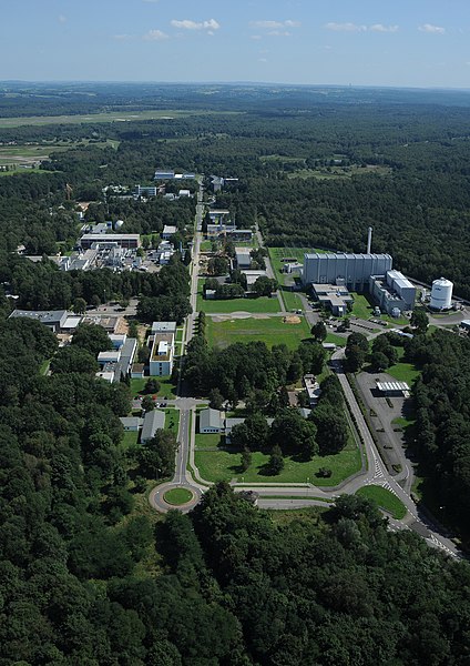
Deutsch: Luftaufnahme des DLR-Standorts Köln mit dem links angrenzenden Gelände des Flughafens Köln/Bonn.
English: Head office of the German Aerospace Center in Lind, Cologne, adjacent to Cologne/Bonn Airport |
| Dato | |
| Kilde | http://www.dlr.de/dlr/desktopdefault.aspx/tabid-10258/314_read-220 |
| Opphavsperson |
Deutsch: unbekannt/Deutsches Zentrum für Luft- und Raumfahrt English: unknown/German Aerospace Center |
| Kameraposisjon | | Dette og andre bilder på denne posisjonen på: OpenStreetMap |
|---|
Lisensiering
| This media has been released under a free license by the Deutsches Zentrum für Luft- und Raumfahrt (DLR). Their website states: "Where expressly stated, DLR images and videos are covered by a Creative Commons Attribution 3.0 Germany (CC BY 3.0) licence. This licence grants permission to reproduce or distribute the work, to make the work and/or its contents publically available, to alter or edit the work and/or its contents and to make commercial use of the work, provided that you explicitly mention DLR as its source in a clearly legible format. Examples: 'Photo: DLR, CC-BY 3.0', 'Images: DLR, CC-BY 3.0', 'Video: DLR, CC-BY 3.0'." To the uploader: You must provide a link (URL) to the original file and the authorship information if available. |
Denne filen er lisensiert under lisensen Creative Commons Navngivelse 3.0 Tyskland.
Navngivelse: DLR, CC-BY 3.0
- Du står fritt:
- til å dele – til å kopiere, distribuere og overføre verket
- til å blande – til å endre verket
- Under de følgende betingelsene:
- navngivelse – Du må kreditere verket på passende vis, lenke til lisensen og indikere hvorvidt det har blitt gjort endringer. Du kan gjøre det på enhver rimelig måte, men ikke på en måte som antyder at lisensgiveren støtter deg eller din bruk av verket.

Filhistorikk
Klikk på et tidspunkt for å vise filen slik den var på det tidspunktet.
| Dato/klokkeslett | Miniatyrbilde | Dimensjoner | Bruker | Kommentar | |
|---|---|---|---|---|---|
| nåværende | 8. sep. 2012 kl. 22:45 | | 2 480 × 3 508 (5,11 MB) | Jotpe | =={{int:filedesc}}== {{Information |description={{de|1=Luftaufnahme des DLR-Standorts Köln mit dem links angrenzenden Gelände des Flughafens Köln/Bonn.}} |date=2010-08-20 13:23 |source=http://www.dlr.de/dlr/desktopdefault.aspx/tabid-10258/314_read-... |
Filbruk
Den følgende siden bruker denne filen:
Global filbruk
Følgende andre wikier bruker denne filen:
- Bruk i ast.wikipedia.org
- Bruk i be.wikipedia.org
- Bruk i ca.wikipedia.org
- Bruk i cs.wikipedia.org
- Bruk i de.wikipedia.org
- Bruk i en.wikipedia.org
- Bruk i eo.wikipedia.org
- Bruk i es.wikipedia.org
- Bruk i gl.wikipedia.org
- Bruk i he.wikipedia.org
- Bruk i it.wikipedia.org
- Bruk i ru.wikipedia.org
- Bruk i ru.wikinews.org
- Bruk i sk.wikipedia.org
- Bruk i tr.wikipedia.org
- Bruk i vi.wikipedia.org
- Bruk i www.wikidata.org
- Bruk i zh.wikipedia.org