
Fil:Island of Ireland location map Meath.svg

Størrelse for denne PNG-forhåndsvisningen av denne SVG-filen: 481 × 599 piksler Andre oppløsninger: 192 × 240 piksler | 385 × 480 piksler | 616 × 768 piksler | 822 × 1 024 piksler | 1 643 × 2 048 piksler | 1 450 × 1 807 piksler.
Opprinnelig fil (SVG-fil, standardstørrelse 1 450 × 1 807 piksler, filstørrelse: 642 KB)
| Denne filen er fra Wikimedia Commons og kan brukes av andre prosjekter. Informasjonen fra filbeskrivelsessiden vises nedenfor. |
| Beskrivelse |
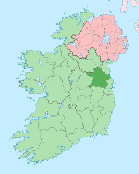
English: The island of Ireland, showing international border between Northern Ireland and Republic of Ireland, traditional provinces, traditional counties, and local authority areas in the Republic of Ireland and Northern Ireland. |
| Dato | (UTC) |
| Kilde | |
| Opphavsperson |
|
| This is a retouched picture, which means that it has been digitally altered from its original version. Modifications: Coloured in regions with county of article highlighted. The original can be viewed here: Island of Ireland location map.svg:
|
Jeg, rettighetsinnehaver av dette arbeidet, publiserer det herved under følgende lisens:
Denne filen er lisensiert under lisensen Creative Commons Navngivelse-DelPåSammeVilkår 3.0 Unported
- Du står fritt:
- til å dele – til å kopiere, distribuere og overføre verket
- til å blande – til å endre verket
- Under de følgende betingelsene:
- navngivelse – Du må kreditere verket på passende vis, lenke til lisensen og indikere hvorvidt det har blitt gjort endringer. Du kan gjøre det på enhver rimelig måte, men ikke på en måte som antyder at lisensgiveren støtter deg eller din bruk av verket.
- del på samme vilkår – Dersom du remikser, omarbeider eller på annen måte bygger på dette verket, må du kun distribuere resultatet under den samme eller en samsvarende lisens som denne.
Orginal opplastningslogg
This image is a derivative work of the following images:
- File:Island_of_Ireland_location_map.svg licensed with Cc-by-sa-3.0
- 2010-03-06T20:43:33Z Rannpháirtí anaithnid 1450x1807 (679207 Bytes) Fix incorrectly coloured isands.
- 2010-03-03T22:19:29Z Rannpháirtí anaithnid 1450x1807 (679744 Bytes) {{Information |Description={{de|Positionskarte von [[:de:Irland|Irland]]}} Quadratische Plattkarte, N-S-Streckung 170 %. Geographische Begrenzung der Karte: * N: 55.6° N * S: 51.2° N * W: 11.0° W * O: 5.0° W {{en|Location
Uploaded with derivativeFX
Filhistorikk
Klikk på et tidspunkt for å vise filen slik den var på det tidspunktet.
| Dato/klokkeslett | Miniatyrbilde | Dimensjoner | Bruker | Kommentar | |
|---|---|---|---|---|---|
| nåværende | 3. jul. 2020 kl. 11:16 | | 1 450 × 1 807 (642 KB) | Chipmunkdavis | Per the Local Government Reform Act 2014, joining both Tipperarys and both Waterfords (and removing Limerick City code). Colouring in islands, cleaning up and grouping code to remove stray objects and show Galway and Lough Ree. |
| 19. jul. 2010 kl. 03:00 |  | 1 450 × 1 807 (815 KB) | Mabuska | {{Information |Description={{en|The island of Ireland, showing international border between Northern Ireland and Republic of Ireland, traditional provinces, traditional counties, and local authority areas in the Republic of Ireland and Northern Ireland.}} |
Filbruk
Det er ingen sider som bruker denne filen.
Global filbruk
Følgende andre wikier bruker denne filen:
- Bruk i ar.wikipedia.org
- Bruk i ast.wikipedia.org
- Bruk i bg.wikipedia.org
- Bruk i ca.wikipedia.org
- Bruk i ceb.wikipedia.org
- Bruk i cs.wikipedia.org
- Bruk i da.wikipedia.org
- Bruk i de.wikivoyage.org
- Bruk i en.wikipedia.org
- Slane
- County Meath
- Trim, County Meath
- List of Ireland-related topics
- Navan
- Kells, County Meath
- Julianstown
- Oldcastle, County Meath
- Carnaross
- Kiltale
- Dunshaughlin
- Duleek
- Faughan Hill
- Moynalty
- Ratoath
- Ráth Chairn
- Skryne
- Nobber
- Dunboyne
- Durhamstown Castle
- 2005 Meath by-election
- Loch Gabhar
- Ardcath
- Monknewtown
- Butlin's Mosney
- Laytown
Vis mer global bruk av denne filen.