
Fil:Europe 912 en.jpg

Størrelse på denne forhåndsvisningen: 584 × 599 piksler. Andre oppløsninger: 234 × 240 piksler | 468 × 480 piksler | 748 × 768 piksler | 1 206 × 1 238 piksler.
Opprinnelig fil (1 206 × 1 238 piksler, filstørrelse: 529 KB, MIME-type: image/jpeg)
| Denne filen er fra Wikimedia Commons og kan brukes av andre prosjekter. Informasjonen fra filbeskrivelsessiden vises nedenfor. |
_en.png)
.png)
.jpg)
Beskrivelse
| Beskrivelse |
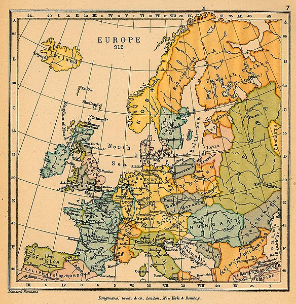
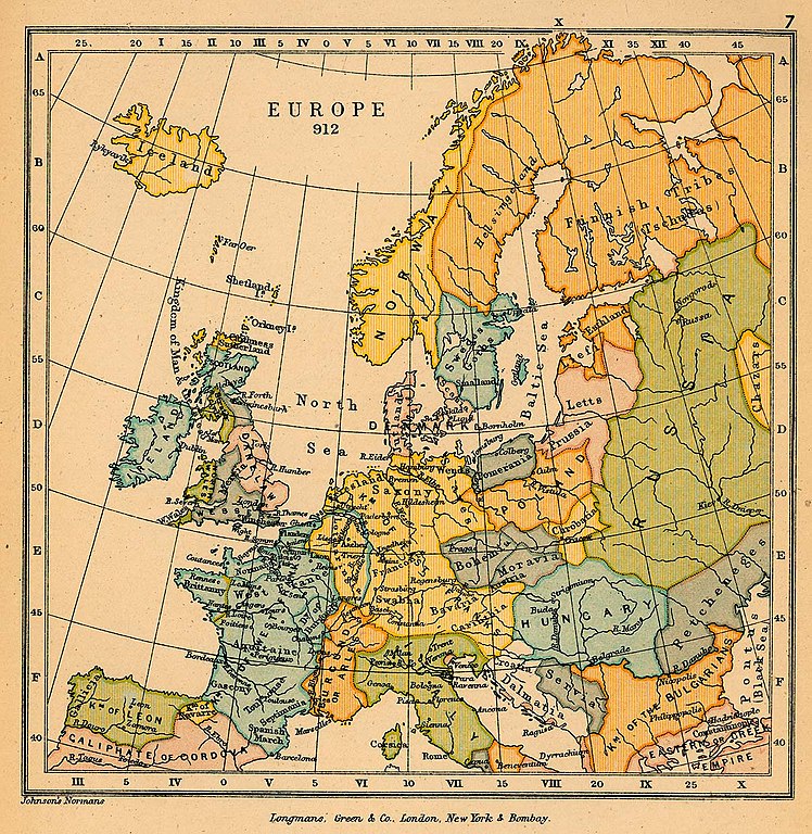
English: A political map of most of Europe in 912 CE |
| Dato | |
| Kilde | The map is taken from "The Public Schools Historical Atlas" by Charles Colbeck. Longmans, Green; New York; London; Bombay. 1905. It was accessed through the University of Texas at Austin's Perry-Castañeda Library Map Collection. |
| Opphavsperson | Charles Colbeck |
Lisensiering
This work is in the public domain in the United States because it was published (or registered with the U.S. Copyright Office) before January 1, 1929.
Public domain works must be out of copyright in both the United States and in the source country of the work in order to be hosted on the Commons. If the work is not a U.S. work, the file must have an additional copyright tag indicating the copyright status in the source country.
Note: This tag should not be used for sound recordings. |
Filhistorikk
Klikk på et tidspunkt for å vise filen slik den var på det tidspunktet.
| Dato/klokkeslett | Miniatyrbilde | Dimensjoner | Bruker | Kommentar | |
|---|---|---|---|---|---|
| nåværende | 11. jan. 2019 kl. 20:28 | | 1 206 × 1 238 (529 KB) | Bryanrutherford0 | User created page with UploadWizard |
Filbruk
Den følgende siden bruker denne filen:
Global filbruk
Følgende andre wikier bruker denne filen:
- Bruk i en.wikipedia.org