
Fil:Saare municipalities 1999–2014.png

Størrelse på denne forhåndsvisningen: 594 × 600 piksler. Andre oppløsninger: 238 × 240 piksler | 476 × 480 piksler | 972 × 981 piksler.
Opprinnelig fil (972 × 981 piksler, filstørrelse: 78 KB, MIME-type: image/png)
| Denne filen er fra Wikimedia Commons og kan brukes av andre prosjekter. Informasjonen fra filbeskrivelsessiden vises nedenfor. |
Beskrivelse
| Beskrivelse |
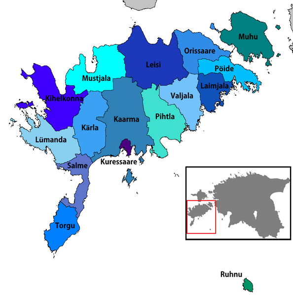
English: Map of the municipalities of Saare county in Estonia, 1999–2014
Eesti: Saare maakonna omavalitsused (1999–2014) |
| Dato | |
| Kilde | Eget verk |
| Opphavsperson | Rarelibra |
| Andre versjoner |
|


Lisensiering
| Jeg, opphavsrettensholderen til dette verket, frigir dette verket til allmennheten. Dette gjelder på verdensbasis. I enkelte land kan dette være juridisk umulig. I så fall: Jeg gir hvem som helst retten til å bruke dette verket for ethvert formål, uten noen vilkår, med mindre slike vilkår kreves ved lov. |
Filhistorikk
Klikk på et tidspunkt for å vise filen slik den var på det tidspunktet.
| Dato/klokkeslett | Miniatyrbilde | Dimensjoner | Bruker | Kommentar | |
|---|---|---|---|---|---|
| nåværende | 25. jan. 2019 kl. 20:09 | | 972 × 981 (78 KB) | Risto est | Conformity with other similar images |
| 24. nov. 2017 kl. 22:58 |  | 702 × 481 (162 KB) | NordNordWest | Reverted to version as of 12:35, 3 May 2013 (UTC); back to cropped version | |
| 9. nov. 2017 kl. 16:15 |  | 1 056 × 816 (38 KB) | RoMex | Reverted to version as of 19:30, 8 January 2007 (UTC), This map now illustrates historic municipal divisions prior to the 2017 reform. | |
| 17. des. 2014 kl. 16:38 |  | 957 × 655 (49 KB) | Pikne | update | |
| 3. mai 2013 kl. 14:35 |  | 702 × 481 (162 KB) | P. S. Burton | ||
| 8. jan. 2007 kl. 21:30 |  | 1 056 × 816 (38 KB) | Rarelibra | Updated map due to 2006 changes. | |
| 22. des. 2006 kl. 19:35 |  | 1 056 × 816 (39 KB) | Rarelibra | Map of the municipalities of Saare county in Estonia. Created by ~~~~ for public domain use, using MapInfo Professional v8.5 and various mapping resources. |
Filbruk
Den følgende siden bruker denne filen:
Global filbruk
Følgende andre wikier bruker denne filen:
- Bruk i ar.wikipedia.org
- Bruk i ba.wikipedia.org
- Bruk i cs.wikipedia.org
- Bruk i de.wikipedia.org
- Bruk i en.wikipedia.org
- Bruk i es.wikipedia.org
- Bruk i et.wikipedia.org
- Bruk i fi.wikipedia.org
- Bruk i fr.wikipedia.org
- Bruk i he.wikipedia.org
- Bruk i ka.wikipedia.org
- Bruk i lt.wikipedia.org
- Bruk i nl.wikipedia.org
- Bruk i nn.wikipedia.org
- Bruk i pt.wikipedia.org
- Bruk i ro.wikipedia.org
- Bruk i ru.wikipedia.org
- Bruk i sco.wikipedia.org
- Bruk i sr.wikipedia.org
- Bruk i sv.wikipedia.org
- Bruk i uk.wikipedia.org