
Fil:OttomanEmpire1801.jpg
Opprinnelig fil (1 638 × 1 296 piksler, filstørrelse: 605 KB, MIME-type: image/jpeg)
| Denne filen er fra Wikimedia Commons og kan brukes av andre prosjekter. Informasjonen fra filbeskrivelsessiden vises nedenfor. |

Beskrivelse
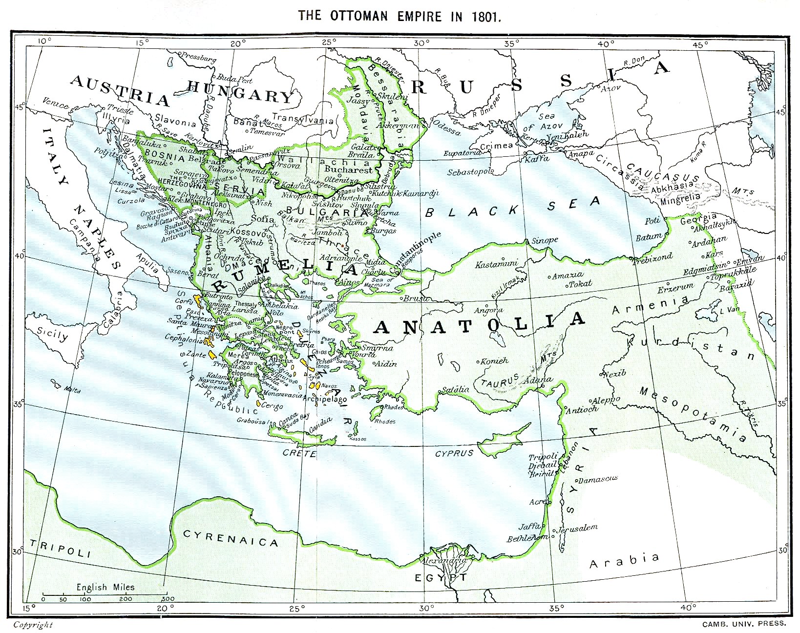
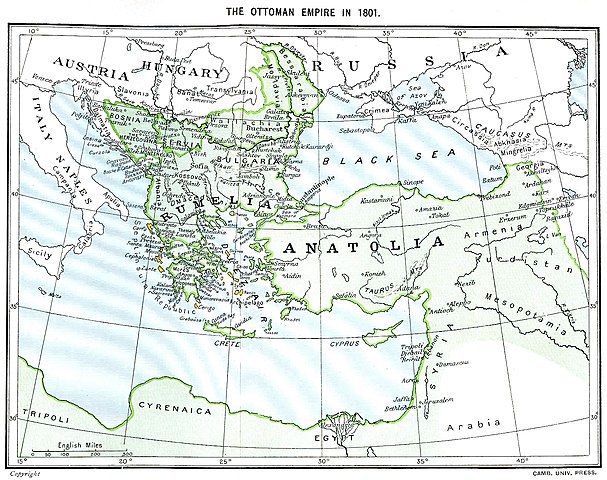
Ottoman Empire (green) and Septinsular Republic (yellow) in 1801.
Lisensiering
|
Dette verket er offentlig eiendom i Norge, EU og land der den opphavsrettslige vernetiden etter opphavsmannens død er 70 år eller kortere. Merk at noen land har lengre vernetid.
| |
| Denne filen har blitt identifisert til å være fri for kjente restriksjoner under lov om opphavsrett, inkludert alle relaterte og nærstående rettigheter. | |
Filhistorikk
Klikk på et tidspunkt for å vise filen slik den var på det tidspunktet.
| Dato/klokkeslett | Miniatyrbilde | Dimensjoner | Bruker | Kommentar | |
|---|---|---|---|---|---|
| nåværende | 11. jan. 2023 kl. 18:06 | | 1 638 × 1 296 (605 KB) | Enyavar | Reverted to version as of 08:56, 11 March 2006 (UTC) --> even if they are wrong, don't change historical maps! |
| 3. feb. 2014 kl. 19:48 |  | 1 638 × 1 296 (518 KB) | Spiridon Ion Cepleanu | Some little changes according with the 1801 situation : The Septinsular Rep. includes Ionian Is., not the Cyclades, Serbia became autonomous 1817... | |
| 11. mar. 2006 kl. 10:56 |  | 1 638 × 1 296 (605 KB) | Julo | Ottoman Empire (green) & Septinsular Republic (yellow) in 1801, on the 19th century map {{PD-old}} category:19th century mapsCategory:Historical maps of the Middle EastCategory:Historical maps of the Balkans[[Category:Historical maps of Africa |
Filbruk
Det er ingen sider som bruker denne filen.
Global filbruk
Følgende andre wikier bruker denne filen:
- Bruk i azb.wikipedia.org
- Bruk i ba.wikipedia.org
- Bruk i el.wikipedia.org
- Bruk i fr.wikipedia.org
- Bruk i hy.wikipedia.org
- Bruk i la.wikipedia.org
- Bruk i pl.wikipedia.org
- Bruk i sq.wikipedia.org
- Bruk i sv.wikipedia.org
- Bruk i uk.wikipedia.org