
Fil:Marquette and jolliet map 1681.jpg

Størrelse på denne forhåndsvisningen: 800 × 335 piksler. Andre oppløsninger: 320 × 134 piksler | 640 × 268 piksler | 1 024 × 428 piksler | 2 056 × 860 piksler.
Opprinnelig fil (2 056 × 860 piksler, filstørrelse: 792 KB, MIME-type: image/jpeg)
| Denne filen er fra Wikimedia Commons og kan brukes av andre prosjekter. Informasjonen fra filbeskrivelsessiden vises nedenfor. |
Beskrivelse
| Beskrivelse |
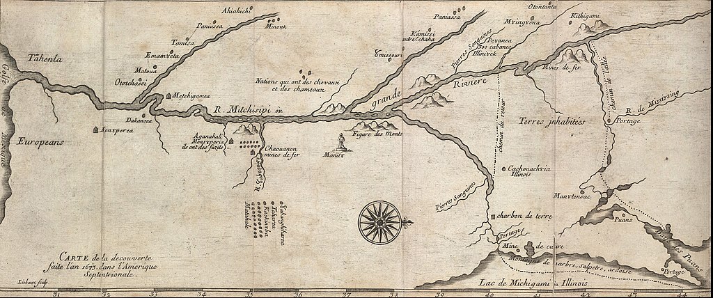
English: ca. 1681 map of the Mississippi River system, based on the 1673 expediton of Jacques Marquette and Louis Jolliet. This is one of many early maps made based on their descriptions of the interior of North America. |
||||||||||||||||||||
| Dato | |||||||||||||||||||||
| Kilde | http://hdl.loc.gov/loc.gmd/g4042m.rb000005 | ||||||||||||||||||||
| Opphavsperson |
|
||||||||||||||||||||
| Andre versjoner |
[1] [2] |
||||||||||||||||||||

Lisensiering
|
This is a faithful photographic reproduction of a two-dimensional, public domain work of art. The work of art itself is in the public domain for the following reason:
The official position taken by the Wikimedia Foundation is that "faithful reproductions of two-dimensional public domain works of art are public domain".
This photographic reproduction is therefore also considered to be in the public domain in the United States. In other jurisdictions, re-use of this content may be restricted; see Reuse of PD-Art photographs for details. | ||||
Orginal opplastningslogg
The original description page was here. All following user names refer to en.wikipedia.
- 2010-04-12 18:35 Billwhittaker 860×2063× (819900 bytes) {{Information |Description = ca. 1681 map of the [[Mississippi River]] system, based on the 1673 expediton of [[Jacques Marquette]] and [[Louis Jolliet]]. This is one of many early maps made based on their descriptions of the interior of North America
Filhistorikk
Klikk på et tidspunkt for å vise filen slik den var på det tidspunktet.
| Dato/klokkeslett | Miniatyrbilde | Dimensjoner | Bruker | Kommentar | |
|---|---|---|---|---|---|
| nåværende | 17. feb. 2019 kl. 00:01 | | 2 056 × 860 (792 KB) | SteinsplitterBot | Bot: Image rotated by 90° |
| 14. jun. 2011 kl. 12:00 |  | 860 × 2 063 (801 KB) | Urdangaray | {{Information |Description={{en|ca. 1681 map of the en:Mississippi River system, based on the 1673 expediton of en:Jacques Marquette and en:Louis Jolliet. This is one of many early maps made based on their descriptions of the interior of |
Filbruk
Den følgende siden bruker denne filen:
Global filbruk
Følgende andre wikier bruker denne filen:
- Bruk i ar.wikipedia.org
- Bruk i cs.wikipedia.org
- Bruk i de.wikipedia.org
- Bruk i en.wikipedia.org
- Bruk i es.wikipedia.org
- Bruk i fa.wikipedia.org
- Bruk i fr.wikipedia.org
- Bruk i hu.wikipedia.org
- Bruk i ja.wikipedia.org
- Bruk i ko.wikipedia.org
- Bruk i pl.wikipedia.org
- Bruk i pt.wikipedia.org
- Bruk i sh.wikipedia.org