
Fil:Karte Rostock in Deutschland.png
Ingen høyere oppløsning tilgjengelig.
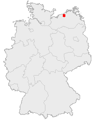
Karte_Rostock_in_Deutschland.png (188 × 235 piksler, filstørrelse: 3 KB, MIME-type: image/png)
| Denne filen er fra Wikimedia Commons og kan brukes av andre prosjekter. Informasjonen fra filbeskrivelsessiden vises nedenfor. |
Beskrivelse
Lisensiering
This image was generated with OpenGeoDB. The information there is placed in the public domain, images generated from OpenGeoDB are derivative works without passing the threshold of creativity, they are therefore also public domain.
| Dette verket er ikke opphavsrettsbeskyttet og er offentlig eiendom (public domain), fordi det ikke har verkshøyde. |
Filhistorikk
Klikk på et tidspunkt for å vise filen slik den var på det tidspunktet.
| Dato/klokkeslett | Miniatyrbilde | Dimensjoner | Bruker | Kommentar | |
|---|---|---|---|---|---|
| nåværende | 24. mai 2006 kl. 21:11 | | 188 × 235 (3 KB) | Jed | Category:Maps of Mecklenburg-Western Pomerania |
Filbruk
Det er ingen sider som bruker denne filen.
Global filbruk
Følgende andre wikier bruker denne filen: