
Fil:C78198s1 Ant.Map Mount Harmsworth.jpg
Størrelse på denne forhåndsvisningen: 710 × 600 piksler. Andre oppløsninger: 284 × 240 piksler | 568 × 480 piksler | 909 × 768 piksler | 1 212 × 1 024 piksler | 2 424 × 2 048 piksler | 3 849 × 3 252 piksler.
Opprinnelig fil (3 849 × 3 252 piksler, filstørrelse: 1,69 MB, MIME-type: image/jpeg)
| Denne filen er fra Wikimedia Commons og kan brukes av andre prosjekter. Informasjonen fra filbeskrivelsessiden vises nedenfor. |
Beskrivelse
| Beskrivelse |
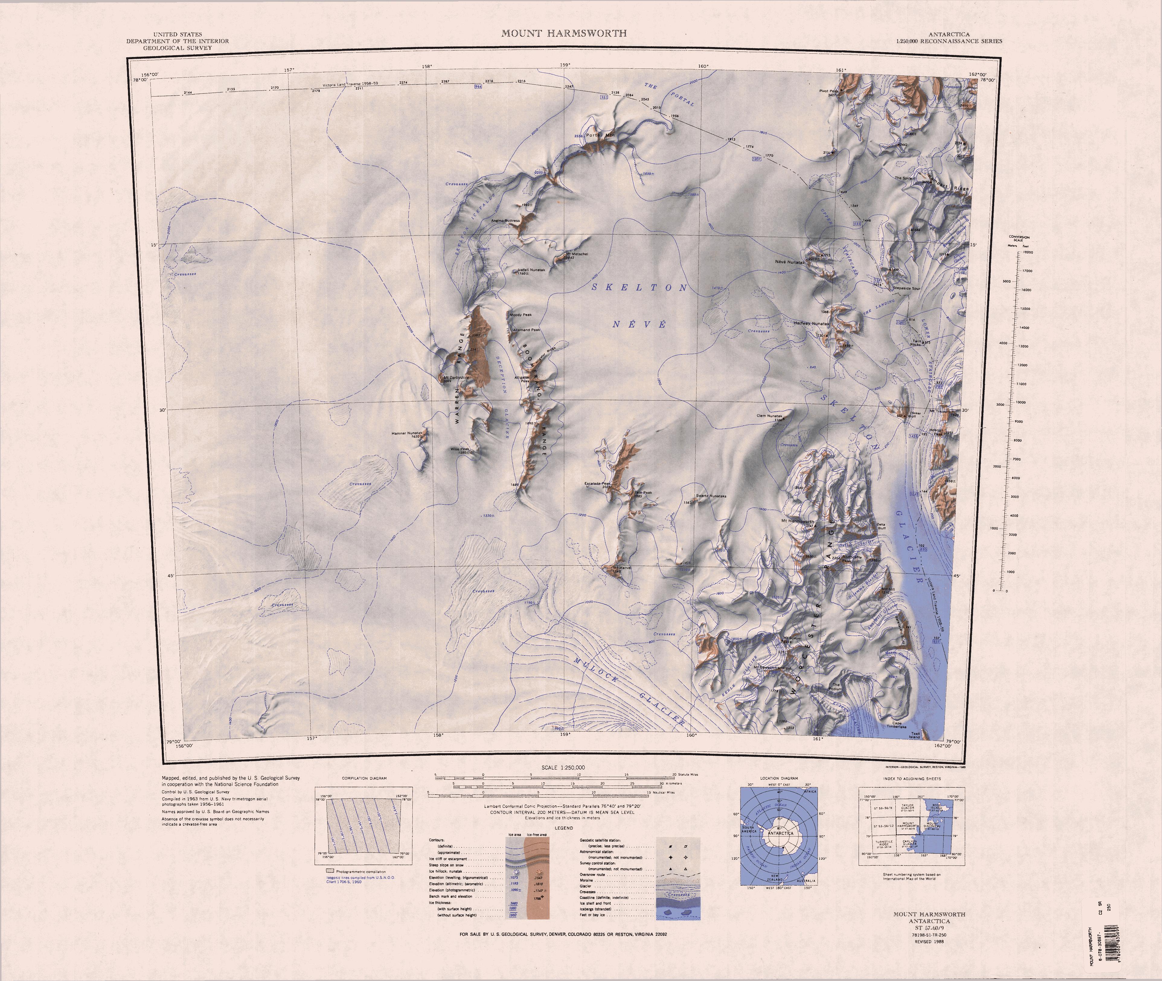
English: 1:250,000-scale topographic reconnaissance map of the Mount Harmsworth area from 156°-162'E to 78°-79°S in Antarctica. Mapped, edited and published by the U.S. Geological Survey in cooperation with the National Science Foundation. |
|||
| Dato | ||||
| Kilde | http://usarc.usgs.gov/drg_dload.shtml | |||
| Opphavsperson | United States Geological Survey | |||
| Tillatelse (Gjenbruk av denne filen) |
|
Filhistorikk
Klikk på et tidspunkt for å vise filen slik den var på det tidspunktet.
| Dato/klokkeslett | Miniatyrbilde | Dimensjoner | Bruker | Kommentar | |
|---|---|---|---|---|---|
| nåværende | 17. apr. 2013 kl. 15:34 | | 3 849 × 3 252 (1,69 MB) | 4ing | == {{int:filedesc}} == {{Information |description={{en|1=1:250,000-scale topographic reconnaissance map of the Mount Harmsworth area from 156°-162'E to 78°-79°S in Antarctica. Mapped, edited and published by the U.S. Geological Survey in cooperation... |
Filbruk
Den følgende siden bruker denne filen:
Global filbruk
Følgende andre wikier bruker denne filen:
- Bruk i bg.wikipedia.org
- Bruk i de.wikipedia.org
- Skelton-Gletscher
- Mulock-Gletscher
- The Portal
- Portal Mountain
- Skelton-Firnfeld
- Allemand Peak
- Moody Peak
- Boomerang Range
- Alligator Peak
- Alligator Ridge
- Skelton-Eisfälle
- Warren Range
- Ant Hill
- Ant-Hill-Gletscher
- Dilemma-Gletscher
- Worcester Range
- Bareface Bluff
- Mount Harmsworth
- Mason-Gletscher
- Delta-Gletscher
- Delta Bluff
- Northcliffe Peak
- Wilkniss Mountains
- Pivot Peak
- Halfway-Nunatak
- Rampart Ridge
- Deception-Gletscher
- Mount Dawson-Lambton
- Mount Speyer
- Kehle-Gletscher
- Escalade Peak
- Hamner-Nunatak
- Wise Peak
- Icefall Nunatak (Süden)
- Mount Marvel
- Mount Metschel
- Swartz-Nunatakker
- Tate Peak
- Van Allen Range
- Ross-Orogen
- Bruk i en.wikipedia.org
Vis mer global bruk av denne filen.