Fil:Boston 1775.jpg

Sideinnholdet støttes ikke på andre språk.
Fra Wikipedia, den frie encyklopedi

Opprinnelig fil(797 × 776 piksler, filstørrelse: 250 KB, MIME-type: image/jpeg)


Wikimedia Commons' logo

Beskrivelse

Beskrivelse Detail from

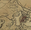
"A plan of the town and harbour of Boston and the country adjacent with the road from Boston to Concord, shewing the place of the late engagement between the King's troops & the provincials, together with the several encampments of both armies in & about Boston. Taken from an actual survey. Humbly inscribed to Richd. Whitworth by J. De Costa; C. Hall, sc."

hand colored map 37 X 49 cm.
Dato
Kilde Library of Congress Geography and Map Division Washington, D.C. 20540-4650 USA G3764.B6S3 1775 .D4 Vault g3764b ar090000 http://hdl.loc.gov/loc.gmd/g3764b.ar090000 "The Library of Congress is providing access to these materials for educational and research purposes and is not aware of any U.S. copyright protection (see Title 17 of the United States Code) or any other restrictions in the Map Collection materials."
Opphavsperson J. DeCosta

Lisensiering

Public domain

Dette verket er offentlig eiendom i Norge, EU og land der den opphavsrettslige vernetiden etter opphavsmannens død er 100 år eller kortere. Merk at noen land har lengre vernetid.


For å kunne lagres på Commons må verket både være offentlig eiendom i USA og i opphavslandet. Vernetiden kan i noen tilfeller være lengre enn 80 år i USA, så i tillegg til dette merket trengs det et eget merke som forklarer hvorfor verket er offentlig eiendom (public domain) i USA.

Bildetekster

Legg til en kort forklaring på hva filen representerer
detail of a historical map of Boston from the American Revolutionary War

Elementer som er med i denne fila

motiv

image/jpeg

7616e669ccf7958e5f3b41d450da4b7810c47ed4

255 754 byte

776 piksel

797 piksel

Filhistorikk

Klikk på et tidspunkt for å vise filen slik den var på det tidspunktet.

Dato/klokkeslettMiniatyrbildeDimensjonerBrukerKommentar
nåværende7. aug. 2006 kl. 15:57Miniatyrbilde av versjonen fra 7. aug. 2006 kl. 15:57797 × 776 (250 KB)Shauni{{Information |Description=Detail from thumb "A plan of the town and harbour of Boston and the country adjacent with the road from Boston to Concord, shewing the place of the late engagement between the Kin

Den følgende siden bruker denne filen:

Global filbruk

Følgende andre wikier bruker denne filen:

Metadata