
Fil:BlankMap-USA-states-Canada-provinces, HI closer.svg

Størrelse for denne PNG-forhåndsvisningen av denne SVG-filen: 512 × 512 piksler Andre oppløsninger: 240 × 240 piksler | 480 × 480 piksler | 768 × 768 piksler | 1 024 × 1 024 piksler | 2 048 × 2 048 piksler.
Opprinnelig fil (SVG-fil, standardstørrelse 512 × 512 piksler, filstørrelse: 104 KB)
| Denne filen er fra Wikimedia Commons og kan brukes av andre prosjekter. Informasjonen fra filbeskrivelsessiden vises nedenfor. |
| Beskrivelse |
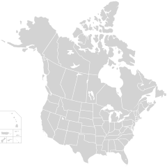
English: Blank SVG map of USA and Canada with state and province borders. Hawaii has been moved closer to the mainland USA to reduce width of image.
Non-contiguous parts of a states/provinces are "grouped" together with the main area of the state/provinces, so any state/provinces can be coloured in completion with one click anywhere on the state/provinces's area. Also, all states/provinces have a "id" attached to them, making them easy to find. Select "find" and then enter in the state/provinces's ISO 3166-2 code in the "id" field to find it. The codes can be found here (Canada) and here (USA). |
| Dato | |
| Kilde |
|
| Opphavsperson | Lokal_Profil |
| Tillatelse (Gjenbruk av denne filen) |
Denne filen er lisensiert under lisensen Creative Commons Navngivelse-DelPåSammeVilkår 2.5 Generisk Navngivelse: Lokal_Profil
|
| Andre versjoner |
Dette vektorbildet inkluderer elementer som har blitt hentet fra denne:
The same as this map with the two-letter state or province name label for each one |
Filhistorikk
Klikk på et tidspunkt for å vise filen slik den var på det tidspunktet.
| Dato/klokkeslett | Miniatyrbilde | Dimensjoner | Bruker | Kommentar | |
|---|---|---|---|---|---|
| nåværende | 23. nov. 2020 kl. 03:48 | | 512 × 512 (104 KB) | Ponderosapine210 | Accidentally uploaded wrong version. Here is the correct one. |
| 23. nov. 2020 kl. 03:38 |  | 512 × 596 (132 KB) | Ponderosapine210 | Added the prominent islands of Manitoulin (Ontario) and Isle Royale (Michigan) to the Great Lakes. | |
| 2. jun. 2019 kl. 00:59 |  | 512 × 512 (99 KB) | Fluffy89502 | added territories | |
| 8. des. 2007 kl. 23:18 |  | 1 730 × 1 730 (212 KB) | Lokal Profil | Code trimming | |
| 3. jul. 2007 kl. 06:21 |  | 1 730 × 1 730 (213 KB) | Lokal Profil | {{Information |Description={{en|Blank SVG map of USA and Canada with state and province borders. Hawaii has been moved closer to the mainland USA to reduce width of image.}} Non-contiguous parts of a states/provinces are "grouped" together with the main a |
Filbruk
Det er ingen sider som bruker denne filen.
Global filbruk
Følgende andre wikier bruker denne filen:
- Bruk i en.wikipedia.org
- Bruk i fr.wikipedia.org