
Fil:Qattara depression map.png
Qattara_depression_map.png (599 × 435 piksler, filstørrelse: 54 KB, MIME-type: image/png)
| Denne filen er fra Wikimedia Commons og kan brukes av andre prosjekter. Informasjonen fra filbeskrivelsessiden vises nedenfor. |

|
Dette bildet bør gjenskapes med hjelp av vektorgrafikk som en SVG-fil. Dette har flere fordeler, se Commons:Media for cleanup for mer informasjon. Hvis en SVG-fil med dette bildet er tilgjengelig, vennligst last den opp. Etter opplasting erstatt denne malen med {{vector version available|nytt bilde.svg}}.
|
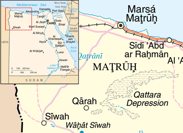
| Beskrivelse | |
| Dato | 20. mai 2005 (original upload date) |
| Kilde | Adapted from https://www.un.org/geospatial/content/egypt and en:Image:Eg-map.png |
| Opphavsperson | The original uploader was ChrisO at engelsk Wikipedia. |
Lisensiering
| This image is a map derived from a United Nations map.
Unless stated otherwise, UN maps are to be considered in the public domain. This applies worldwide. UN maps are, in principle, open source material and you can use them in your work or for making your own map. UN requests however that you delete the UN name, logo and reference number upon any modification to the map. Content of your map will be your responsibility. You can state in your publication, if you wish, something like: based on UN map … (map name, map number, revision number and date). See: Geospatial Information Section. And: Geospatial, location data for a better world. |
 |
Orginal opplastningslogg
- 2005-05-20 22:10 ChrisO 599×435× (54888 bytes) Map of the [[Qattara Depression]], [[Egypt]] Adapted from http://www.un.org/Depts/Cartographic/map/profile/egypt.pdf and [[:Image:Eg-map.png]] {{UN map}}
Filhistorikk
Klikk på et tidspunkt for å vise filen slik den var på det tidspunktet.
| Dato/klokkeslett | Miniatyrbilde | Dimensjoner | Bruker | Kommentar | |
|---|---|---|---|---|---|
| nåværende | 31. mar. 2009 kl. 14:29 | | 599 × 435 (54 KB) | File Upload Bot (Magnus Manske) | {{BotMoveToCommons|en.wikipedia|year={{subst:CURRENTYEAR}}|month={{subst:CURRENTMONTHNAME}}|day={{subst:CURRENTDAY}}}} {{Information |Description={{en|Map of the en:Qattara Depression, en:Egypt Adapted from http://www.un.org/Depts/Cartographic |
Filbruk
Den følgende siden bruker denne filen:
Global filbruk
Følgende andre wikier bruker denne filen:
- Bruk i ar.wikipedia.org
- Bruk i arz.wikipedia.org
- Bruk i cs.wikipedia.org
- Bruk i da.wikipedia.org
- Bruk i en.wikipedia.org
- Bruk i eo.wikipedia.org
- Bruk i es.wikipedia.org
- Bruk i fa.wikipedia.org
- Bruk i fi.wikipedia.org
- Bruk i fr.wikipedia.org
- Bruk i ga.wikipedia.org
- Bruk i hr.wikipedia.org
- Bruk i id.wikipedia.org
- Bruk i ml.wikipedia.org
- Bruk i my.wikipedia.org
- Bruk i uk.wikipedia.org
- Bruk i ur.wikipedia.org
- Bruk i vi.wikipedia.org
- Bruk i war.wikipedia.org
- Bruk i zh.wikipedia.org
- Bruk i zu.wikipedia.org