Fil:Ophir High Line Trestles.jpg

Sideinnholdet støttes ikke på andre språk.
Fra Wikipedia, den frie encyklopedi

Opprinnelig fil(1 372 × 1 884 piksler, filstørrelse: 1,46 MB, MIME-type: image/jpeg)


Wikimedia Commons' logo

Beskrivelse

Beskrivelse
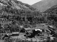
English: Trestles 46-D and 46-E on the High Line south of Ophir Loop on Rio Grande Southern Railroad.
Dato etter 1905
date QS:P,+1905-00-00T00:00:00Z/7,P1319,+1905-00-00T00:00:00Z/9
Kilde

http://memory.loc.gov/pnp/habshaer/co/co0000/co0030/photos/021935pv.jpg

Historical American Engineering Record entry (original image is CO-2-8)
Opphavsperson HAER - National Park Service
Andre versjoner Original file:

Lisensiering

This file comes from the Historic American Buildings Survey (HABS), Historic American Engineering Record (HAER) or Historic American Landscapes Survey (HALS). These are programs of the National Park Service established for the purpose of documenting historic places. Records consist of measured drawings, archival photographs, and written reports.

Dette merket angir ikke verkets opphavsrettsstatus. Et vanlig opphavsrettsmerke er fremdeles nødvendig.

Public domain This image or media file contains material based on a work of a National Park Service employee, created as part of that person's official duties. As a work of the U.S. federal government, such work is in the public domain in the United States. See the NPS website and NPS copyright policy for more information.

Filhistorikk

Klikk på et tidspunkt for å vise filen slik den var på det tidspunktet.

Dato/klokkeslettMiniatyrbildeDimensjonerBrukerKommentar
nåværende9. mai 2013 kl. 00:34Miniatyrbilde av versjonen fra 9. mai 2013 kl. 00:341 372 × 1 884 (1,46 MB)Aldebaran{{Information |Description ={{en|1=Trestles 46-D and 46-E on the High Line south of Ophir Loop on Rio Grande Southern Railroad.}} |Source =http://memory.loc.gov/pnp/habshaer/co/co0000/co0030/photos/021935pv.jpg [http://memory.loc.gov/pnp/hab...

Den følgende siden bruker denne filen: