
Fil:Mountain Fork Bridge.jpg

Størrelse på denne forhåndsvisningen: 471 × 599 piksler. Andre oppløsninger: 189 × 240 piksler | 377 × 480 piksler | 604 × 768 piksler | 805 × 1 024 piksler | 1 611 × 2 048 piksler | 3 691 × 4 693 piksler.
Opprinnelig fil (3 691 × 4 693 piksler, filstørrelse: 1,61 MB, MIME-type: image/jpeg)
| Denne filen er fra Wikimedia Commons og kan brukes av andre prosjekter. Informasjonen fra filbeskrivelsessiden vises nedenfor. |
|
This is an image of a place or building that is listed on the National Register of Historic Places in the United States of America. Its reference number is 90000540. |
| Kameraposisjon | | Dette og andre bilder på denne posisjonen på: OpenStreetMap |
|---|
| Beskrivelse |
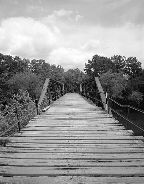
English: Looking west on the Mountain Fork Bridge, which carries County Road 38 over Mountain Fork Creek near Mena in Saline County, Arkansas, United States. Built in 1926, this Pratt pony truss bridge is listed on the National Register of Historic Places. |
||||
| Dato | |||||
| Kilde | Library of Congress, Prints and Photograph Division HAER: ARK,57-CAPI.V,1-3 | ||||
| Opphavsperson | Jeff Holder | ||||
| Tillatelse (Gjenbruk av denne filen) |
|

|
This image is available from the United States Library of Congress's Prints and Photographs division
under the digital ID hhh.ar0092. This tag does not indicate the copyright status of the attached work. A normal copyright tag is still required. See Commons:Licensing.
|
Filhistorikk
Klikk på et tidspunkt for å vise filen slik den var på det tidspunktet.
| Dato/klokkeslett | Miniatyrbilde | Dimensjoner | Bruker | Kommentar | |
|---|---|---|---|---|---|
| nåværende | 13. des. 2009 kl. 04:03 | | 3 691 × 4 693 (1,61 MB) | Nyttend | {{Location|34|31|41|N|94|24|0|W}} {{Information |Description={{en|Looking west on the {{w|Mountain Fork Bridge}}, which carries County Road 38 over Mountain Fork Creek near {{w|Mena, Arkansas|Mena}} in {{w|Saline County, Arkansas|Saline County}}, {{w|Arka |
Filbruk
Den følgende siden bruker denne filen:
Global filbruk
Følgende andre wikier bruker denne filen:
- Bruk i ar.wikipedia.org
- Bruk i ceb.wikipedia.org
- Bruk i ce.wikipedia.org
- Bruk i cy.wikipedia.org
- Bruk i en.wikipedia.org
- Bruk i es.wikipedia.org
- Bruk i fr.wikipedia.org
- Bruk i ga.wikipedia.org
- Bruk i hu.wikipedia.org
- Bruk i hy.wikipedia.org
- Bruk i ki.wikipedia.org
- Bruk i pl.wikipedia.org
- Bruk i ru.wikipedia.org
- Bruk i sr.wikipedia.org
- Bruk i tt.wikipedia.org
- Bruk i ur.wikipedia.org
- Bruk i www.wikidata.org
- Bruk i zh-min-nan.wikipedia.org