
Fil:Mexico map, MX-DIF.svg

Størrelse for denne PNG-forhåndsvisningen av denne SVG-filen: 800 × 544 piksler Andre oppløsninger: 320 × 218 piksler | 640 × 435 piksler | 1 024 × 696 piksler | 1 280 × 870 piksler | 2 560 × 1 741 piksler | 1 000 × 680 piksler.
Opprinnelig fil (SVG-fil, standardstørrelse 1 000 × 680 piksler, filstørrelse: 144 KB)
| Denne filen er fra Wikimedia Commons og kan brukes av andre prosjekter. Informasjonen fra filbeskrivelsessiden vises nedenfor. |
Beskrivelse
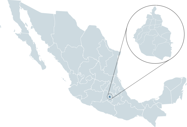
| Beskrivelse | Locator map for Distrito Federal within Mexico. | ||
| Dato | |||
| Kilde | Mexico template.svg fra Lokal_Profil | ||
| Opphavsperson | Lokal_Profil | ||
| Tillatelse (Gjenbruk av denne filen) |
Original image licensed under
|
||
| SVG utvikling | Denne vektorgrafikken ble laget med Inkscape. |
Filhistorikk
Klikk på et tidspunkt for å vise filen slik den var på det tidspunktet.
| Dato/klokkeslett | Miniatyrbilde | Dimensjoner | Bruker | Kommentar | |
|---|---|---|---|---|---|
| nåværende | 14. feb. 2008 kl. 01:47 | | 1 000 × 680 (144 KB) | El bart089 | {{Information |Description= |Source= |Date= |Author= |Permission= |other_versions= }} |
| 19. nov. 2007 kl. 03:26 |  | 1 000 × 680 (123 KB) | El bart089 | Based on the image made by Lokal Profil | |
| 4. jul. 2007 kl. 19:27 |  | 1 000 × 680 (117 KB) | Lokal Profil | {{Information |Description=Locator map for Distrito Federal within Mexico. |Source=Image:Mexico template.svg by Mario Fuente Cid <small>and Lokal_Profil</small> |Date=0 |
Filbruk
Den følgende siden bruker denne filen:
Global filbruk
Følgende andre wikier bruker denne filen:
- Bruk i af.wikipedia.org
- Bruk i arz.wikipedia.org
- Bruk i ay.wikipedia.org
- Bruk i bs.wikipedia.org
- Bruk i bxr.wikipedia.org
- Bruk i de.wikipedia.org
- Bruk i en.wikipedia.org
- Bruk i es.wikipedia.org
- Organización Nacional Estudiantil de Fútbol Americano
- Liga Mayor 1945-46
- Torneo Verano 1997 (México)
- Liga Mayor 1946-47
- Liga Mayor 1947-48
- Primera División de México: México 1986
- Primera División de México PRODE 1985
- Torneo Apertura 2007 (México)
- Liga Mayor 1948-49
- Primera División de México 1992-93
- Primera División de México 1956-57
- Primera División de México 1958-59
- Primera División de México 1959-60
- Primera División de México 1960-61
- Primera División de México 1961-62
- Primera División de México 1969-70
- Liga Mexicana de Béisbol 1999
- Liga Mexicana de Béisbol 2000
- Liga Mexicana de Béisbol 2001
- Torneo Clausura 2008 (México)
- Torneo Apertura 2008 (México)
- Primera División de México 1991-92
- Categoría:Ciudad de México
- Torneo Clausura 2009 (México)
- Liga Mexicana de Béisbol 1925
- Liga Mexicana de Béisbol 1998
- Liga Mexicana de Béisbol 1997
- Liga Mexicana de Béisbol 1996
- Liga Mexicana de Béisbol 1994
- Liga Mexicana de Béisbol 1993
- Liga Mexicana de Béisbol 1995
- Torneo Apertura 2009 (México)
- Liga Mayor 1949-50
- Primera División de México 1950-51
Vis mer global bruk av denne filen.