
Fil:Map of Butler County Ohio Highlighting Oxford City.png
Ingen høyere oppløsning tilgjengelig.
Map_of_Butler_County_Ohio_Highlighting_Oxford_City.png (547 × 521 piksler, filstørrelse: 28 KB, MIME-type: image/png)
| Denne filen er fra Wikimedia Commons og kan brukes av andre prosjekter. Informasjonen fra filbeskrivelsessiden vises nedenfor. |
| Beskrivelse |
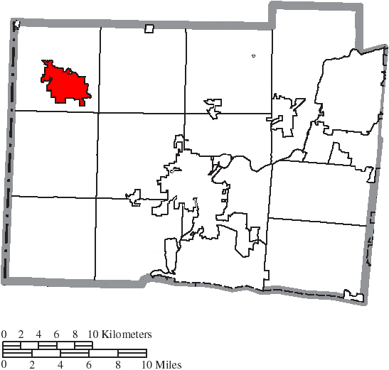
English: Map of the municipal and township boundaries of Butler County, Ohio, United States, as of the 2000 census, with the location of the city of Oxford highlighted. Township borders are shown only in unincorporated areas in order to differentiate incorporated and unincorporated areas more clearly. |
| Dato | |
| Kilde | File:Map of Butler County Ohio With Municipal and Township Labels.PNG |
| Opphavsperson | Ruhrfisch and Nyttend |
| Tillatelse (Gjenbruk av denne filen) |
Denne filen er lisensiert under lisensen Creative Commons Navngivelse-DelPåSammeVilkår 3.0 Unported
|
Filhistorikk
Klikk på et tidspunkt for å vise filen slik den var på det tidspunktet.
| Dato/klokkeslett | Miniatyrbilde | Dimensjoner | Bruker | Kommentar | |
|---|---|---|---|---|---|
| nåværende | 18. aug. 2015 kl. 00:49 | | 547 × 521 (28 KB) | Nyttend | {{Information |Description={{en|Map of the municipal and township boundaries of {{w|Butler County, Ohio|Butler County}}, {{w|Ohio}}, {{w|United States}}, as of the 2000 census, with the location of the city of {{w|Oxford, Ohio|Oxford}} highlighted. To... |
Filbruk
Den følgende siden bruker denne filen:
Global filbruk
Følgende andre wikier bruker denne filen:
- Bruk i en.wikipedia.org
- Bruk i tr.wikipedia.org
- Bruk i zh.wikipedia.org