
Fil:Grangemouthmap1945.jpg

Størrelse på denne forhåndsvisningen: 730 × 599 piksler. Andre oppløsninger: 292 × 240 piksler | 585 × 480 piksler | 936 × 768 piksler | 1 247 × 1 024 piksler | 2 495 × 2 048 piksler | 3 525 × 2 894 piksler.
Opprinnelig fil (3 525 × 2 894 piksler, filstørrelse: 4,92 MB, MIME-type: image/jpeg)
| Denne filen er fra Wikimedia Commons og kan brukes av andre prosjekter. Informasjonen fra filbeskrivelsessiden vises nedenfor. |
This work is an Ordnance Survey map over 50 years old, which is covered by Crown Copyright which in this case expires 50 years after publication. Ordnance Survey does however ask that they be credited and that the date of publication be given.
Any ancillary rights gained through the creation of the electronic version are granted as freely usable under any circumstances.
|
This work created by the United Kingdom Government is in the public domain.
This is because it is one of the following:
HMSO has declared that the expiry of Crown Copyrights applies worldwide (ref: HMSO Email Reply)
|
 |
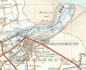
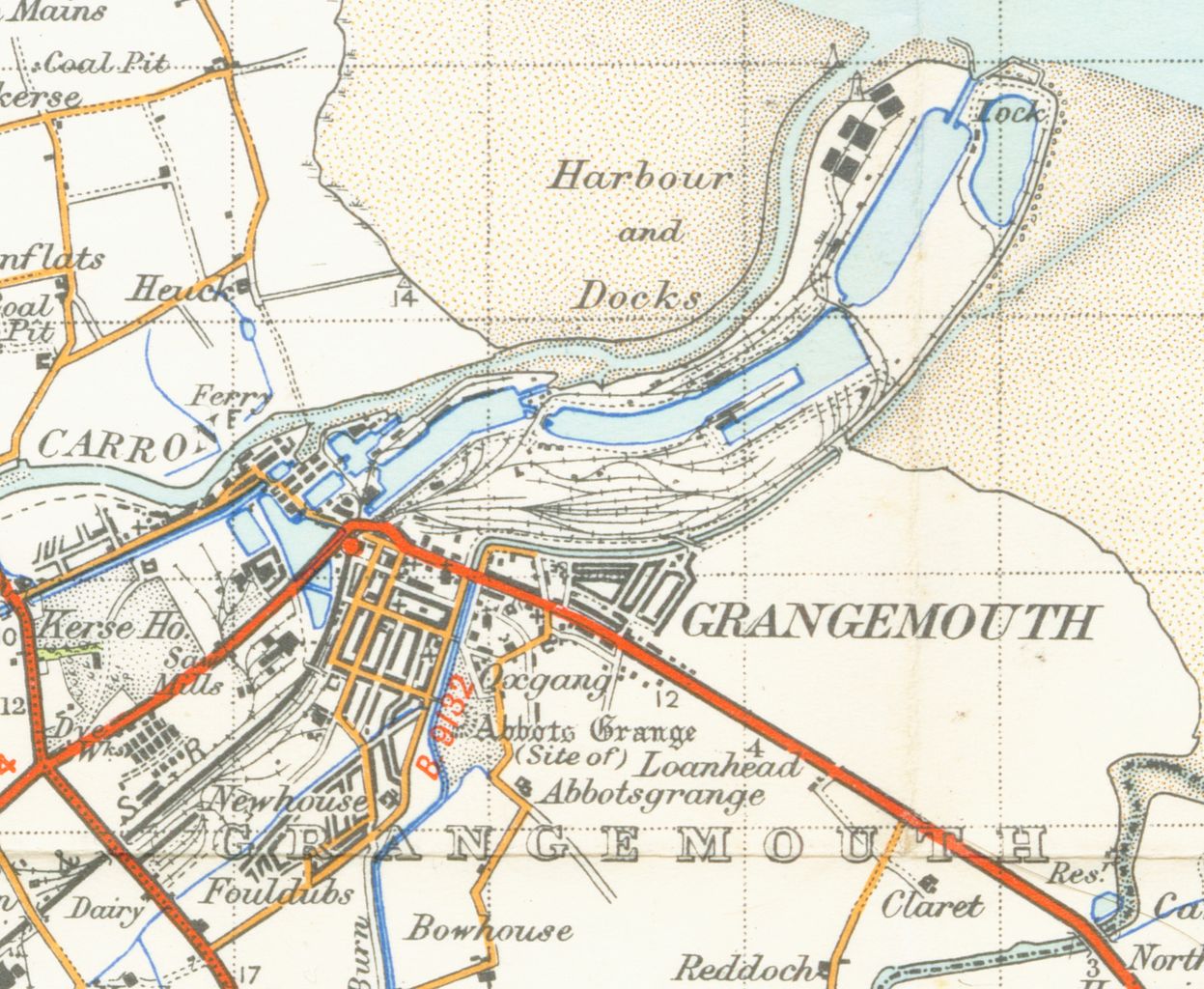
| Beskrivelse | map of Grangemouth 1 inch to the mile scale scanned at 900 DPI |
| Dato | |
| Kilde | OS map stirling and Dunfermline sheet 67 1945 |
| Opphavsperson | OS |
Filhistorikk
Klikk på et tidspunkt for å vise filen slik den var på det tidspunktet.
| Dato/klokkeslett | Miniatyrbilde | Dimensjoner | Bruker | Kommentar | |
|---|---|---|---|---|---|
| nåværende | 31. mar. 2007 kl. 03:18 | | 3 525 × 2 894 (4,92 MB) | Geni | {{oldOS}} {{Information |Description=map of Grangemouth 1 inch to the mile scale scanned at 900 DPI |Source=OS map stirling and Dunfermline sheet 67 1945 |Date=1945 |Author=OS |Permission=none needed |other_versions= }} Category:Maps of Fife |
Filbruk
Den følgende siden bruker denne filen:
Global filbruk
Følgende andre wikier bruker denne filen:
- Bruk i azb.wikipedia.org
- Bruk i de.wikipedia.org
- Bruk i en.wikipedia.org
- Bruk i fr.wikipedia.org