Fil:Floridakeys-nasa.jpg

Størrelse på denne forhåndsvisningen: 800 × 571 piksler. Andre oppløsninger: 320 × 229 piksler | 640 × 457 piksler | 1 024 × 731 piksler | 1 400 × 1 000 piksler.
Opprinnelig fil (1 400 × 1 000 piksler, filstørrelse: 215 KB, MIME-type: image/jpeg)
Filhistorikk
Klikk på et tidspunkt for å vise filen slik den var på det tidspunktet.
| Dato/klokkeslett | Miniatyrbilde | Dimensjoner | Bruker | Kommentar | |
|---|---|---|---|---|---|
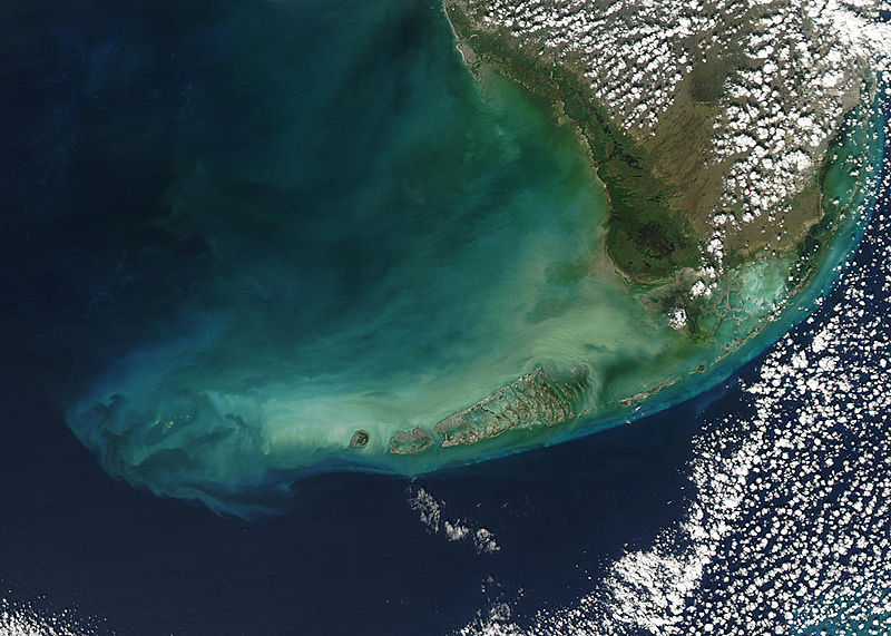
| nåværende | 23. aug. 2005 kl. 23:59 |  | 1 400 × 1 000 (215 KB) | Nanosmile | * Credit Jeff Schmaltz, MODIS Rapid Response Team, NASA/GSFC Turbid waters surround southern Florida and the Florida Keys in this true-color Moderate Resolution Imaging Spectroradiometer (MODIS) image taken by the Aqua satellite on Dece |
Filbruk
Den følgende siden bruker denne filen:
Global filbruk
Følgende andre wikier bruker denne filen:
- Bruk i ar.wikipedia.org
- Bruk i arz.wikipedia.org
- Bruk i az.wikipedia.org
- Bruk i be.wikipedia.org
- Bruk i ca.wikipedia.org
- Bruk i ceb.wikipedia.org
- Bruk i de.wikipedia.org
- Bruk i en.wikipedia.org
- Bruk i eo.wikipedia.org
- Bruk i es.wikipedia.org
- Bruk i fa.wikipedia.org
- Bruk i fr.wikipedia.org
- Bruk i fy.wikipedia.org
- Bruk i he.wikipedia.org
- Bruk i it.wikipedia.org
- Bruk i ka.wikipedia.org
- Bruk i pl.wikipedia.org
- Bruk i pl.wiktionary.org
- Bruk i pt.wikipedia.org
- Bruk i ru.wikipedia.org
- Bruk i uk.wikipedia.org
- Bruk i www.wikidata.org
- Bruk i zh.wikipedia.org


