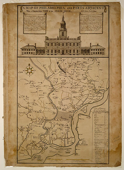
Fil:A Map of Philadelphia and Parts Adjacent vc6b.1.jpg

Størrelse på denne forhåndsvisningen: 437 × 599 piksler. Andre oppløsninger: 175 × 240 piksler | 350 × 480 piksler | 640 × 877 piksler.
Opprinnelig fil (640 × 877 piksler, filstørrelse: 156 KB, MIME-type: image/jpeg)
Filhistorikk
Klikk på et tidspunkt for å vise filen slik den var på det tidspunktet.
| Dato/klokkeslett | Miniatyrbilde | Dimensjoner | Bruker | Kommentar | |
|---|---|---|---|---|---|
| nåværende | 14. des. 2006 kl. 05:44 |  | 640 × 877 (156 KB) | Dogears | en: Independence Hall ''A Map of Philadelphia and Parts Adjacent, With A Perspective View of the State House''. Philadelphia: Lawrence Hebert, 1752 {{PD-LOC}} |
Filbruk
Det er ingen sider som bruker denne filen.
Global filbruk
Følgende andre wikier bruker denne filen:
- Bruk i de.wikipedia.org
- Bruk i en.wikipedia.org
- Bruk i es.wikipedia.org
- Bruk i fr.wikipedia.org
- Bruk i gl.wikipedia.org
- Bruk i he.wikipedia.org
- Bruk i it.wikipedia.org
- Bruk i vi.wikipedia.org


