
Fil:Yugoslavia map norwegian.svg

Opprinnelig fil (SVG-fil, standardstørrelse 595 × 431 piksler, filstørrelse: 315 KB)
| Denne filen er fra Wikimedia Commons og kan brukes av andre prosjekter. Informasjonen fra filbeskrivelsessiden vises nedenfor. |
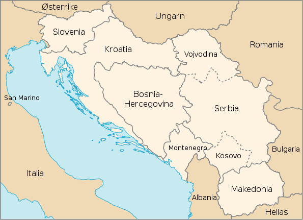
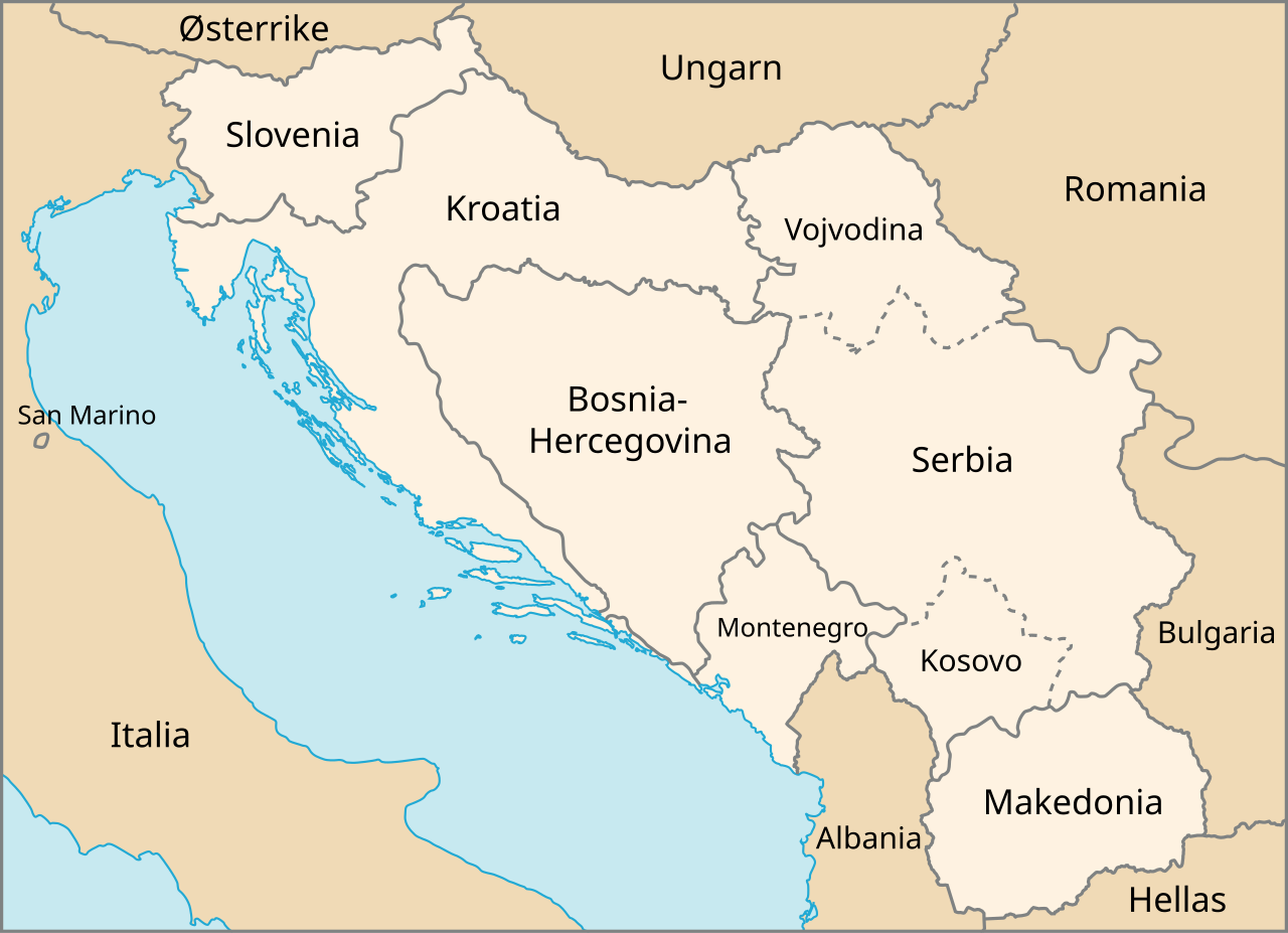
| Beskrivelse | Map of The Former Yugoslavia in Norwegian | |||
| Dato | February, 2003 (created), February, 2007 (edited) | |||
| Kilde | http://www.un.org/Depts/Cartographic/map/profile/frmryugo.pdf | |||
| Opphavsperson | Department of Public Information Cartographic Section, edited by Stian H. | |||
| Tillatelse (Gjenbruk av denne filen) |
|

Filhistorikk
Klikk på et tidspunkt for å vise filen slik den var på det tidspunktet.
| Dato/klokkeslett | Miniatyrbilde | Dimensjoner | Bruker | Kommentar | |
|---|---|---|---|---|---|
| nåværende | 19. feb. 2007 kl. 19:29 | | 595 × 431 (315 KB) | Stianbh | {{Information| |Description=Map of The Former Yugoslavia in Norwegian |Source=http://www.un.org/Depts/Cartographic/map/profile/frmryugo.pdf |Date=February, 2003 (created), February, 2007 (edited) |Author=Department of Public Information Cartographic Secti |
Filbruk
De følgende 3 sidene bruker denne filen:
Global filbruk
Følgende andre wikier bruker denne filen:
- Bruk i fi.wikipedia.org
- Bruk i nn.wikipedia.org