
Fil:USACE John H Kerr Dam and Lake.jpg
Størrelse på denne forhåndsvisningen: 800 × 533 piksler. Andre oppløsninger: 320 × 213 piksler | 640 × 427 piksler | 1 024 × 683 piksler | 1 500 × 1 000 piksler.
Opprinnelig fil (1 500 × 1 000 piksler, filstørrelse: 651 KB, MIME-type: image/jpeg)
| Denne filen er fra Wikimedia Commons og kan brukes av andre prosjekter. Informasjonen fra filbeskrivelsessiden vises nedenfor. |
| Beskrivelse |
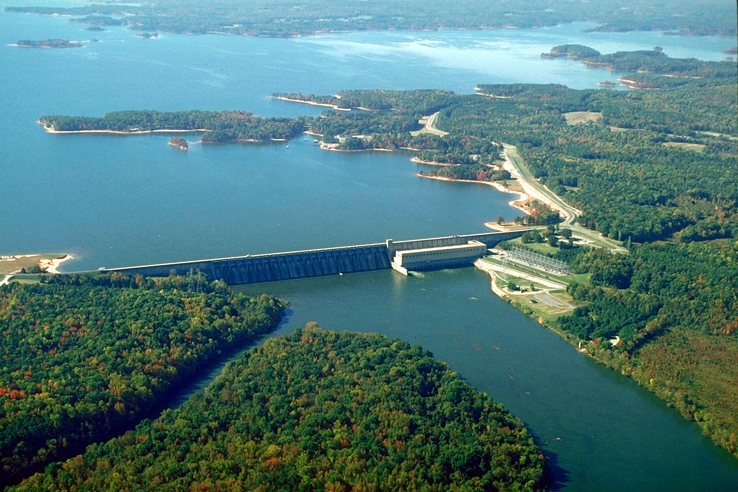
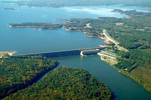
English: The John H. Kerr Dam and Lake on the Roanoke River in Mecklenburg County, Virginia, USA. The U.S. Army Corps of Engineers constructed the dam for flood control on the Roanoke River. View is to the south-southwest.
Coordinates: 36°35′53.76″N 78°17′53.63″W / 36.5982667°N 78.2982306°W |
|||
| Sted | Mecklenburg County, Virginia, USA | |||
| Dato | (Caveat: Dates provided by U.S. Army Corps of Engineers Digital Visual Library are not reliable and are often wrong.) | |||
| Kilde |
U.S. Army Corps of Engineers Digital Visual Library Image page Image description page Digital Visual Library home page |
|||
| Opphavsperson | Bud Davis, U.S. Army Corps of Engineers | |||
| Tillatelse (Gjenbruk av denne filen) |
|
Filhistorikk
Klikk på et tidspunkt for å vise filen slik den var på det tidspunktet.
| Dato/klokkeslett | Miniatyrbilde | Dimensjoner | Bruker | Kommentar | |
|---|---|---|---|---|---|
| nåværende | 26. apr. 2007 kl. 06:40 | | 1 500 × 1 000 (651 KB) | DanMS | {{Information | Description = {{en|The John H. Kerr Dam and Lake on the Roanoke River in Mecklenburg County, Virginia, USA. The U.S. Army Corps of Engineers constructed the dam for flood control on the Roanoke River. View is to the south-southwest.}} C |
Filbruk
Den følgende siden bruker denne filen:
Global filbruk
Følgende andre wikier bruker denne filen:
- Bruk i ceb.wikipedia.org
- Bruk i de.wikipedia.org
- Bruk i en.wikipedia.org
- Bruk i es.wikipedia.org
- Bruk i fr.wikipedia.org
- Bruk i ja.wikipedia.org
- Bruk i sr.wikipedia.org
- Bruk i uk.wikipedia.org
- Bruk i www.wikidata.org