
Fil:Dengue06.png
Størrelse på denne forhåndsvisningen: 800 × 435 piksler. Andre oppløsninger: 320 × 174 piksler | 640 × 348 piksler | 1 161 × 631 piksler.
Opprinnelig fil (1 161 × 631 piksler, filstørrelse: 42 KB, MIME-type: image/png)
| Denne filen er fra Wikimedia Commons og kan brukes av andre prosjekter. Informasjonen fra filbeskrivelsessiden vises nedenfor. |

|
Dette bildet bør gjenskapes med hjelp av vektorgrafikk som en SVG-fil. Dette har flere fordeler, se Commons:Media for cleanup for mer informasjon. Hvis en SVG-fil med dette bildet er tilgjengelig, vennligst last den opp. Etter opplasting erstatt denne malen med {{vector version available|nytt bilde.svg}}.
|
Beskrivelse
| Beskrivelse |
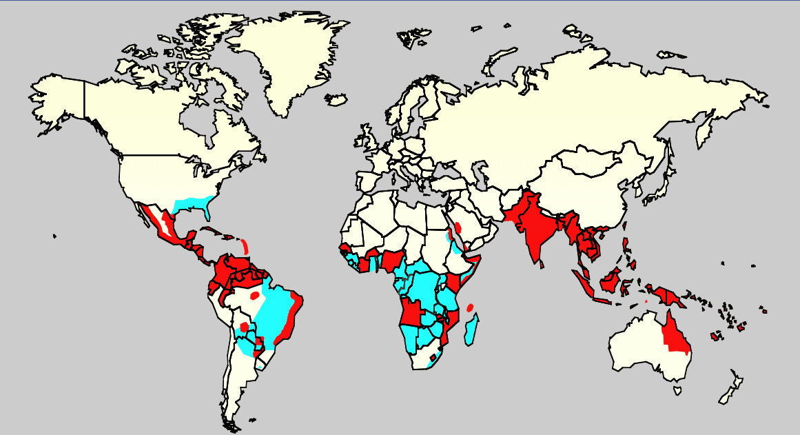
English: Map showing the distribution of dengue fever in the world, as of 2006. Map produced by the Agricultural Research Service of the US Department of Agriculture.
Key:
|
| Kilde |
Own work using:
ReferenciasCeleste: Monday/OClubMorning/TRIServiceDENemergingJAX2007.ppt Áreas infectadas con el mosquito 'Aedes aegyptis Rojo: Áreas que estan infectadas con el mosquito Aedes Aegyptis y que tienen una reciente expansión epidémica. |
| Opphavsperson | Ukjent |
Lisensiering
This work is in the public domain in the United States because it is a work prepared by an officer or employee of the United States Government as part of that person’s official duties under the terms of Title 17, Chapter 1, Section 105 of the US Code.
Note: This only applies to original works of the Federal Government and not to the work of any individual U.S. state, territory, commonwealth, county, municipality, or any other subdivision. This template also does not apply to postage stamp designs published by the United States Postal Service since 1978. (See § 313.6(C)(1) of Compendium of U.S. Copyright Office Practices). It also does not apply to certain US coins; see The US Mint Terms of Use.
|
 | |
| Denne filen har blitt identifisert til å være fri for kjente restriksjoner under lov om opphavsrett, inkludert alle relaterte og nærstående rettigheter. | ||
Filhistorikk
Klikk på et tidspunkt for å vise filen slik den var på det tidspunktet.
| Dato/klokkeslett | Miniatyrbilde | Dimensjoner | Bruker | Kommentar | |
|---|---|---|---|---|---|
| nåværende | 21. feb. 2016 kl. 02:14 | | 1 161 × 631 (42 KB) | Jahoe | Removed large chunk of irrelevant metadata, left behind by adobe editing software. No visible changes. |
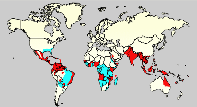
| 18. des. 2015 kl. 18:26 |  | 1 161 × 631 (63 KB) | Splette | Remove border between East and West Germany, as it has been united since 1990 (long before 2006) | |
| 3. jun. 2007 kl. 01:34 |  | 1 161 × 631 (48 KB) | Aetheling | Map showing the distribution of dengue fever in the world, as of 2006. Map produced by the Agricultural Research Service of the US Department of Agriculture. Source: Slide #8 of a presentation by Gary G. Clark, PhD, entitled "Dengue: An emerging arbovira |
Filbruk
Den følgende siden bruker denne filen:
Global filbruk
Følgende andre wikier bruker denne filen:
- Bruk i ar.wikipedia.org
- Bruk i arz.wikipedia.org
- Bruk i ast.wikipedia.org
- Bruk i bn.wikipedia.org
- Bruk i ca.wikipedia.org
- Bruk i cs.wikipedia.org
- Bruk i cy.wikipedia.org
- Bruk i de.wikipedia.org
- Bruk i el.wikipedia.org
- Bruk i en.wikipedia.org
- Natural hazards in Colombia
- Mosquito-borne disease
- User:Justthefacts1/Sandbox
- Dengue fever outbreaks
- Talk:Dengue fever/Archive 1
- Wikipedia:Wikipedia Signpost/2011-07-11/Featured content
- Wikipedia:WikiProject Medicine/Collaborative publication/Dengue fever
- Wikipedia:Wikipedia Signpost/2014-10-01/News and notes
- Wikipedia:Wikipedia Signpost/Single/2014-10-01
- Wikipedia:Wikipedia Signpost/Single/2011-07-11
- User:Notorious Biggles/Tobagoitis
- Wikipedia:WikiProject WikiFundi Content/Dengue fever
- Bruk i es.wikipedia.org
- Bruk i es.wiktionary.org
- Bruk i eu.wikipedia.org
- Bruk i fa.wikipedia.org
- Bruk i fi.wikipedia.org
- Bruk i fr.wikipedia.org
- Bruk i ga.wikipedia.org
- Bruk i he.wikipedia.org
- Bruk i hi.wikipedia.org
- Bruk i hr.wikipedia.org
- Bruk i hu.wikipedia.org
- Bruk i hu.wikibooks.org
- Bruk i is.wikipedia.org
- Bruk i it.wikipedia.org
- Bruk i ja.wikipedia.org
- Bruk i la.wikipedia.org
- Bruk i ml.wikipedia.org
- Bruk i ms.wikipedia.org
- Bruk i nl.wikipedia.org
- Bruk i or.wikipedia.org
- Bruk i pl.wikipedia.org
Vis mer global bruk av denne filen.